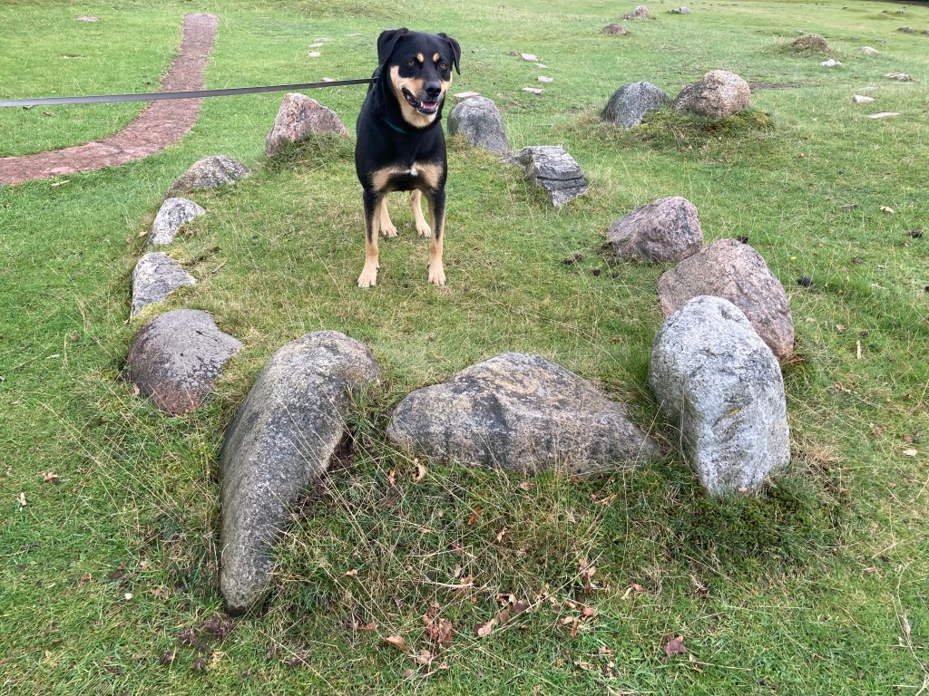
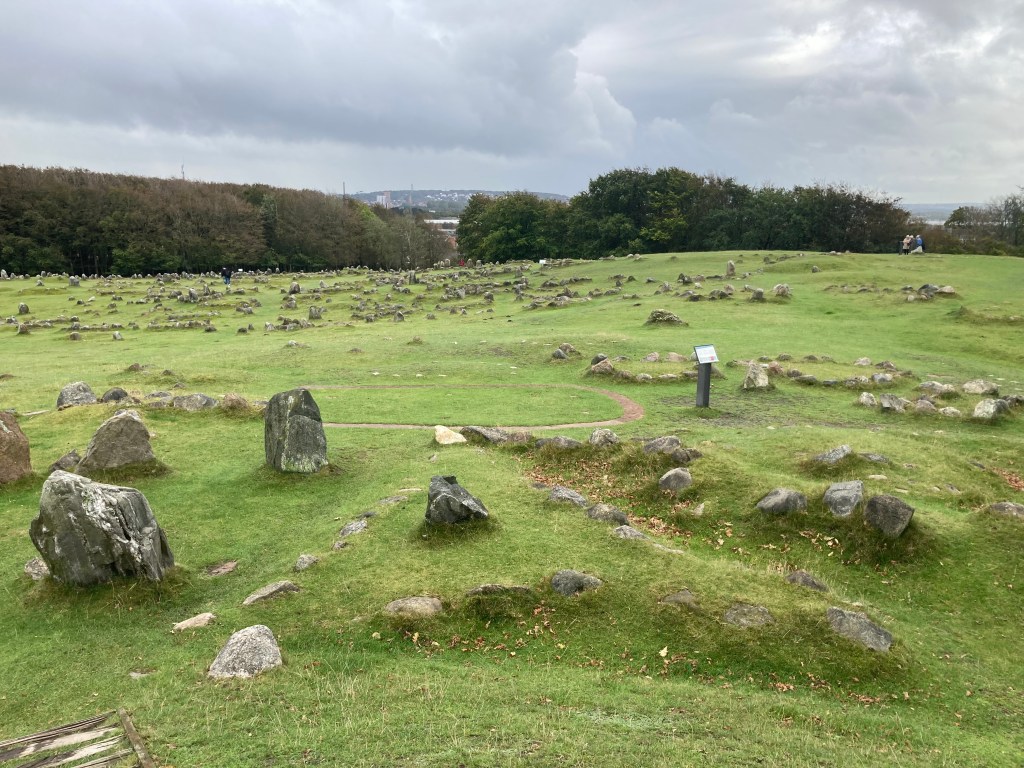
On Wednesday the plan was to see some Viking burial stones at Lindholm Høje, visit a highly recommended beach at Løkken and finish off at Grennen where the North Sea and Baltic Sea meet.
Despite rain overnight it was a drier start to the day, so we spent a good amount of time looking around the very interesting complex at Lindholm Høje. Yala definitely enjoyed wiggling in and out of the stones and sniffing the sheep droppings.
Although smaller it reminded us of a similar trip to The Plain of Jars in Laos.
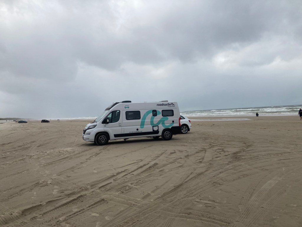
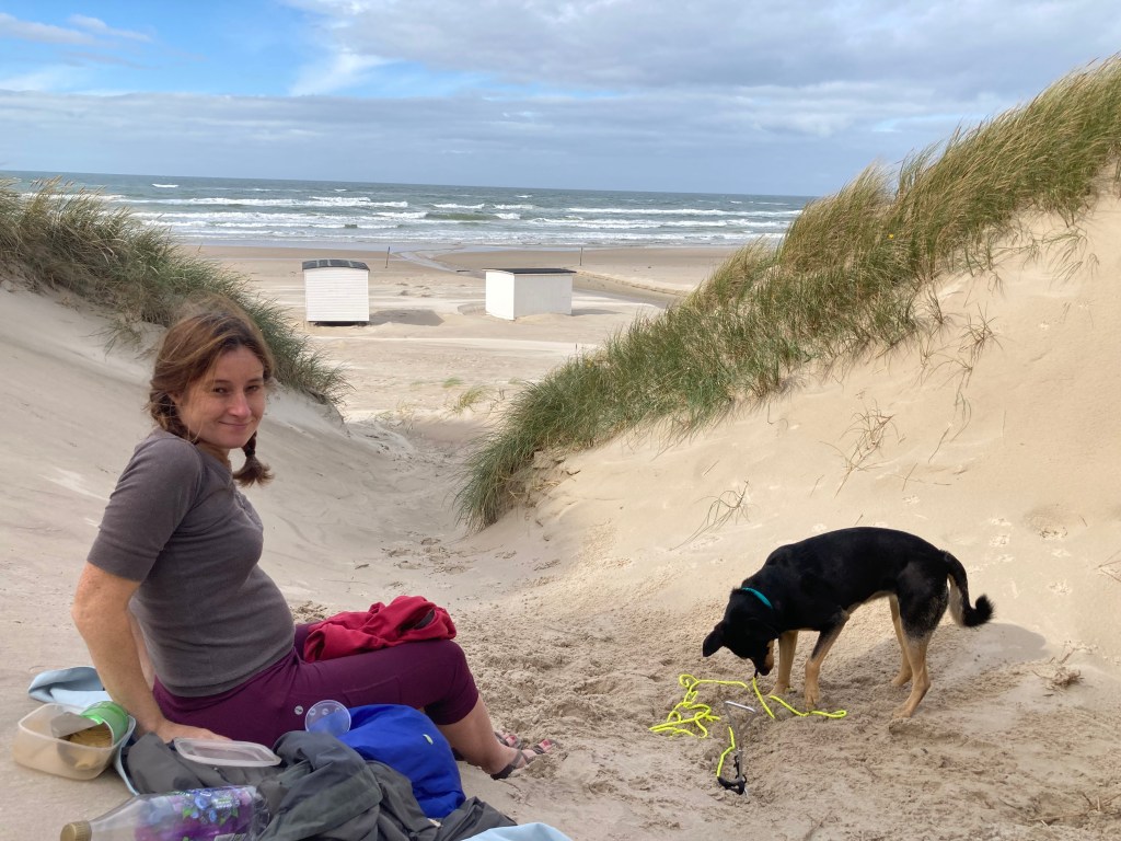
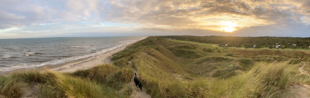
After a coffee in the café we drove out to the coast at Fløkken. Here a long sandy beach awaited us, dotted with lots of white beach huts and edged by modest but steep dunes.
Parking was on the beach itself and a lot of people had driven right along the sand to find the perfect spot. We opted to keep close to the road in case we got the camper stuck. The lady at the hire centre had said that the insurance doesn’t cover stupidity and parking on a beach feels like it could come under the German definition of stupid.
Not that it mattered where we parked as there was so much space. After a quick game of “ball” we had a picnic in the dunes, sheltering from the wind blown sand.
After lunch we had a quick paddle in the sea and even managed to entice Yala in, even though it was a bit reluctantly.
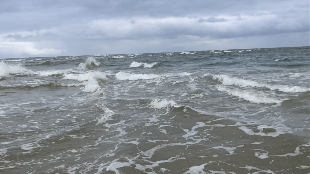
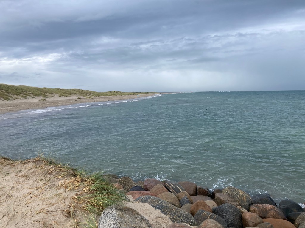
For the afternoon excitement we had a fair drive to the northernmost point in Denmark. Grennen is the spit of land just north of the pretty fishing and tourist town of Skagen. It’s the point where the waves of the North and Baltic Seas are funnelled against one another creating really choppy seas and strong currents.
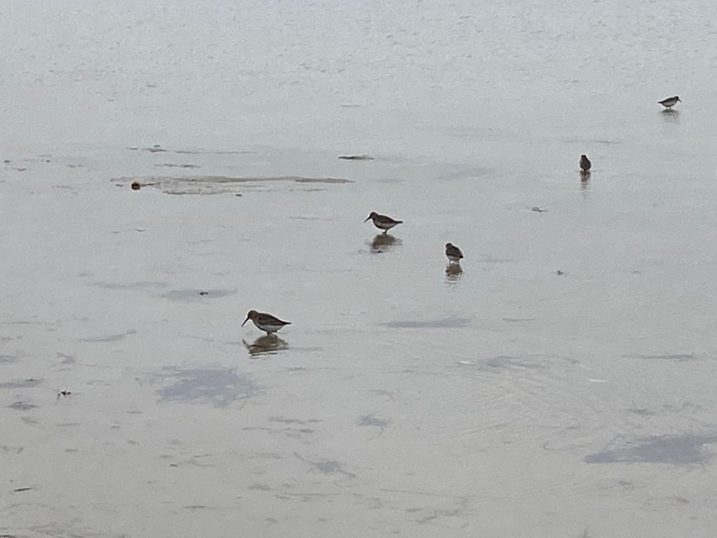
After a sharp shower we headed out along the beach to the peninsula. Although a bit blustery and showery it was a refreshing walk. There were a lot of birds busy in the sand searching for food.
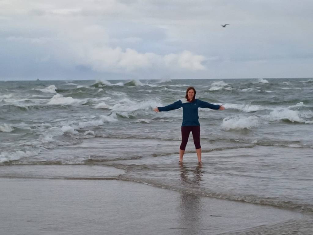
The sand bar itself was very cool (at least for Environmental Scientists). The waves crashed together as they met and as we waded in up to our knees we could feel our legs being dragged in different directions by the currents. Yala preferred to watch from the shore.
After that excitement we went back to our beachside campsite to the south of Skagen, where our day ended with a beautiful sunset.
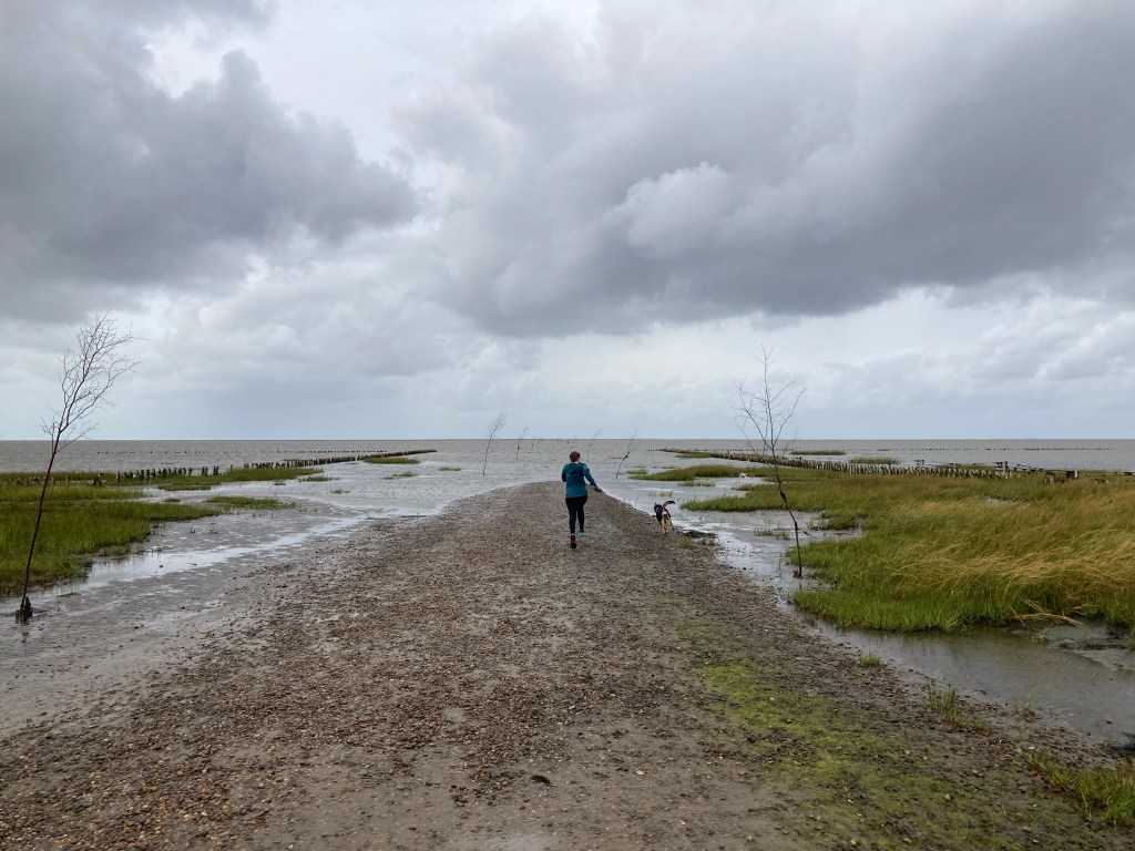
After driving up from Hamburg yesterday, we stayed the night in the tiny village Husum-Ballum in (or near) Waddensea National Park. The weather was pretty terrible overnight with the wind rocking the camper and rain clattering on the roof. We woke up to slightly better weather though and after a light breakfast we hit the road north to visit the sea. First stop was Vadnhavncetret (the Wadden Sea Centre) – an information and art centre in another tiny village. Rather than go inside, as it was dry we took a guided walk around the local area. We learnt that the coast had been part of German defences during the Second World War and that the land had been drained for farming with a large embankment built to keep out the sea.
We then headed down to the sea and the road that goes across to Mandø island (through the sea!). The sticks poking out of the sea guide the way. As we left a group of school kids were about to cross using waders and sticks to feel their way!
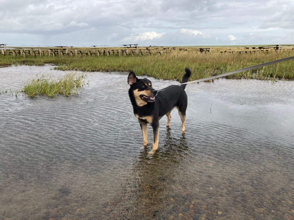
Yala loved playing in the water. A welcome respite from the stress of travelling.
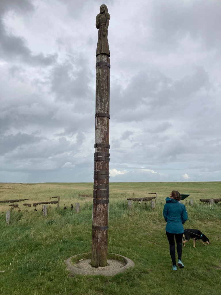
A large pole showed the height of various North Sea storm surges over the years.
After a quick bite to eat we heady inland and northwards to what passes for mountains in Denmark.
At not quite 171m high, the twin peaks of Møllehøj and Ejer Bavnhøj are not particularly challenging to start with. However the car park right next to the summit made getting to the top particularly easy! That said, with dogs not allowed on the former, we only managed the one, but at least it got us back out of the rain quicker.
A monument at the top of one of Denmark’s two tallest hills.
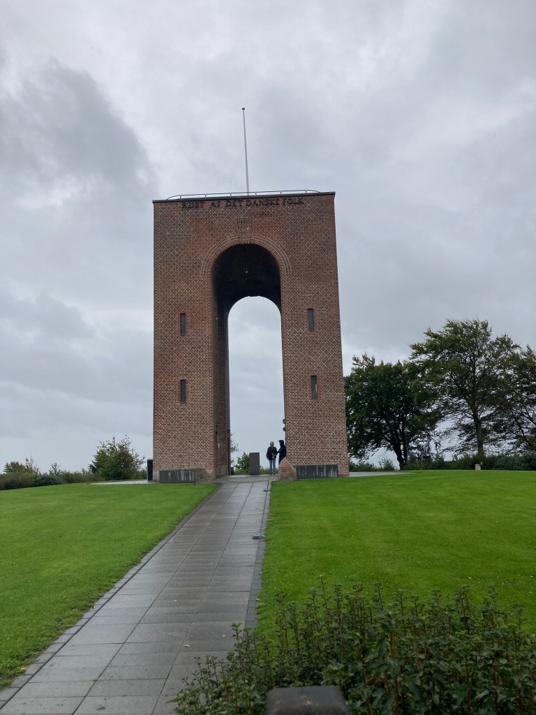
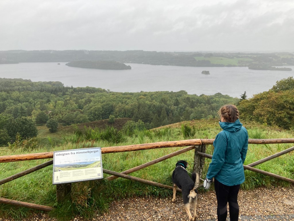
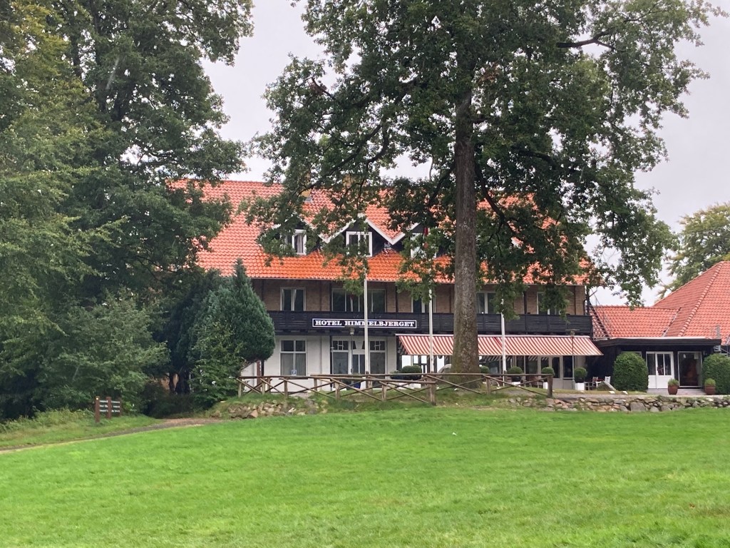
We then headed further north along the country roads towards Silkeborg. At the end of one of these narrow roads through the forest was the large and almost completely empty car park for the Himmelbjerget. Once thought to be the highest mountain in Denmark, it’s actually only 147m (so some way off!). In the Nordic mythology, Himmelbjerget is the highest mountain in the world of the gods, Asgaard. The God, Heimdal, lives on Himmelbjerget. He sits at the end of the rainbow, Bifrost, and makes sure that no giants ever manage to sneak into Asgaard.
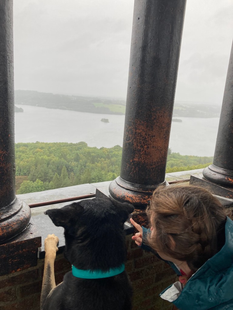
Unfortunately for us there were no rainbows, just rain, but there was at least a glimpse of a fantastic view, which must look even better on a clear day.
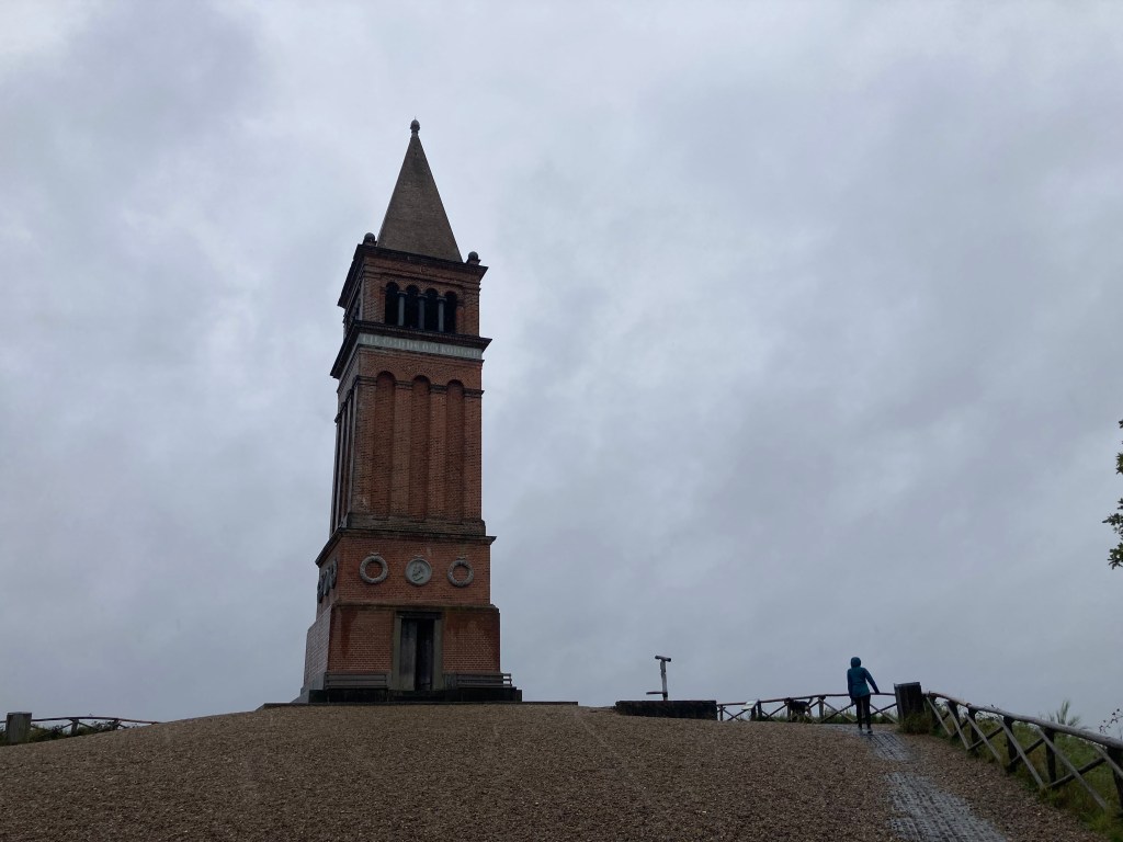
The tower at the top of the hill is a memorial to King Frederik 7th who gave Denmark its Constitution and Democracy.
For less that a pound (10 kroner) you can go to the top and get a better view.
We scurried back through the rain to our camper past the Himmelbjerget Hotel, which looked more like the Overlook Hotel as it was obviously shut up for the winter.
We didn’t wait to see if there was a caretaker position available and headed off to a campsite to the north of Silkeborg. We had the place pretty much to ourselves save a few farm animals and some permanent residents.
Hopefully the weather will improve tomorrow as we’re off to the beach!
We’re back off on our travels again. This time with our four legged friend Yala (a three year old Romanian rescue).
We’re planning to travel around Scandanavia, but as we’ve given up flying (we had our fair share on our last trip) we’ve driven to Hamburg to pick up the camper.
The camper is called a Couple Cottage from a large hire company called Roadsurfer. It’s quite roomy compared to some we’ve stayed in, but you need that with a dog in tow.
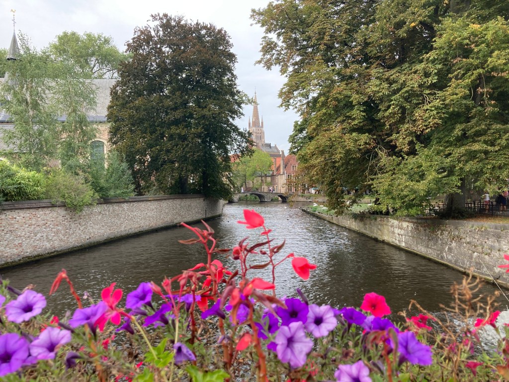
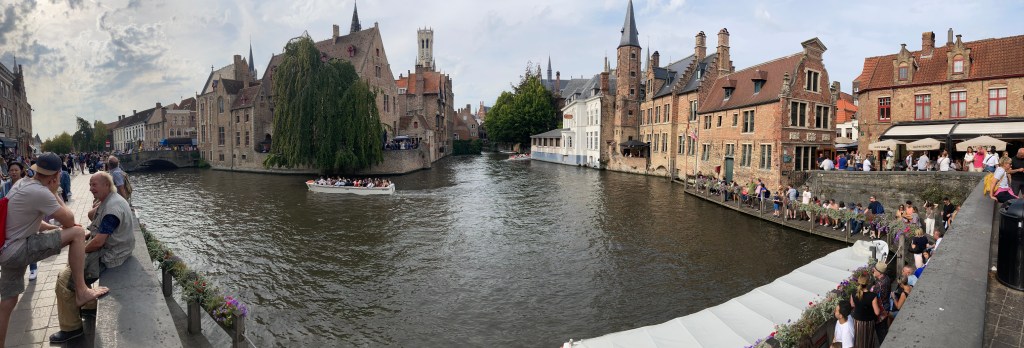
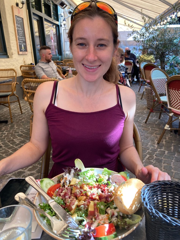
On our way to Hamburg we stopped off in Bruges.
Bruges is a beautiful city with lots of canals and some lovely old architecture.
We stopped in one of the squares for some lunch. Gareth tried the Belgian style rabbit stew and Claire had a very substantial salad.
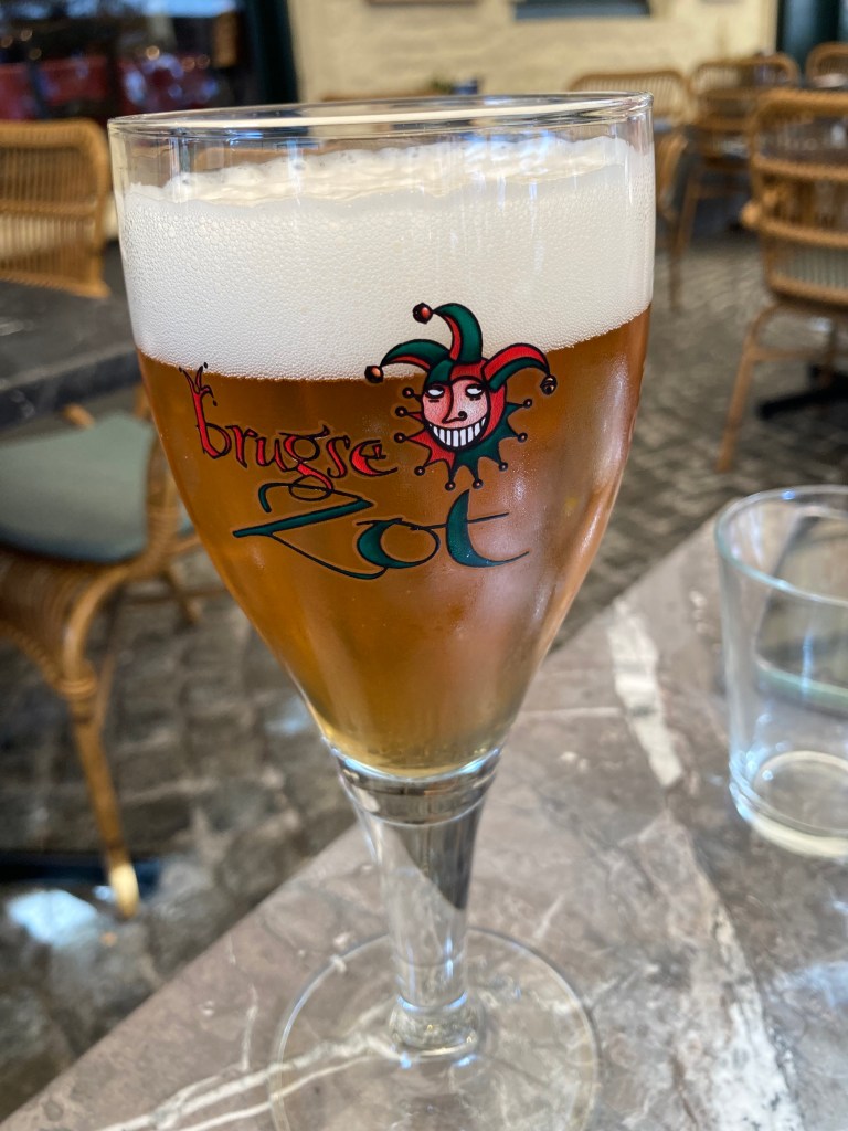
Gareth also tried a couple of the local beers to help fortify him after a long driving stint and some refreshment from the hot sun.
We stayed the night at a very arty AirBnB in the small town of Tongeren near the Dutch border.
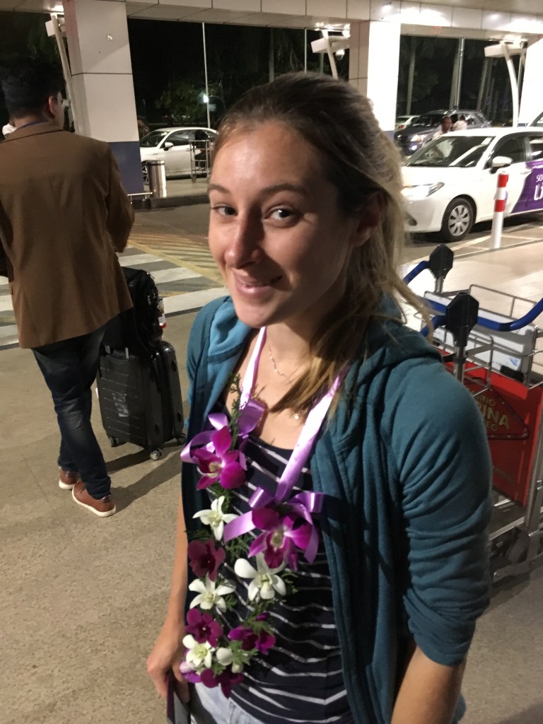
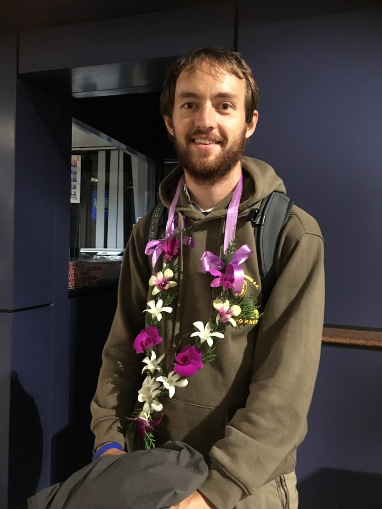
We arrived in Sri Lanka after a very long flight from Christchurch by way of Singapore. We were met at the airport by our guide and driver “Sam” Samarshinge, who was very polite at formal at first, but we got to know him a lot better over the next two weeks.
We were welcomed again at our villa in Negombo by porters and were helped to our room before falling straight to sleep.
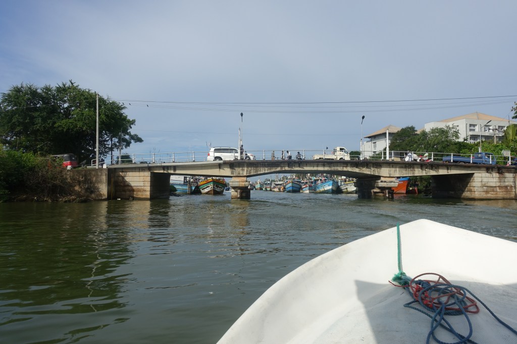
The Lagoon
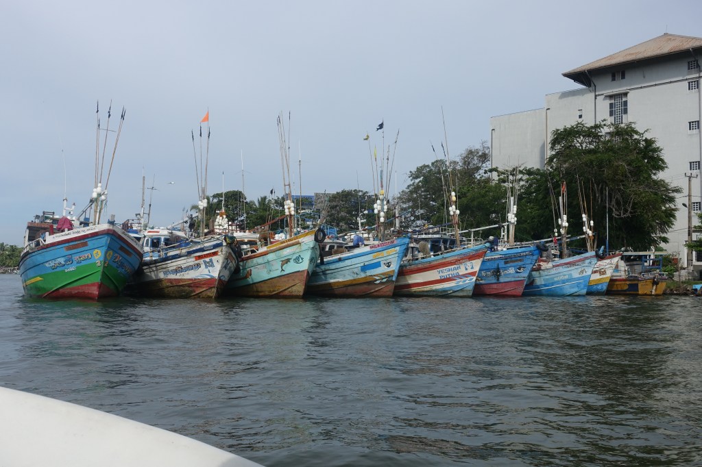
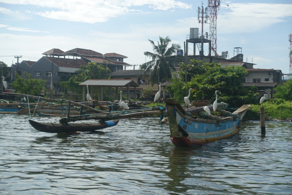
Fishing Boats
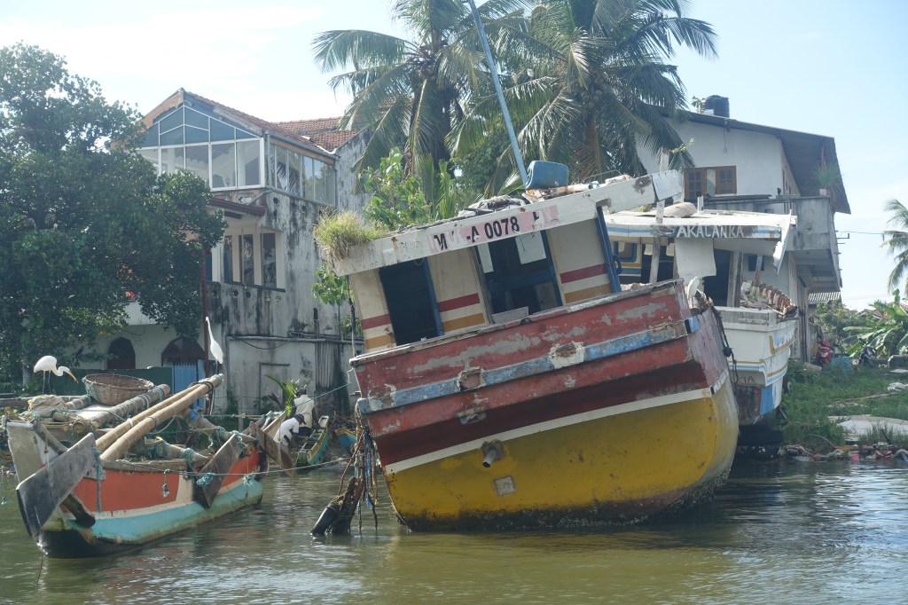
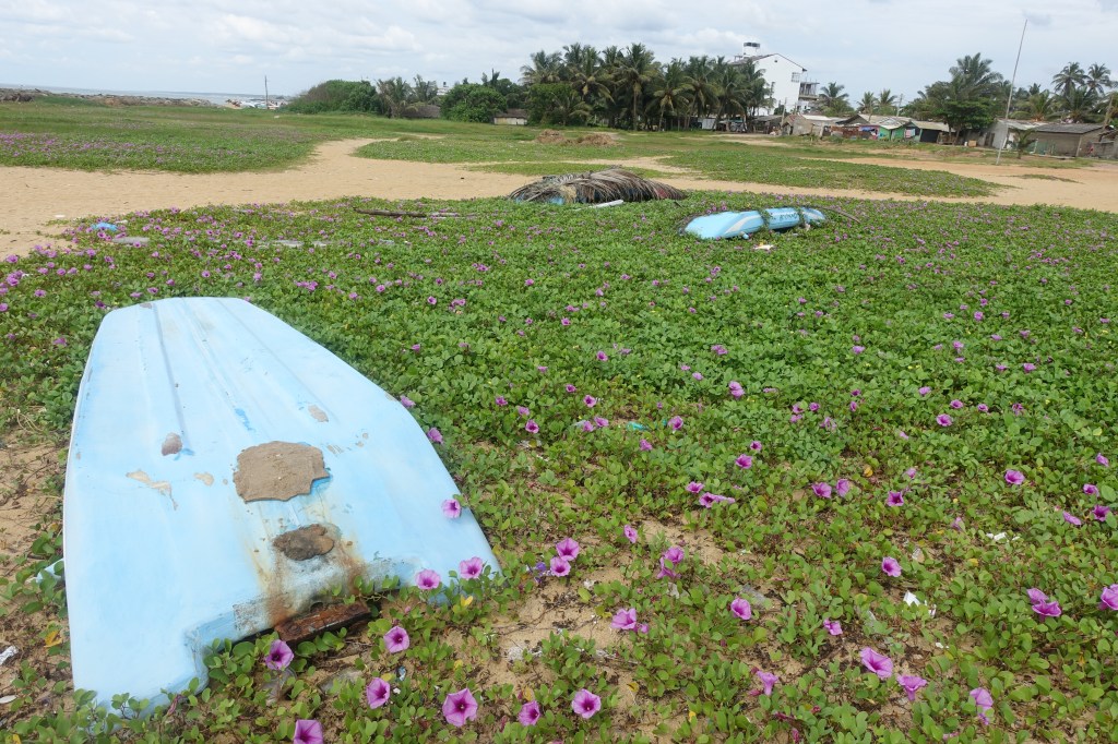
Tsunami damage
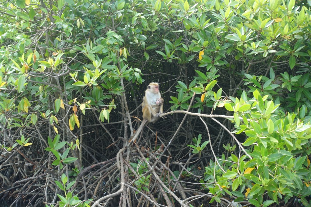
Macaques
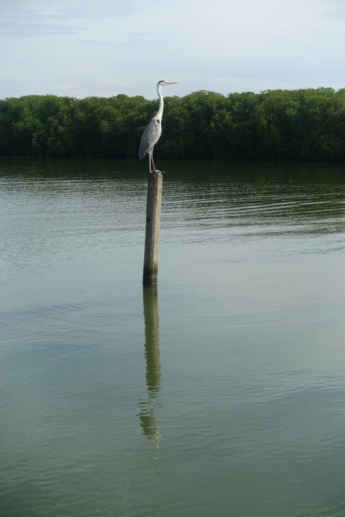
Heron
Water Monitor
Storks and Egrets
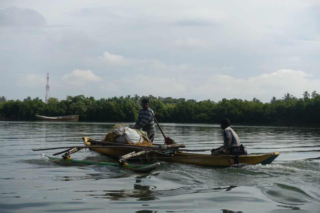
Fishermen
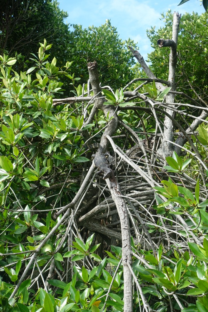
The next morning we were taken to a canal in Negombo to hop onto a motorboat for a tour of the Hamilton Canal and the Negombo Lagoon. Despite the jet lag it was a really interesting trip. We saw fishermen heading back with the days catch after an early mornings fishing and in the harbour we saw lots of colourful boats including a few that had been badly damaged in the 2004 Tsunami that were still waiting to be fixed. We also saw lots of wildlife. The were storks, egrets and herons, monitor lizards and bats and groups of macaque monkeys living in the mangroves at the edge of the lagoon. A great start to this leg of the trip, but one that eased us in gently as well.
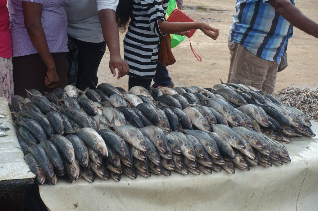
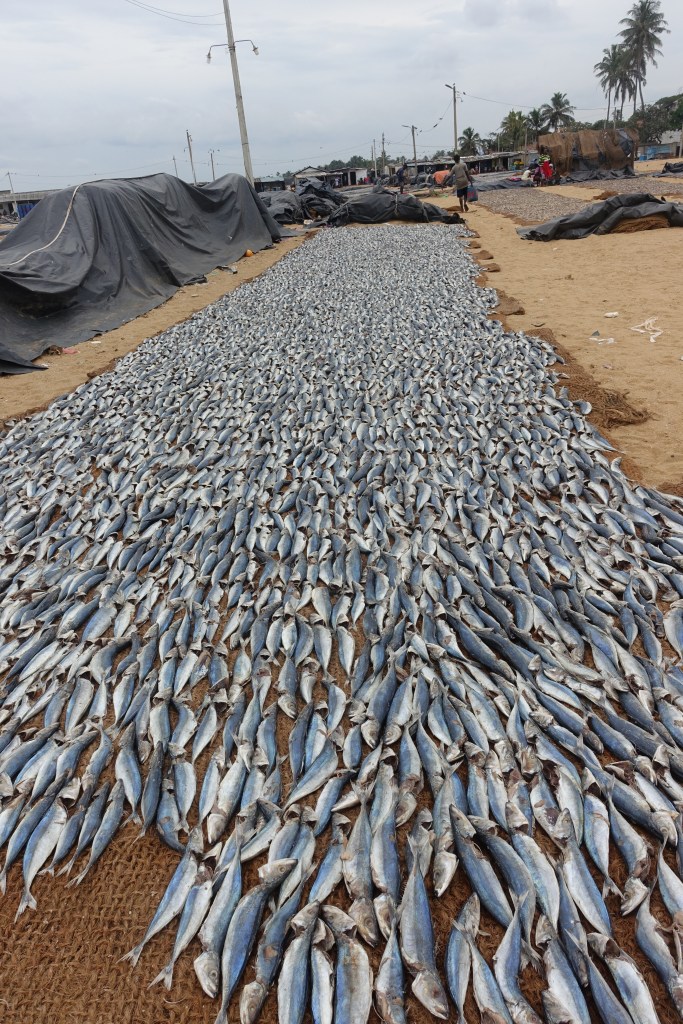
Regular fish
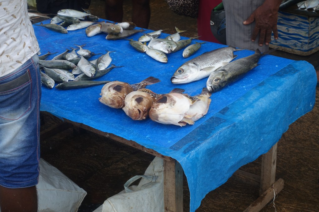
“Miscellaneous”
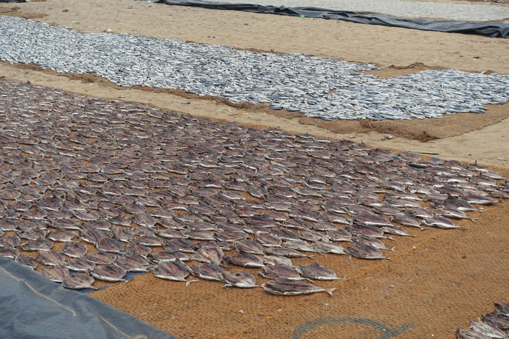
Dried fish
Shellfish
Fish drying on one of many mats
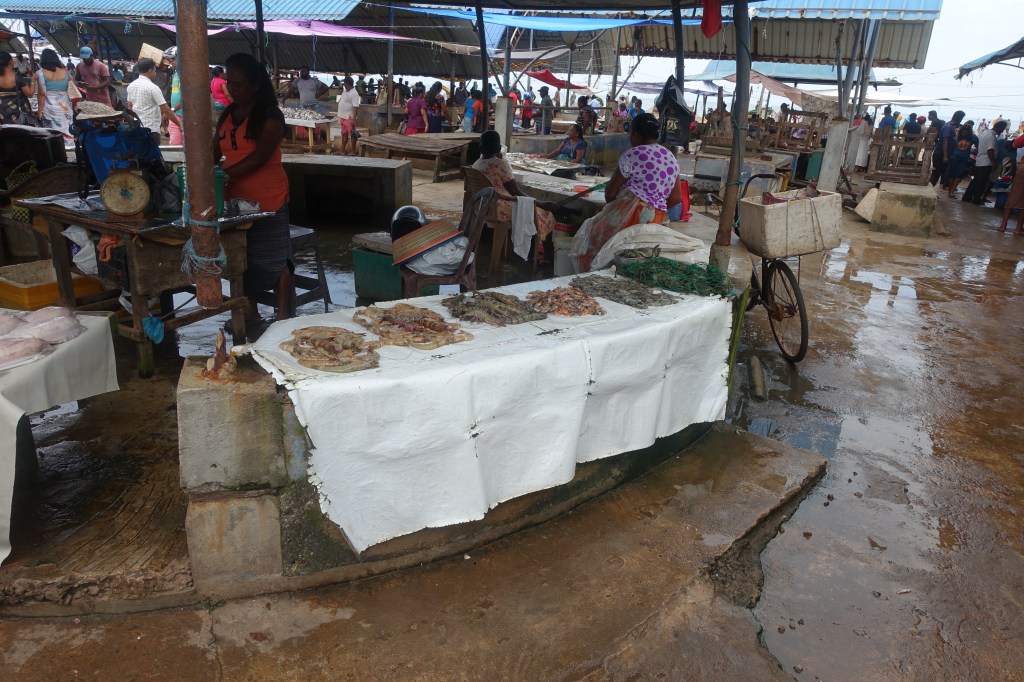
After a cup of tea at the house of the owner of our boat, we took a tour around the town with Sam and he then took us to the famous Fish Market. We weren’t sure how well known it is outside of Sri Lanka, but it definitely was impressive. Lots and lots of fresh fish for sale as well as some drying on the beach. Some were the standard mackerel or sardines, but there were also spiky puffer fish, sword fish and big tuna. Claire had to over come her fear of fish eyes (she thinks that dead fish can still see you!), but was definitely fascinated by the variety on show.
After being dropped back at the villa and going or a dip in the pool (we had treated ourselves a bit in Sri Lanka with an agent booked itinerary) we headed to the beach for a stroll, mostly to keep us awake during the afternoon!
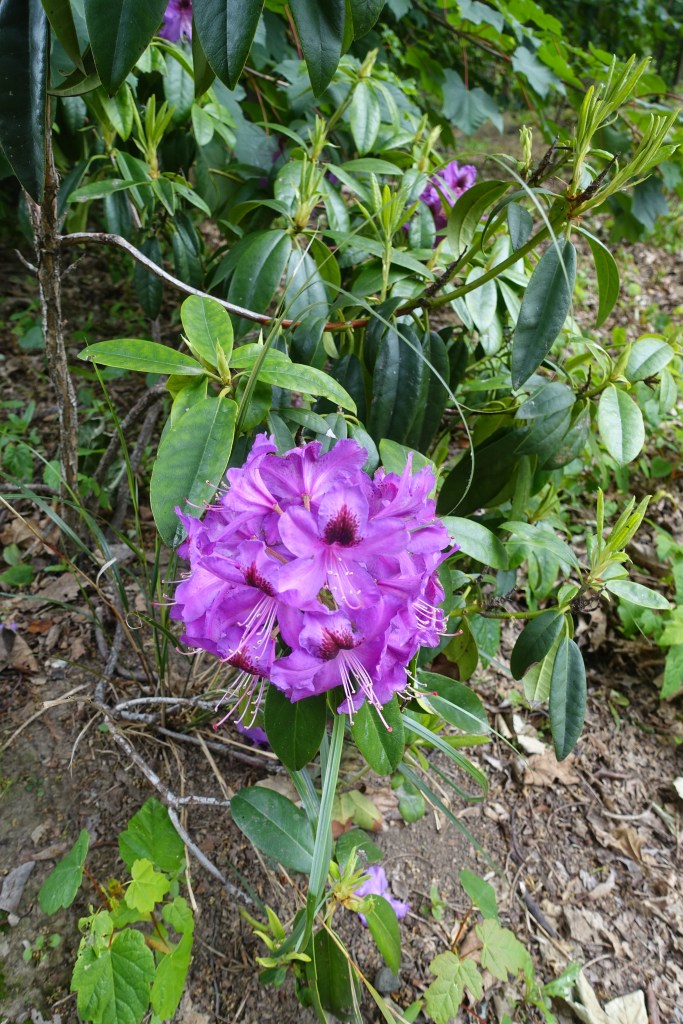
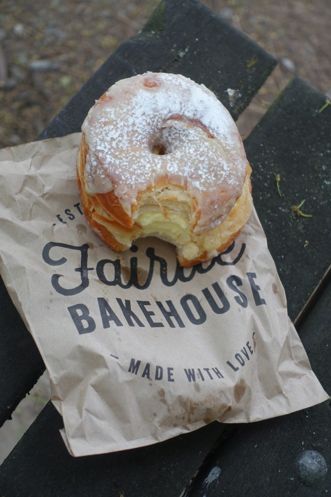
Some of the flowers were out of season, but fortunately the cream cake wasn’t!
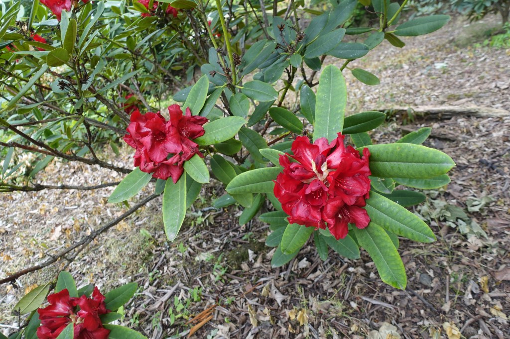
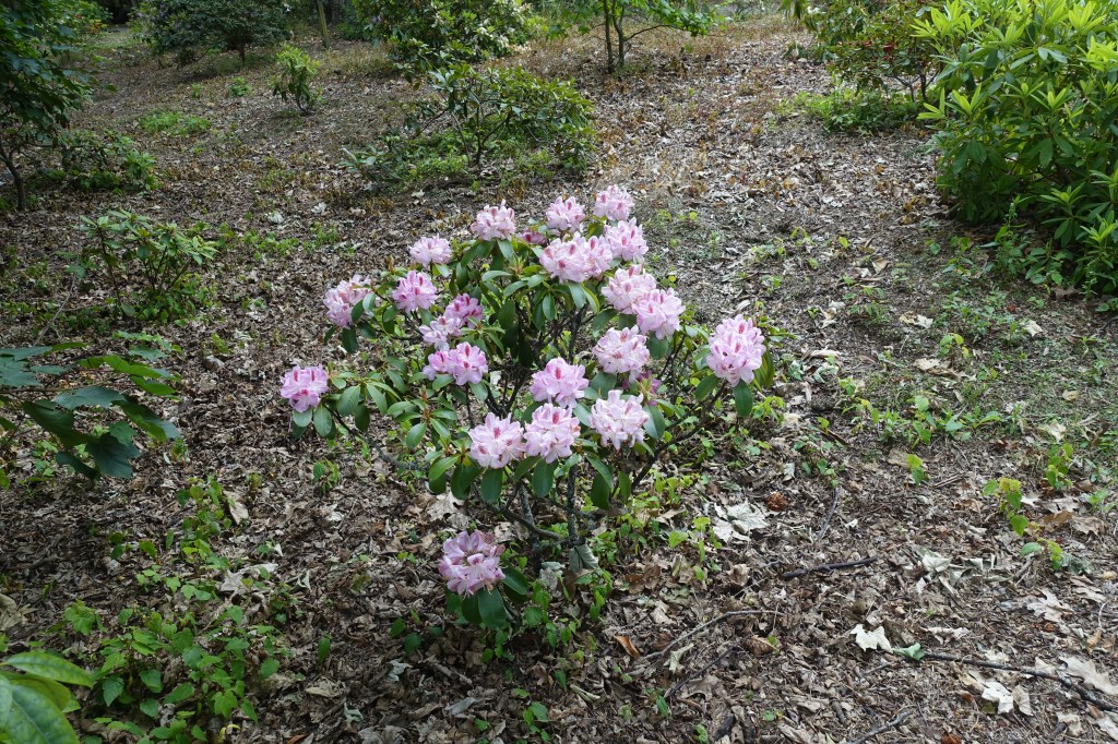
Only three days left in New Zealand and still so much left to see and do! Our next stop was the famous Fairlie Bakery to fuel up on pastries for a day of adventure before heading for a stroll around the rhododendron gardens down the road in Geraldine. Then we set off north along Route 72, skirting the central New Zealand hills to Rakaia Gorge.
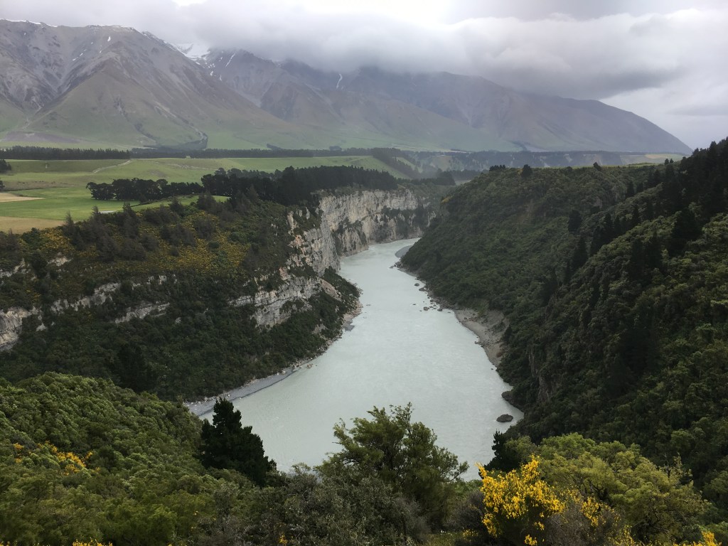
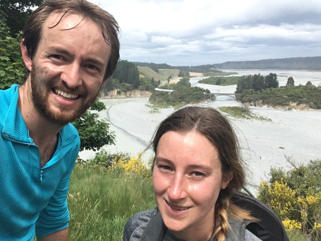
Rakaia Gorge: a great option for a day trip from Christchurch
According to our guide books, the 12km walk along the gorge was one of the best day walks in the Canterbury region. There was however one thing our trip in the South Island had been lacking so far. For the last two weeks we hadn’t been on a single run! As a result (and as we had a lot of distance to cover) we decided to switch hiking shoes for running shoes. Although some of the steep hills defeated us, it was a great way to see the gorge, and we just managed to get back to the van before it started to rain!
The view from the end of the Rakaia Gorge was another cracker!
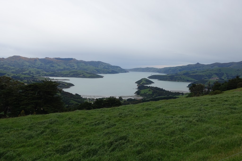
That afternoon we journeyed east, past Christchurch, to the Banks peninsular. This peninsular is full of beautiful natural bays and mountain ridges created by two volcanic eruptions from the now extinct craters. We took the scenic drive around the spectacular crater rim, before arriving in the beautiful harbour town Akaroa.
Akaroa Harbour from the top of the volcanic crater
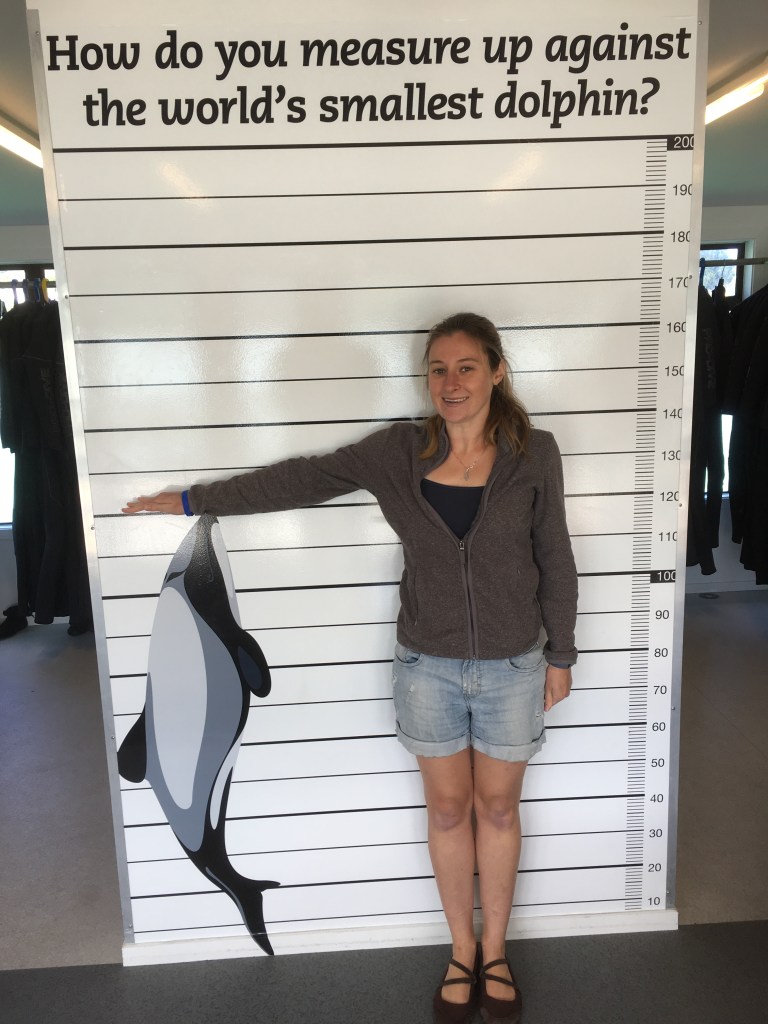
Akaroa is unique for two reasons. Firstly, the town thinks it’s in France. An old French colony that is certainly proud of its roots; French flags line the Rues, with bakeries and coffee shops lining the sea front. Secondly, the bay is home to world’s smallest, rarest and friendliest dolphins, the Hector’s dolphins.
Even Claire is bigger than these mini dolphins!
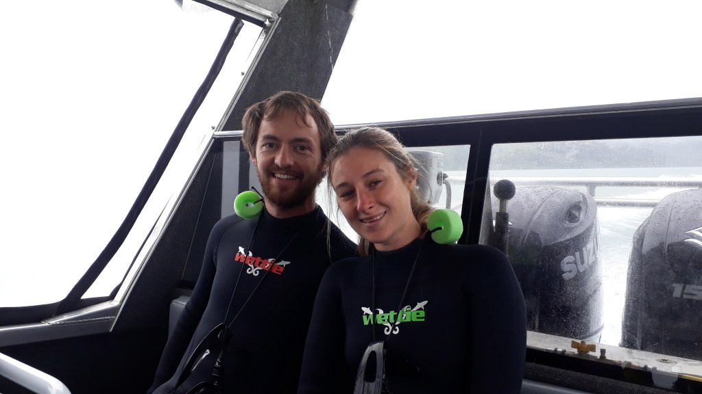
After a relaxed evening eating up the last of our supplies, we were up bright and early for an 8am catamaran trip, and a morning swim with a difference. After donning on wetsuits and a morning briefing we were off onto the water in search of some friendly dolphins. Sadly, whilst we saw a few family groups of Hector’s dolphins during our 2 hour trip, none of them were making the signs of wanting to play. Instead we got slightly sea sick in the stormy weather, and in all honesty were quite glad when we turned back for shore. We will have to leave swimming with dolphins for another trip!
At the beginning of our boat trip; pre sea sickness and dolphin disappointment
Back on dry land, we headed off to our final Kiwi destination; Christchurch. New Zealand was obviously sad that we were leaving as that afternoon the heavens opened, making cleaning the inside of the van before our departure the next day a more attractive activity than a city walk in torrential rain! With our chores done and the rain subsiding, we did make it out into the city that evening. We took a mini walk through the city and then settled down to a fantastic final meal at Fiddlesticks bar and restaurant.
And so it was so long New Zealand! Epic doesn’t begin to describe it!
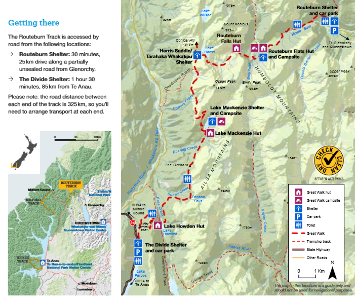
We had four days to get to Christchurch and two potential routes. The first option was to head south to Invercargill, before driving along the east coast road to Dunedin. The second option was to head north east through the central mountain belt to Mount Cook before meeting the coast further north. Having sought advice from several kiwis along the Routeburn Track, the second option proved by far to be the most popular.
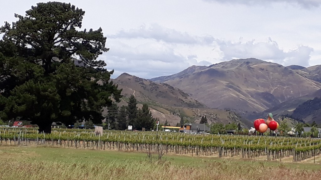
After a tiring few days we kicked things off with a short hour drive to Cromwell, a famous Pinot Noir region. Our first stop was the Sunday morning formers market in the Heritage Precinct of the town, where old buildings have been preserved and turned into a local history museum following the creation of Lake Dunston reservoir.
The heritage district in Cromwell. Home of the village museum and farmers market.
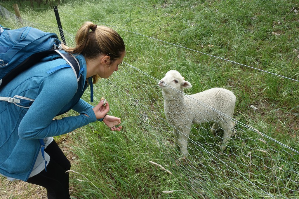
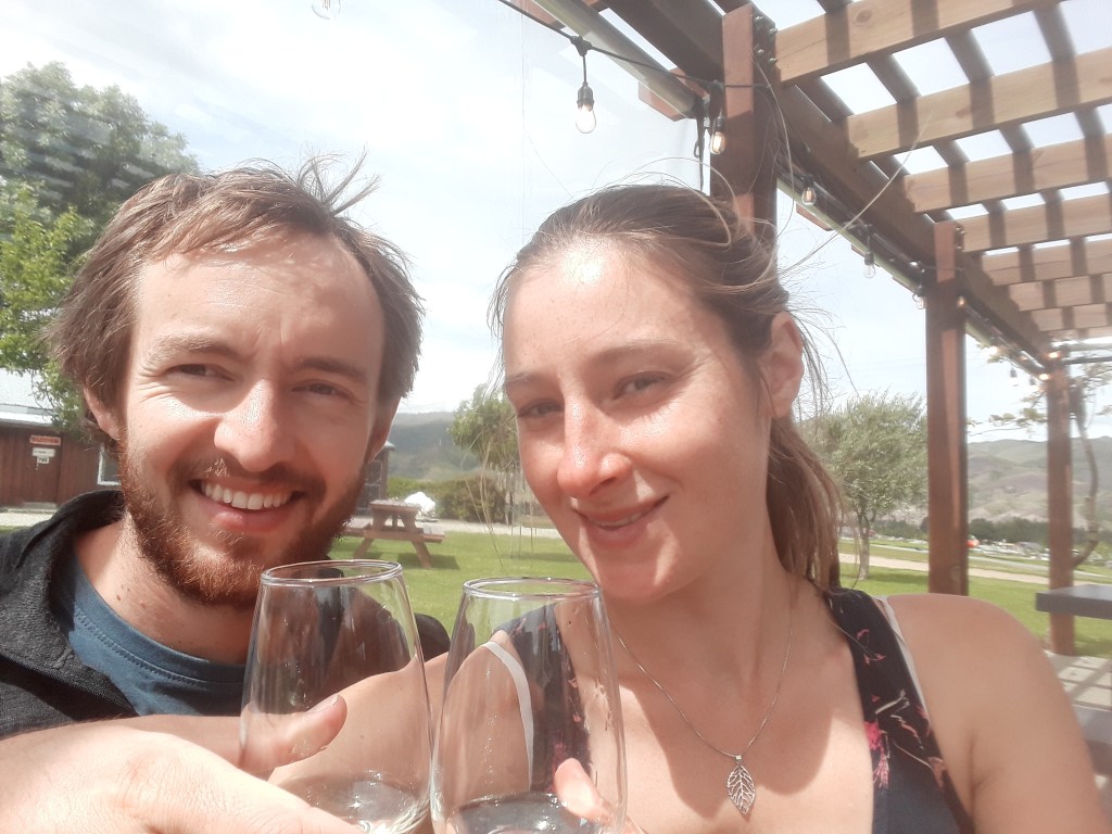
After stocking up on far too much local cheese we dropped off the camper van at a great freedom camping site by the side of the lake and headed out along the self guided 5km “Four Barrels” walking wine tour. This was an excellent way to try an abundance of wine on a budget; the ‘tasters’ seemed to get larger at each winery we went too and the scenery was beautiful.
Claire found a friend in an excitable lamb!
We would definitely suggest eating at one of the stops as Claire in particular was a little sloshed by the time we’d finished at winery number three, where we decided to call it a day and head back to the camper to devour the cheese from earlier to soak up the wine!
Enjoying some unusual wines at Scott Base Winery (include lemon sherbet flavour!)
The view across Cromwell from Wooing Tree Vineyard, named after the tree on the left of the picture.
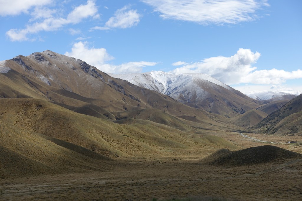
The next morning we set off in search of Mount Cook. Our journey north took us through the beautiful Lindis Pass, where we had a brief stop to admire the mountains before continuing up the road to Twizel where we had hoped we would be able to hire bikes to complete a section of the Alps2Ocean Great ride.
The beautiful Lindis Pass.
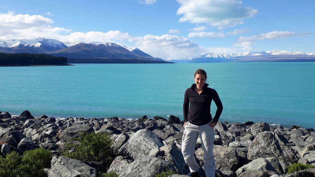
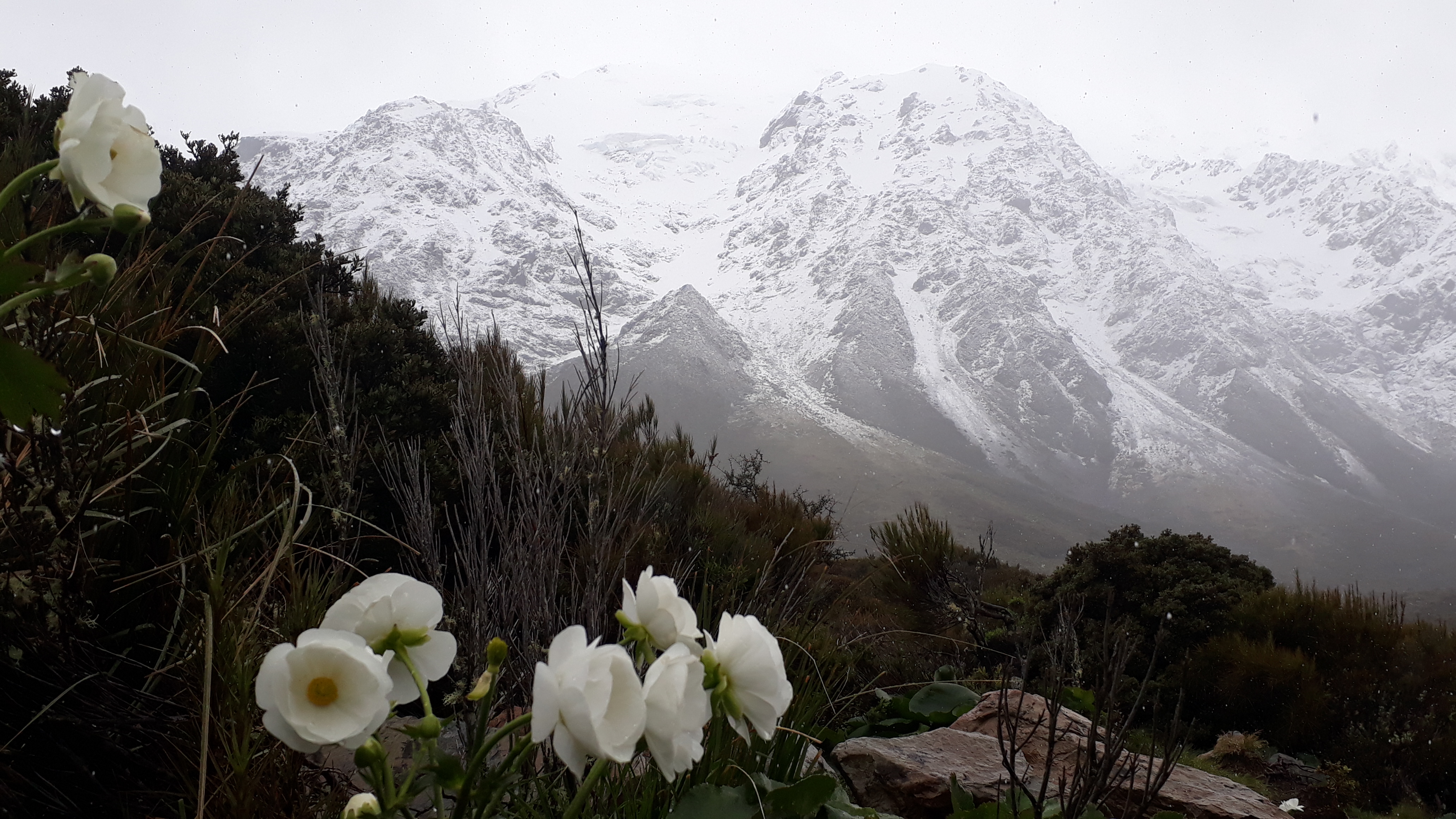
Sadly ‘The Jollie Biker’ was jolly well closed when we arrived so we continued on four wheels to Lake Pukaki, a 20 mile long bright blue lake, which looked stunning with the Southern Alps in the background. At the far end of the lake is the village of Mount Cook (and also the location for Lake Town in The Hobbit movie) where we parked the car and set off on foot further up the valley hoping for a glimpse of the top of the mountain that gives the village its name.
Claire at the sunny end of Lake Pukaki
Unfortunately, up this end of the lake the weather was less accommodating and rain and cloud meant that we weren’t able to see much further than the lower slopes from the glacial lake at the end of the valley. We did enjoy the snowy surroundings though, as well as being able to spot some Mount Cook Lilies at the side of the path.
We popped into the Department of Conservation visitor center back in the village to look at the exhibitions about early New Zealand climbers (including Edmund Hillary), who had all honed their skills in the area. One story we read was about New Zealanders Tom Fyfe, Jack Clarke and George Graham who decided to climb the mountain before the Brits or Americans could get there. They summited on Christmas Day 1894 just before the first foreign party arrived to steal the glory. Not wanting to steal any glory from the Kiwis ourselves we left the summit to them.
At the end of our Routeburn Track hike we were picked up at The Divide by a coach that, after it had dropped off a couple of hikers going in the opposite direction to us, was completely empty apart from the driver. He was a very friendly and knowledgeable chap and he pointed out to us the landmarks as we headed to Milford Sound. He also had a “chilly bin” full of our picnic lunch, which was very welcome later on.
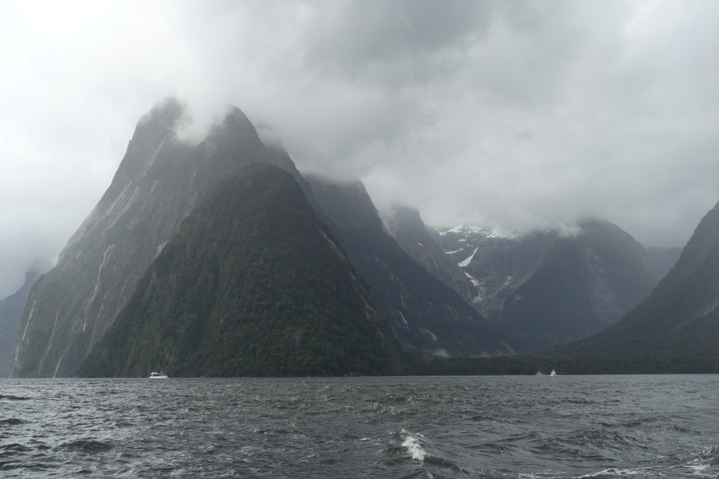
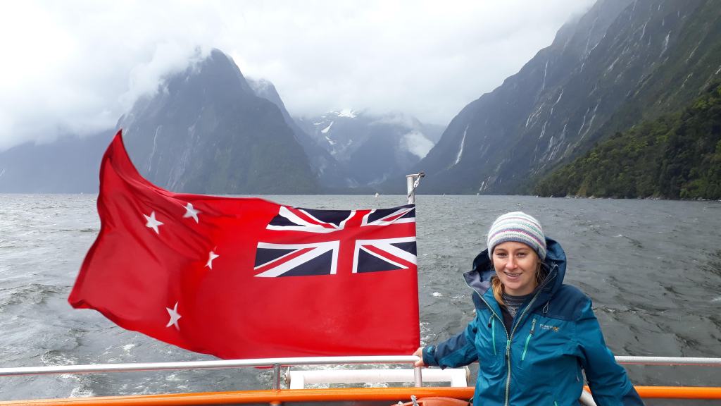
Milford sound is located in Fiordland, the wettest part of New Zealand (and one of the wettest parts of the world). With over 300 days of rainfall, the weather during our visit was pretty typical.
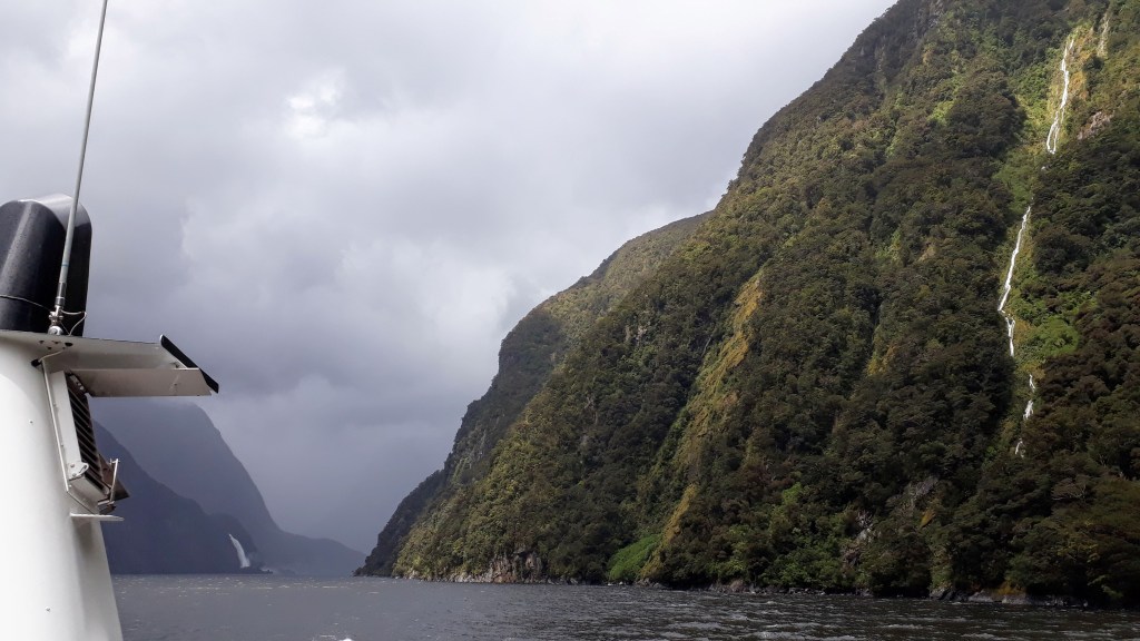
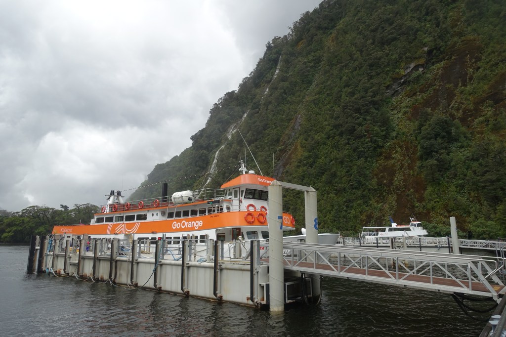
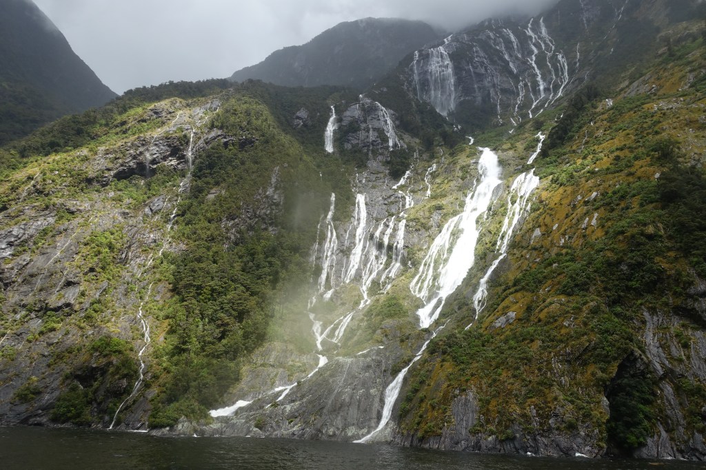
The rain was falling pretty heavily as we were driven down the valley and we could see hundreds of waterfalls crashing down the steep sides. They looked like many shimmering silvery strands when looked at from a distance. At the ferry port the rain had stopped and we were able to go outside and get a first view of the fjord before wolfing down our lunch ahead of our cruise through the Sound.
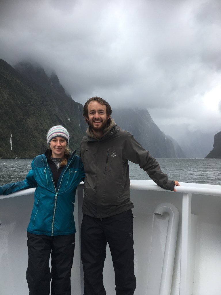
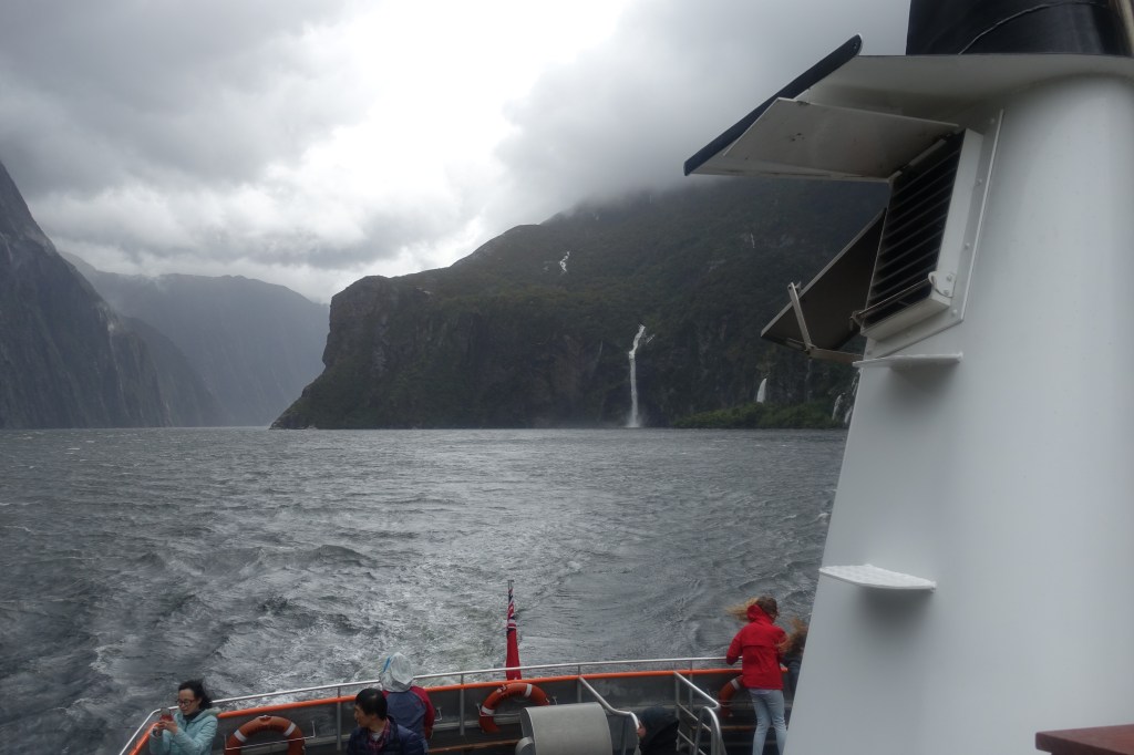
On our journey out through the Sound. Our top tip for visiting is to pack a waterproof!
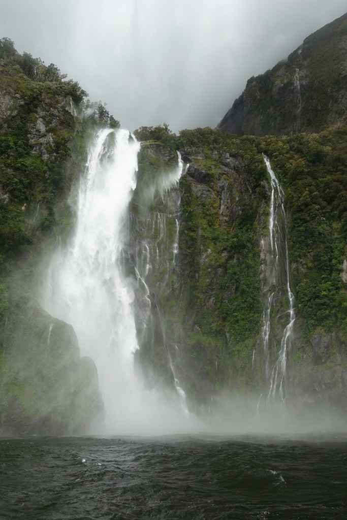
As we set out from the dock we could see more amazing waterfalls streaming down the steep sides of the mountains and into the Fjord. As all but two waterfalls along the Sound disappear on a dry day we couldn’t be too disappointed in the weather during our visit, and we even got the occasional shaft of sunlight in between showers!
Our captain certainly allowed us to make the most of the waterfalls as he enjoyed driving the boat directly below them and letting those of us at the front get completely soaked!
If your doing the Routeburn or Milford track then we would definitely recommend this trip as agreat finish to your trip before heading back to Queenstown
In total we spent two hours out on the water, and on the way back were rewarded with views of seals and a yellow eyed penguin.
After our cruise we headed back to Queenstown to treat ourselves to our first fresh food in three days, and to plan our route to Christchurch and our final views days in New Zealand.
Our regular readers may have noted the numerous day segments of New Zealand’s great walks and rides that we had so far enjoyed on our trip. Whilst these had all been excellent, both of us were keen to get the full experience by completing an entire Great Walk, and over the next few days we would be doing just that on the Routeburn Track.
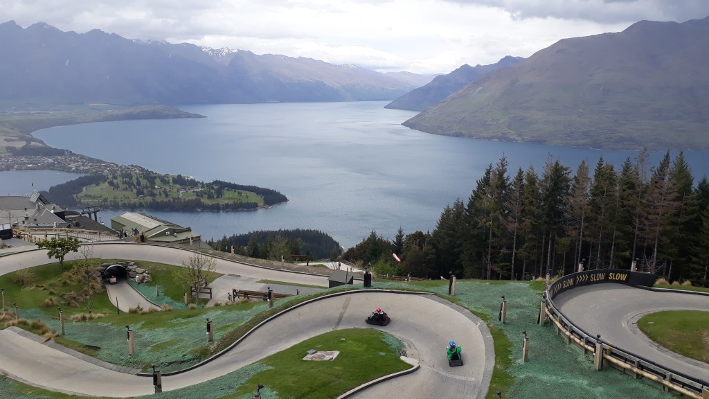
We had a full day in Queenstown before we would begin our trek, so made the most of a rainy day by heading up the gondola for a morning on the luge track above the town. The track was a bit slippery in the heavy rain but that made it more fun and caused a couple of exciting spins. The afternoon was filled with preparation for our trek; stocking up on snacks and dehydrated food, re-waterproofing our hiking gear, ‘signing in’ with the Department of Conservation and tracking down all the equipment hire we would need to pick up the following morning, We rewarded ourselves for our productive afternoon with a very delicious evening meal at the ‘Public Kitchen and Bar’ (don’t let the dull name put you off – the food was outstanding).
The view down Lake Wakatipu from the luge track (before the rain)
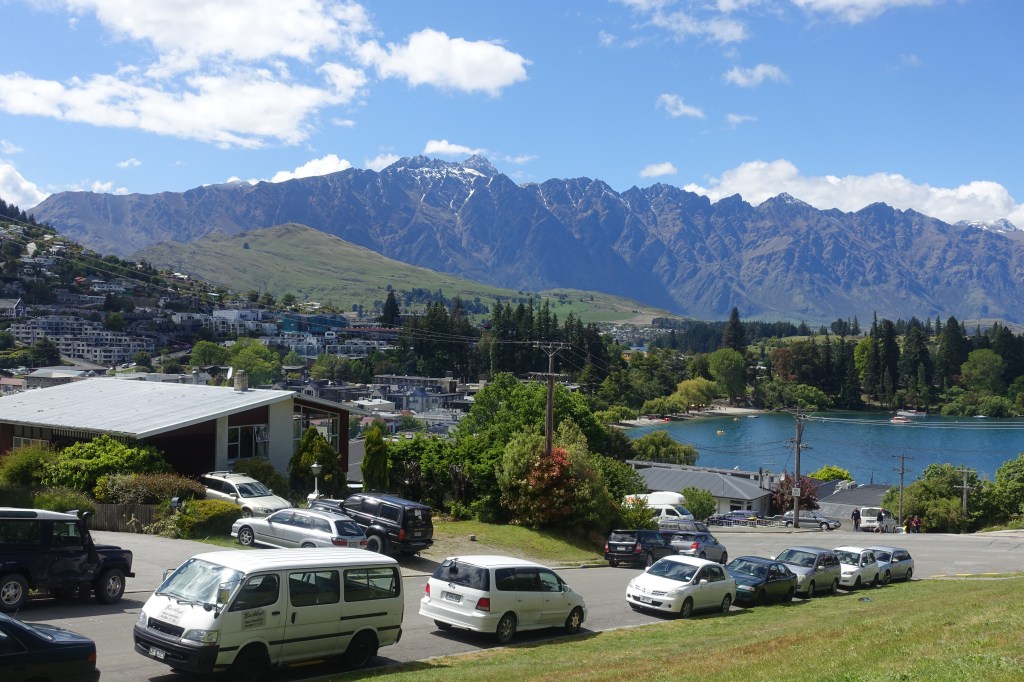
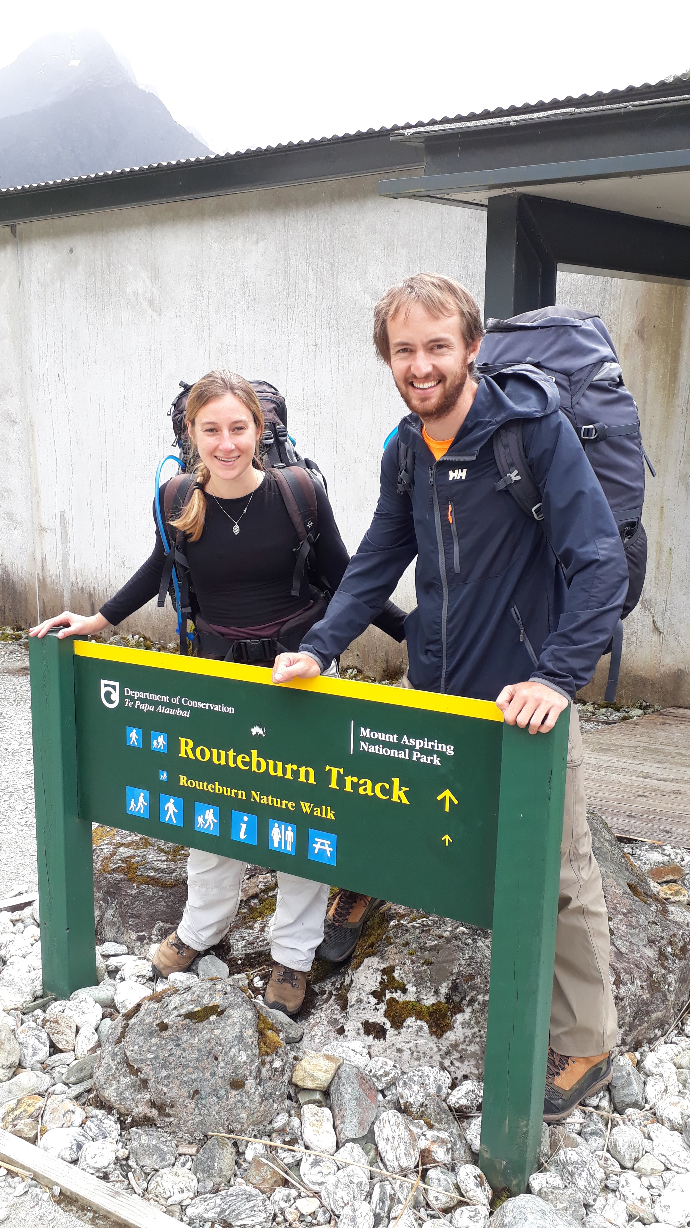
We woke the next day to blue skies and after picking up and packing the last of our gear, took our midday shuttle bus around the shoreline of the lightning bolt shaped Lake Wakatipu to the beginning of the Routeburn track, just north of Glenorchy (passing Isengard, Lothlorien Forest and The Misty Mountains enroute).
The view of “The Remarkables” from Queenstown
Whilst the clouds had started to gather as we took the first steps on our trek, we were fortunate to avoid rain on the first afternoon segment of the Routeburn.
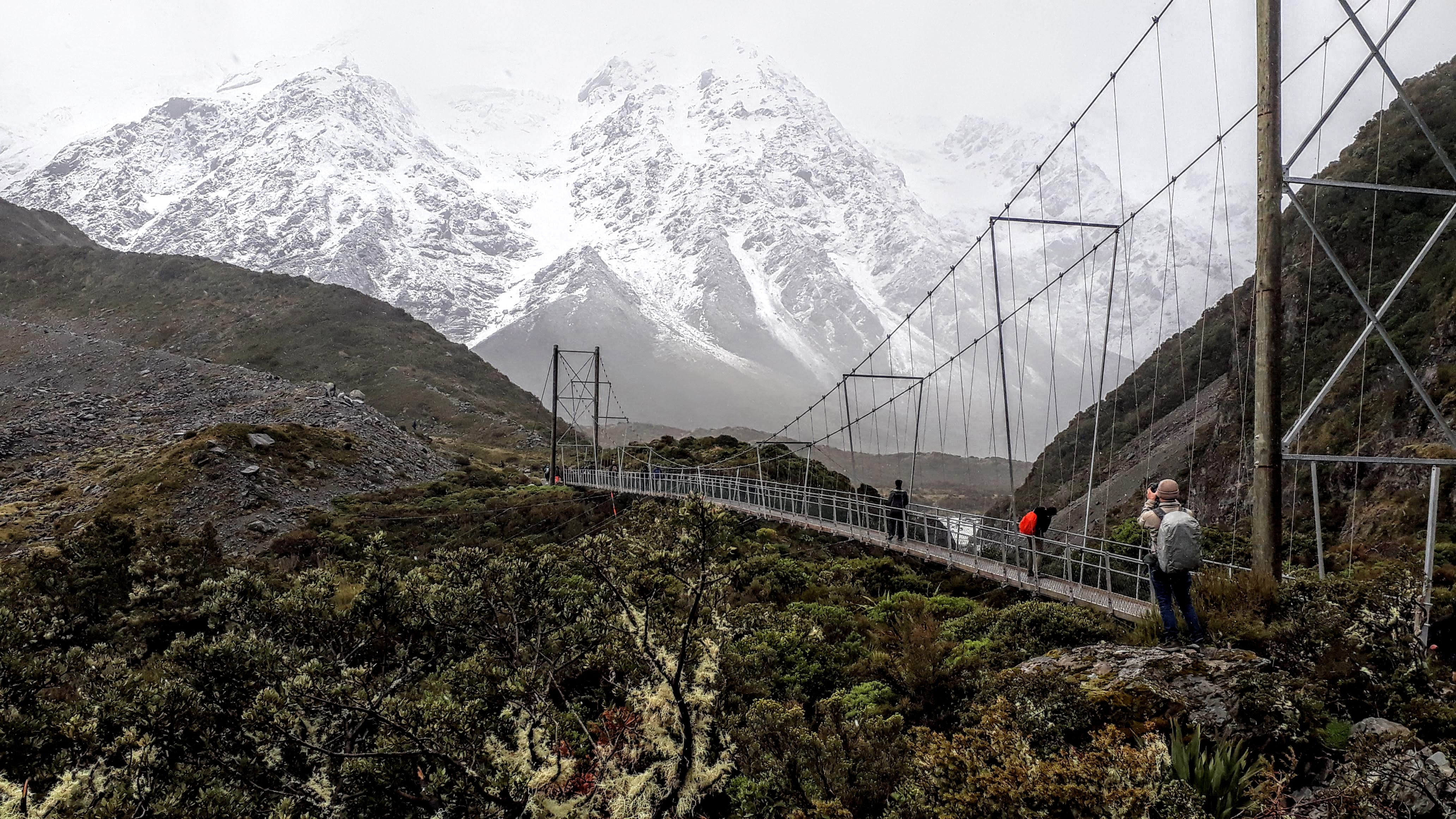
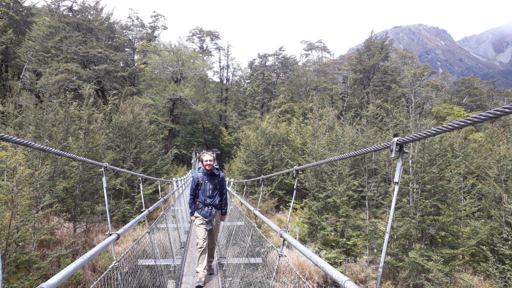
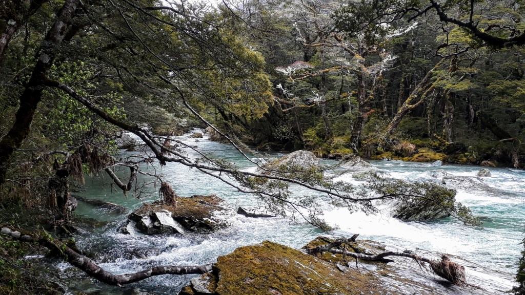
We started the trek with four friendly New Zealanders who had shared our shuttle bus from Queenstown, but before long we were alone in a moss covered forest surrounded by the sounds of nature. The well defined trail was punctuated with numerous suspension bridges taking us across the steep sided gorges and the impressive aquamarine Route Burn and its tributaries.
Starting out along the Route Burn
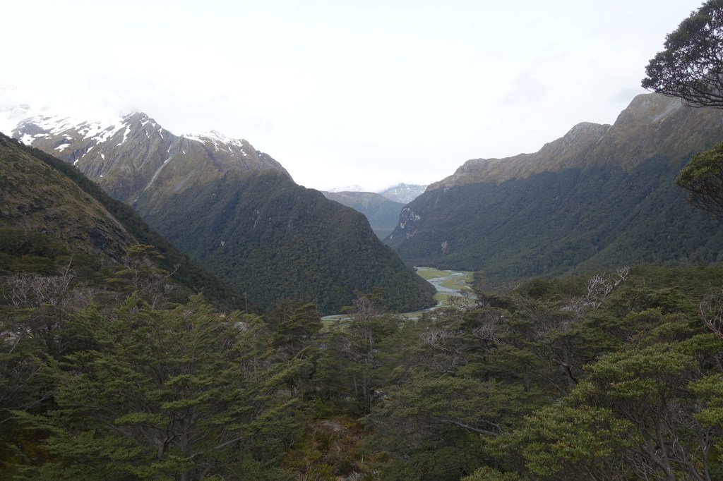
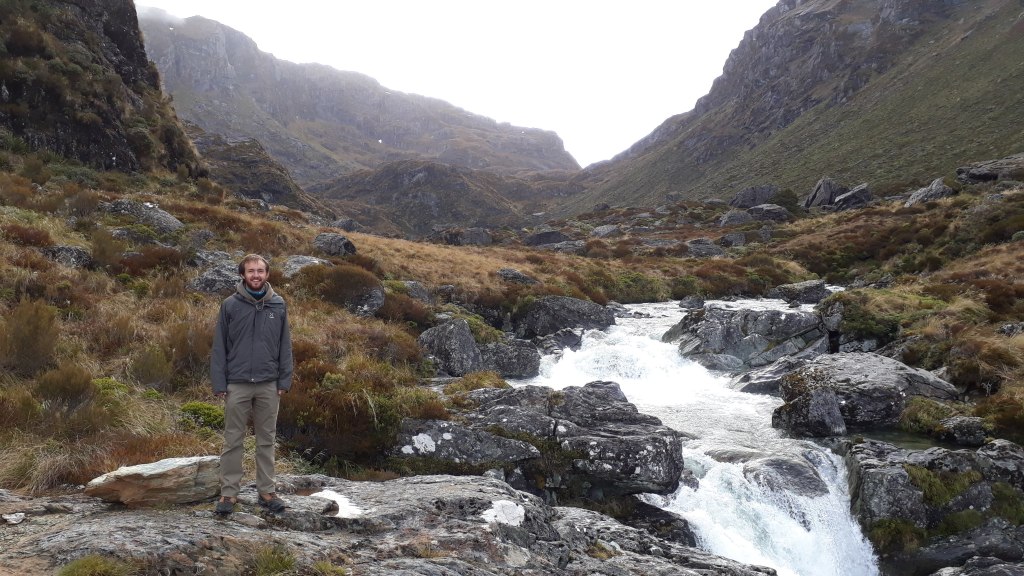
The trail wound gradually uphill for the first couple of hours before beginning to steepen as the trees thinned giving us a great view back across the isolated valley to the snowy peaks beyond.
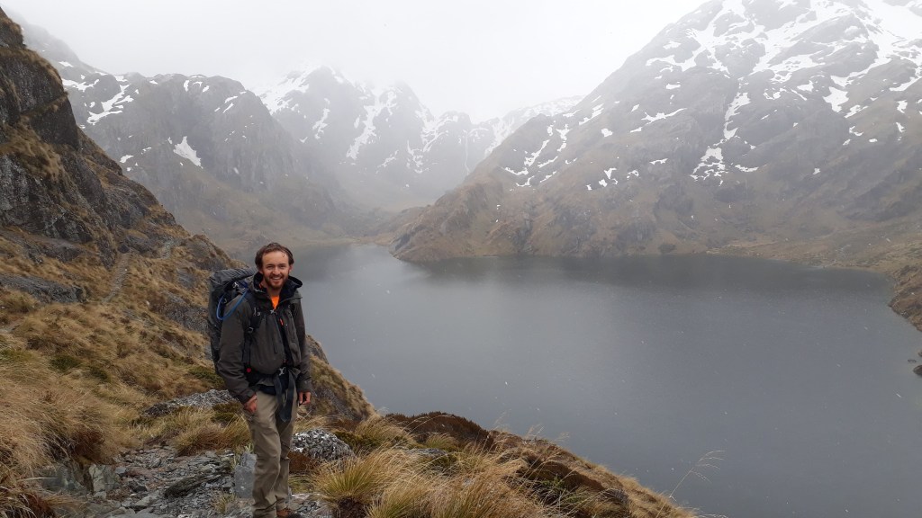
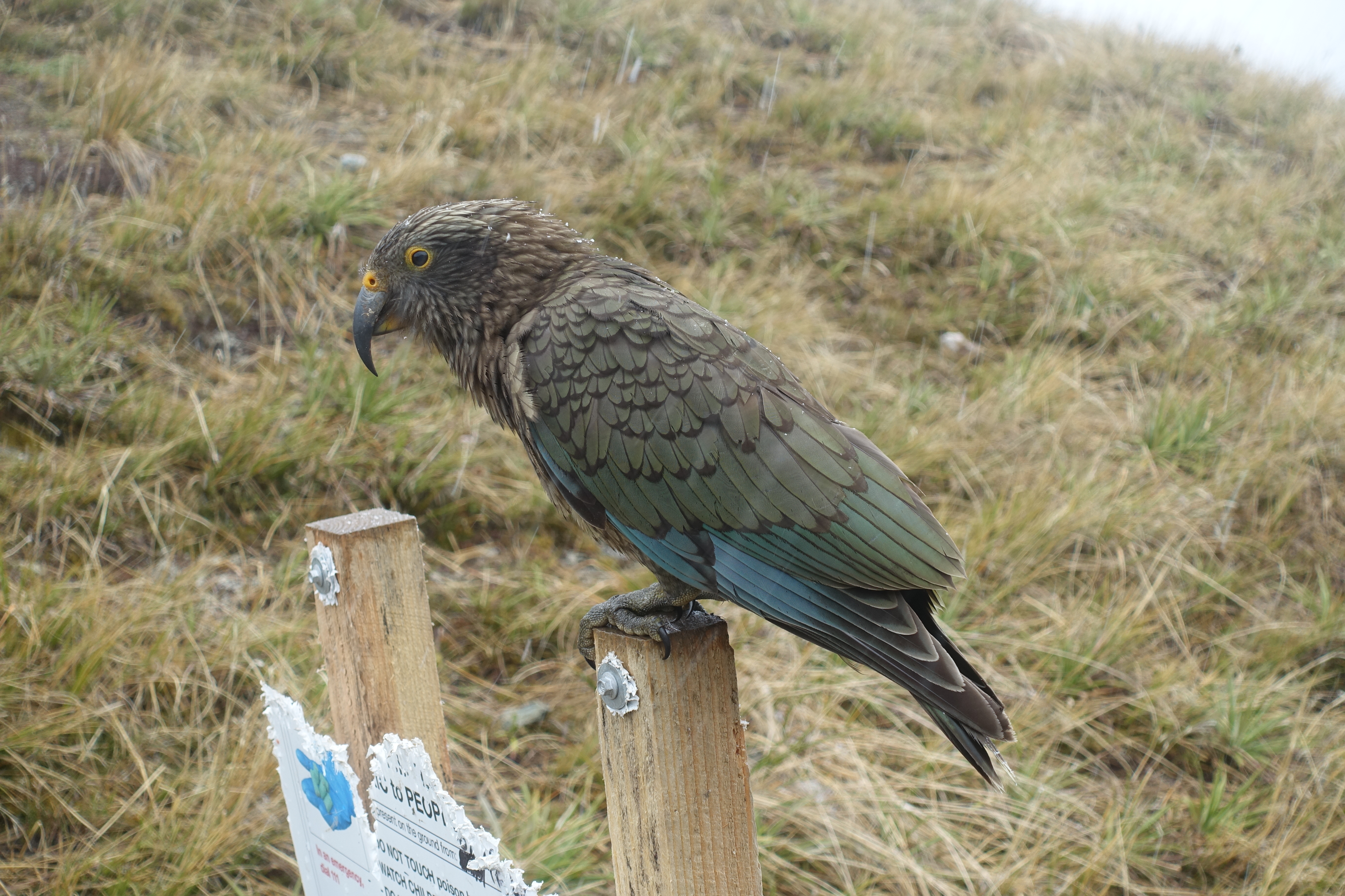
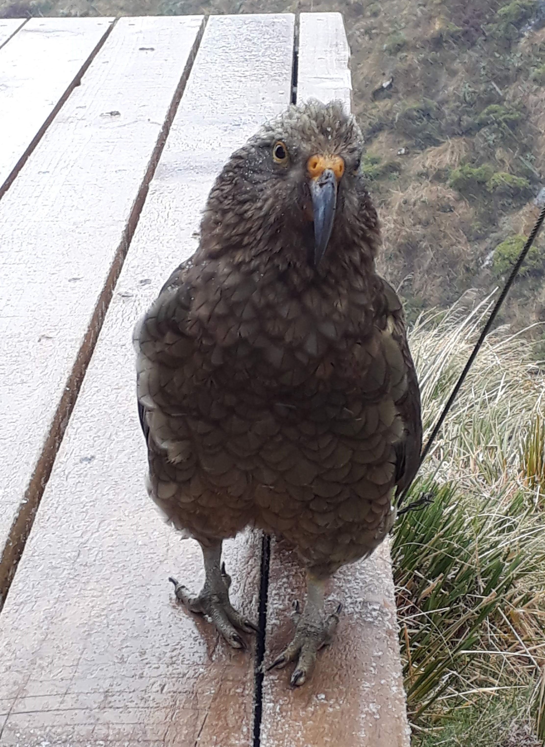
We arrived at the Routeburn Falls mountain hut in the late afternoon, picked ourselves out some bunks and headed into the kitchen where fellow walkers were warming themselves by the fire. The hut had a fantastic view of the valley, along with several inquisitive Kea (alpine parrots) who we were warned would steel any coats or shoes left outside!
Looking back towards Routeburn Flatts from Routeburn Falls Hut
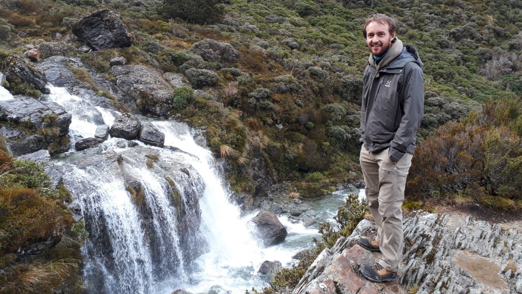
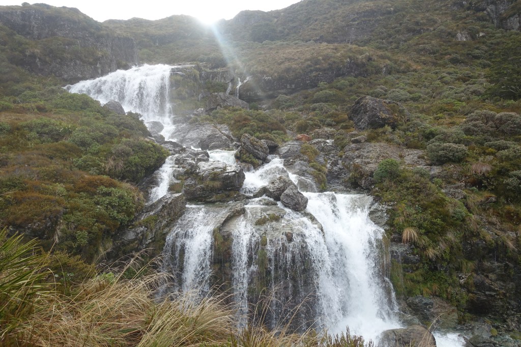
The hut ranger warned us that the weather over the next few days was going to be extremely soggy so we decided to make the most of the dry evening and go a little further up the path to the Routeburn Falls that give the mountain hut its name.
Exploring the Routeburn Falls just before sunset
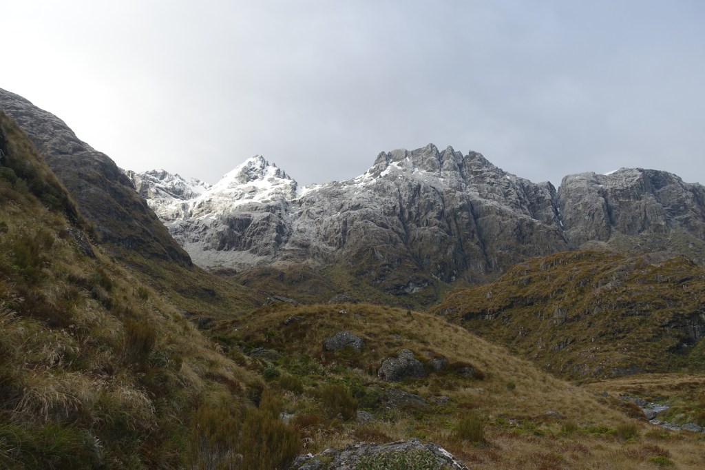
The next day was our longest of the walk and as the weather was due to get worse as the day progressed we decided to make an early start. By 8am the first flakes of snow began to fall and we turned to look out back towards the hut and say goodbye to the sun for the next couple of days.
A dusting of snow on the mountains made for a magical morning of walking
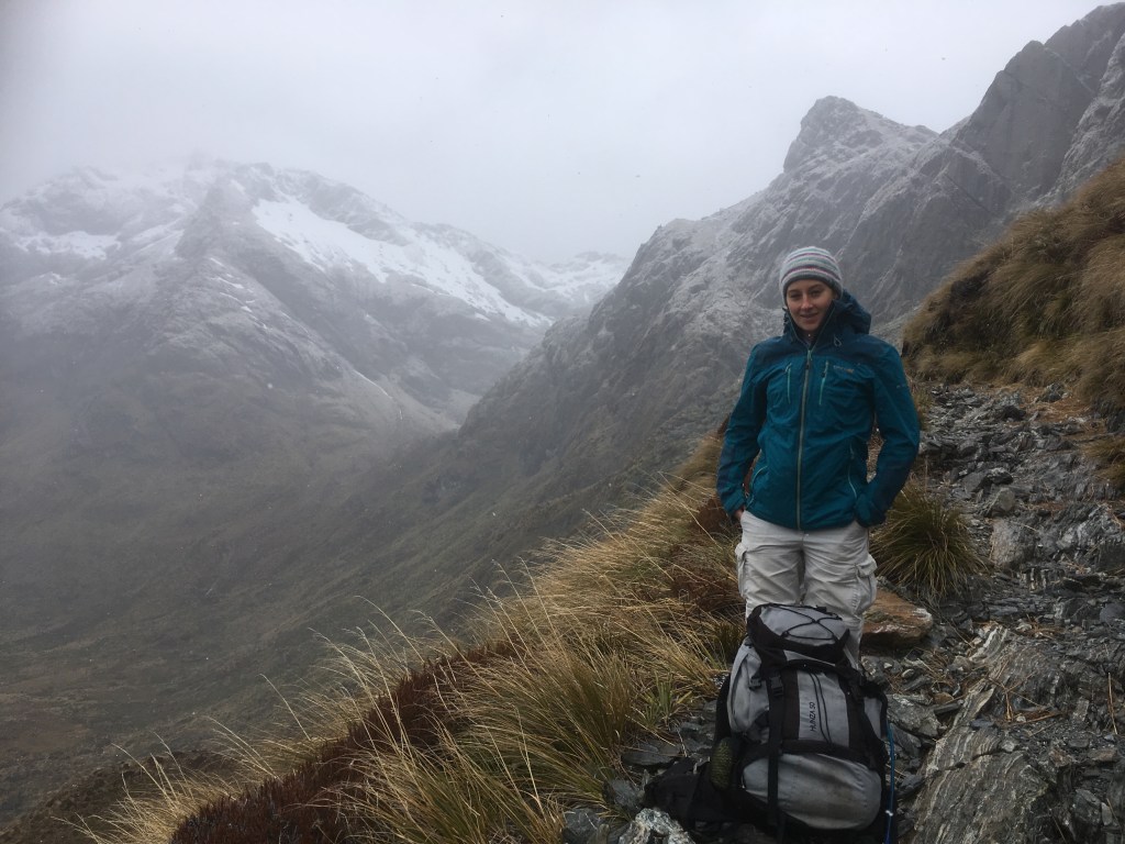
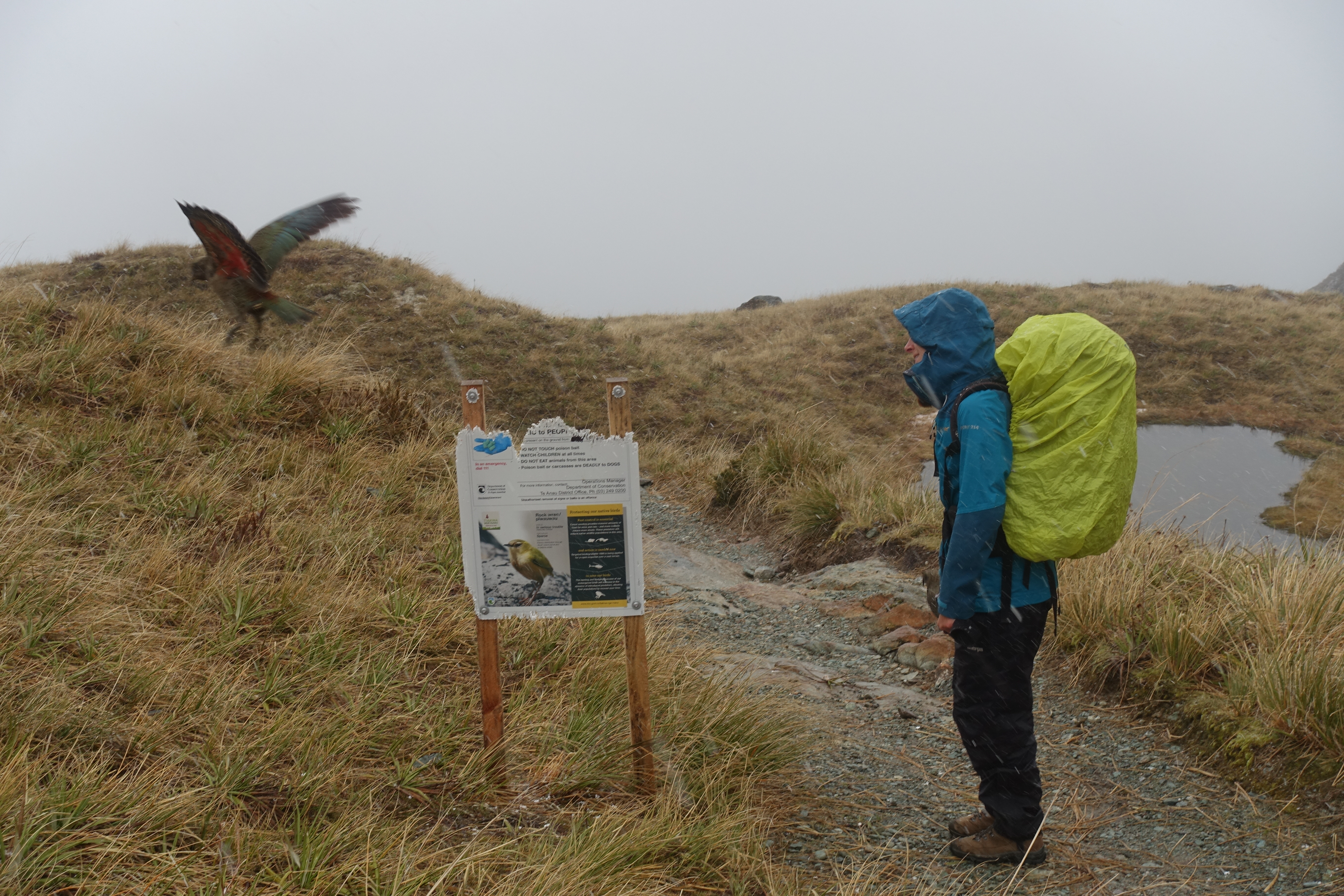
We reached Harris Lake and the ‘saddle’ at the peak of the Routeburn Track before we were completely submerged by cloud and were entertained by some very bold Kea as we escaped the snow at the Harris Shelter to get fully kitted out in our wet weather gear.
Snow fell gently around Harris Saddle
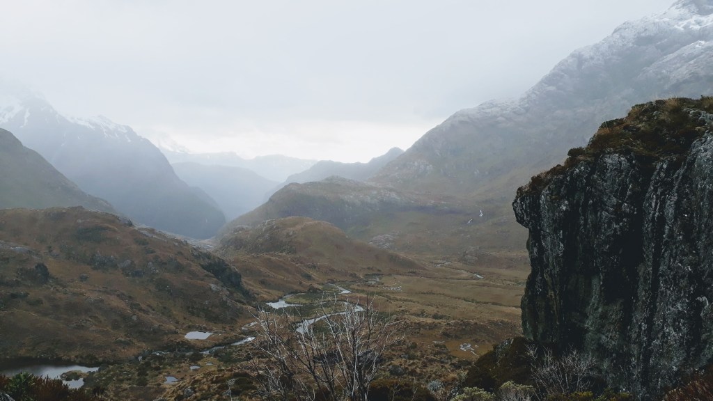
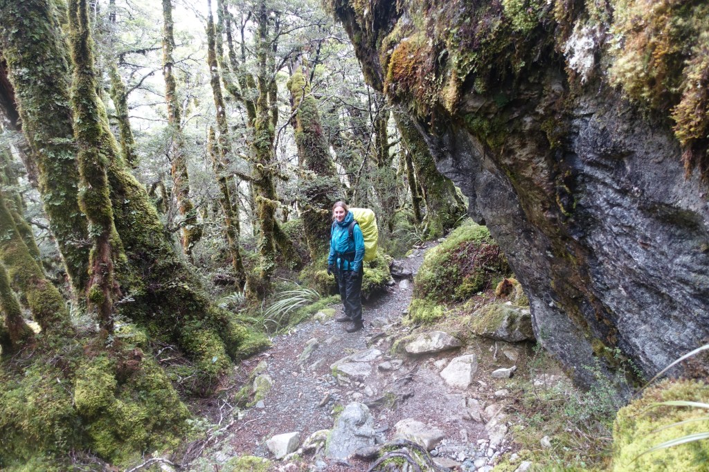
The far side of Harris Saddle was more exposed to the weather. On the plus side we would much rather walk in the snow than the rain, but it was disappointing not to be able to see the valley floor on this side of the mountain ridge, which we knew was somewhere in the cloudy mist below us. The cloud did break momentarily as we began our descent from the mountains to our lunchtime stop at Lake Mackenzie. Unfortunately the drop in altitude had also turned the snow to rain, but at least we had the cover of the forest again to protect us from the downpours.
Calire in the ancient forest on the track between the two huts
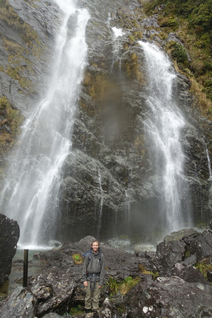
Gareth below Earland Falls – one of the biggest on the track – we couldn’t see the top, which was in the mist!
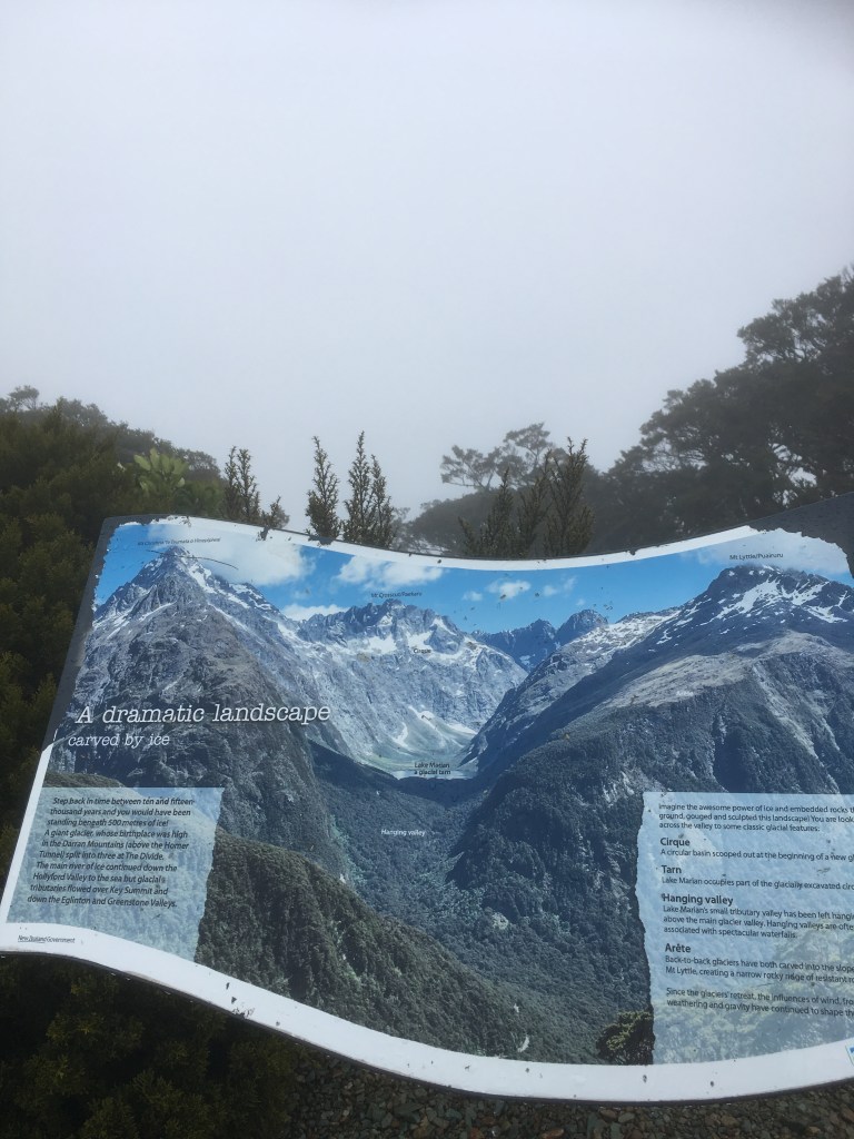
We reached Lake Howden hut, our overnight stay, at 3:30pm. With the fire not yet on we decided to drop off our packs and head over to Key Summit just 30 minutes away so we could claim at least one peak during our hike. We were reliably informed that, in good weather, Key Summit has the most spectacular views of the mountains along the Routeburn Track – but we had to settle for the picture on the notice board!
What a great view this would have been!
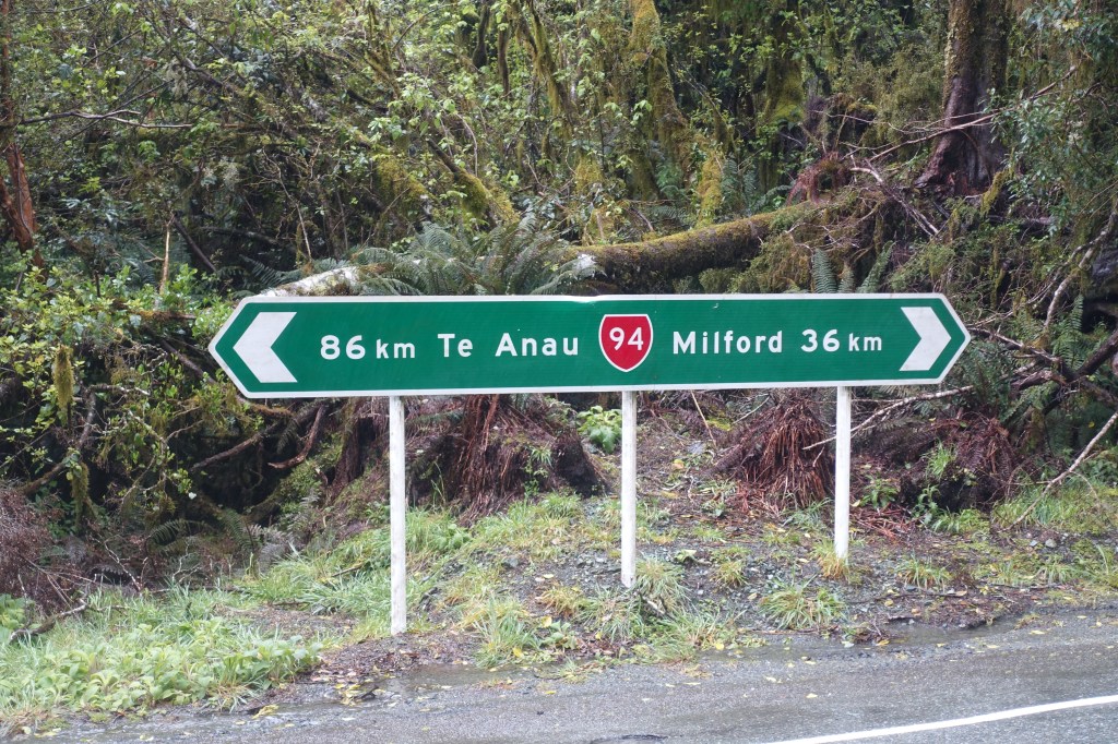
The rain continued all through the night and with just an hours walk to reach The Divide (the end of the Routeburn Track) we treated ourselves to a lazy morning, enjoying an extended breakfast before we set off into the rain. The rainwater was pouring down the tracks as we made our way to the pick up point, but fortunately there was a large shelter at the end for us to dry off and warm up in as we waited for the bus to Milford Sound.
When we finished our trip down the west coast, we stopped briefly at the town of Haast, which one of our guidebooks described as the middle of nowhere. It definitely felt pretty remote with only a few farms along the dead end road further down the coast. We chose to avoid the detour and head inland on route 6 up the Haast Pass.
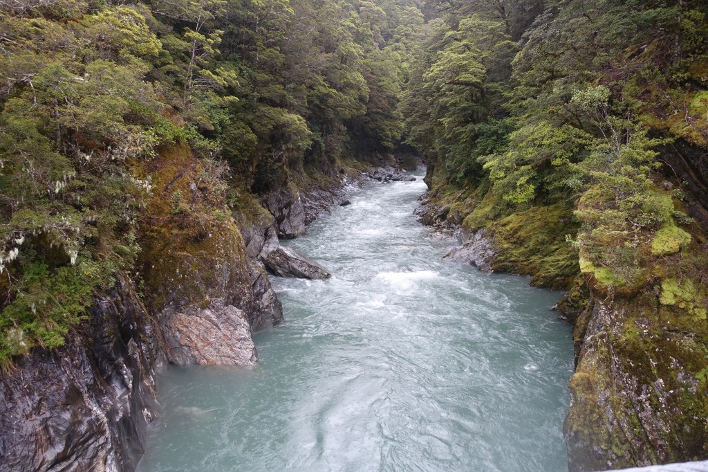
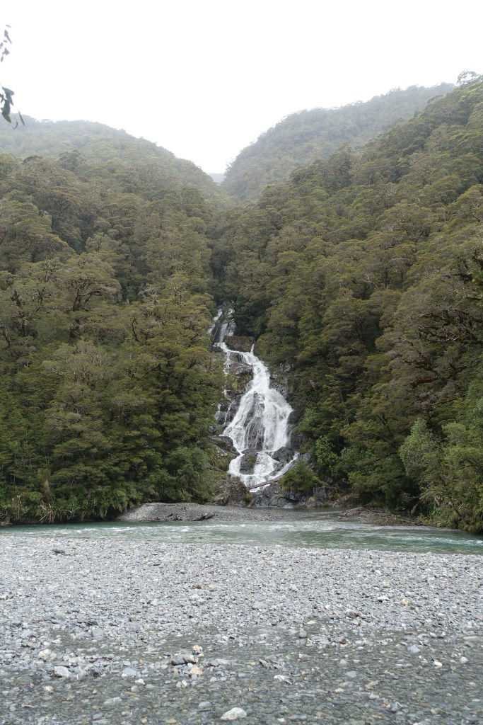
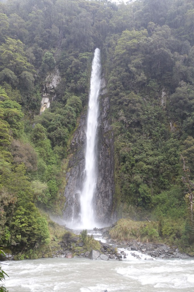
We made a few stops on our way up the pass and places with some great names such as Roaring Billy, Thunder Creek Falls and Fantail Falls. We also went for a walk at a place called Blue Pools, but after all the rain of the last few days the river was high and it wasn’t altogether clear where the pools were.
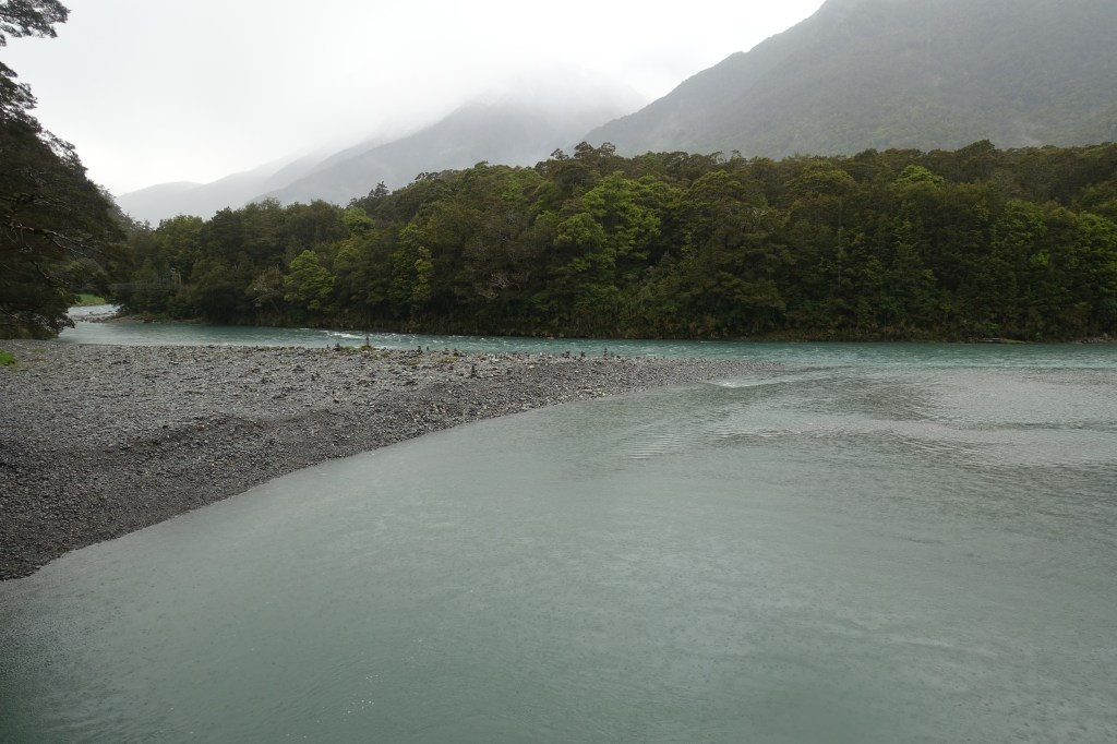
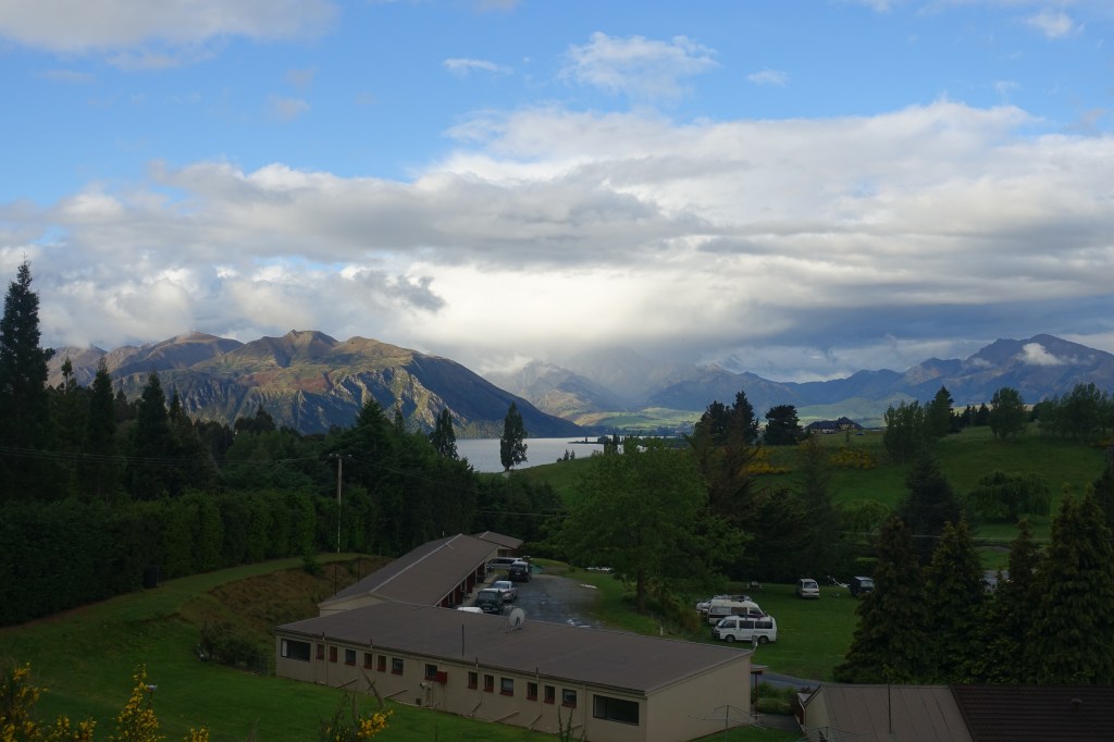
We made it to the top of the pass and began to lose altitude until we arrived at the far end of Lake Wanaka, which at 45km outside of town still felt quite remote! We headed through a gap in the mountains to reach Lake Hawea and drove along its shore before we got to Wanaka where we would stay the night. The campsite had a great view of the mountains, which the photo below doesn’t really do justice (but as you will see we got plenty of other photo opportunities the next day).
The view from our campsite for the night
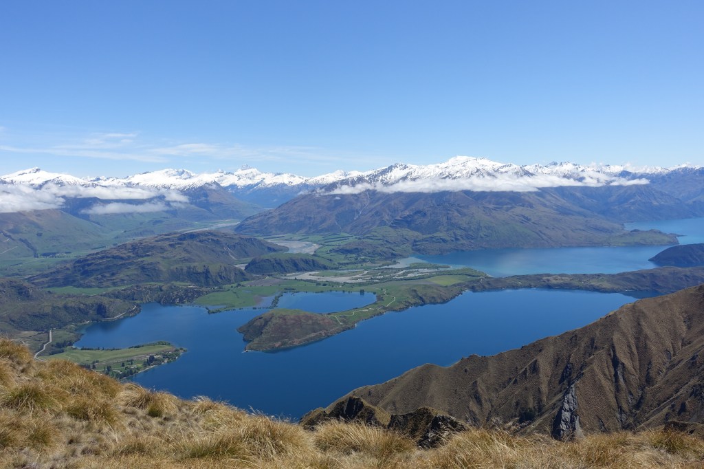
Determined to get outside and enjoy the nice weather that was forecast for the following day we planned a walk up Roy’s Peak, a famous half day walk in those parts. It definitely did not disappoint. Once we’d managed to find a spot to park (we weren’t the only ones making the most of the weather), we started making our way up the winding path that snaked its way across some very steep cow and sheep pasture. As the pasture turned into more of a mountain grassland, more of the view down to Lake Wanaka started to open out. It was a view that got better and better as we got higher and the Alpine peaks of Mount Aspiring National Park began to dominate the skyline.
As we climbed the morning clouds dispersed leaving a blue sky and a beautiful view behind. Glendhu Bay in the foreground with Mount Aspiring National Park in the background
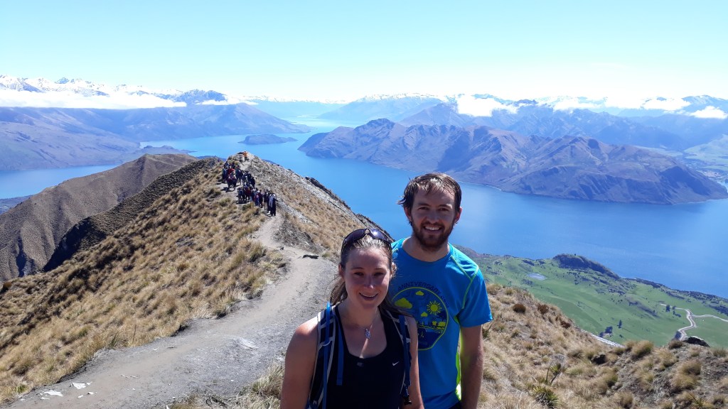
We skipped out on the tourist covered traditional photo opportunity about two thirds of the way up and carried on to create our own just a bit higher up. With the sun out and the amazing views we stopped at the top to enjoy a picnic. Although the wind was a bit chilly that high up and we didn’t hang about on the way back down to help warm us up again.
For some reason the majority of the hikers on Roy’s peak chose to queue for the same photo on the shoulder of the mountain rather that carrying on up the mountain for an even better view.
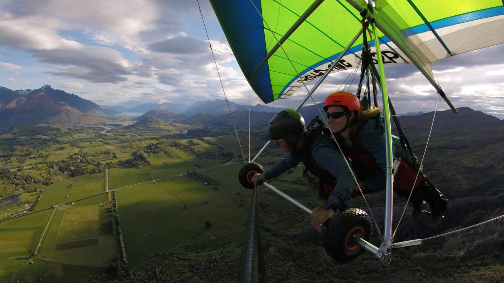
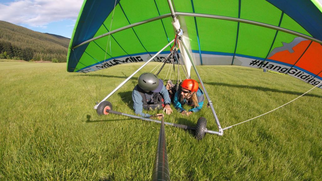
Reaching the bottom and getting back to the camper at about 2pm, we wanted to find something else to do with the remainder of the sunny day, so we headed back to town to the I-Site (Tourist Info) to find out about short walks or activities in the area. The Wanaka and Queenstown region is famous for adrenaline activities. As a child Claire had always hoped she could learn to fly. Having failed to grow wings or gather enough fairy dust to attempt this unaided, she was instead keen to try some hang gliding which is the closet a human could get to bird flight. We discovered that while they didn’t do it in Wanaka they did in Queenstown and the I-Site recommended going that afternoon before the weather got worse the next day. And there was one space left on the 6pm “flight”.
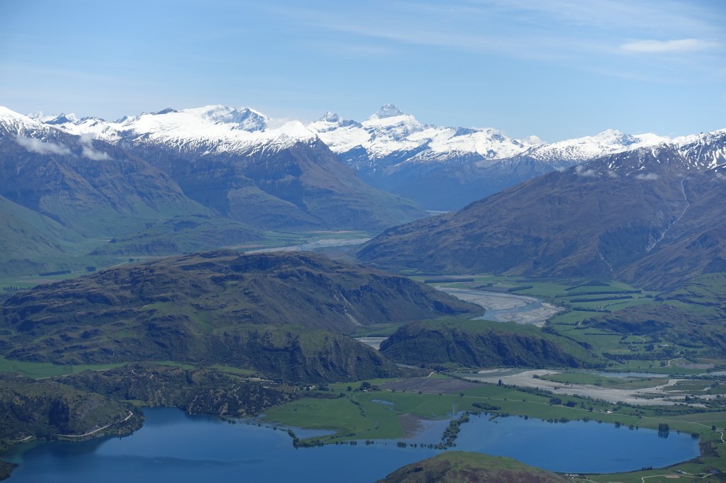
Mount Aspiring (in the centre of the photo) which gives its name to a large area of National Park and was correctly identified by Claire as Gareth meticulously fumbled over the map.
So before you could say “Gareth was relieved that there wasn’t a second space”, we were headed south a day earlier than planned to the adventure capital of New Zealand so that Claire could run off the side of a mountain! We arrived in Queenstown with just minutes to spare and before you could say ‘where s the landing site’ Claire was driven off back up the mountain, leaving Gareth to try to await her return in a nearby pub!
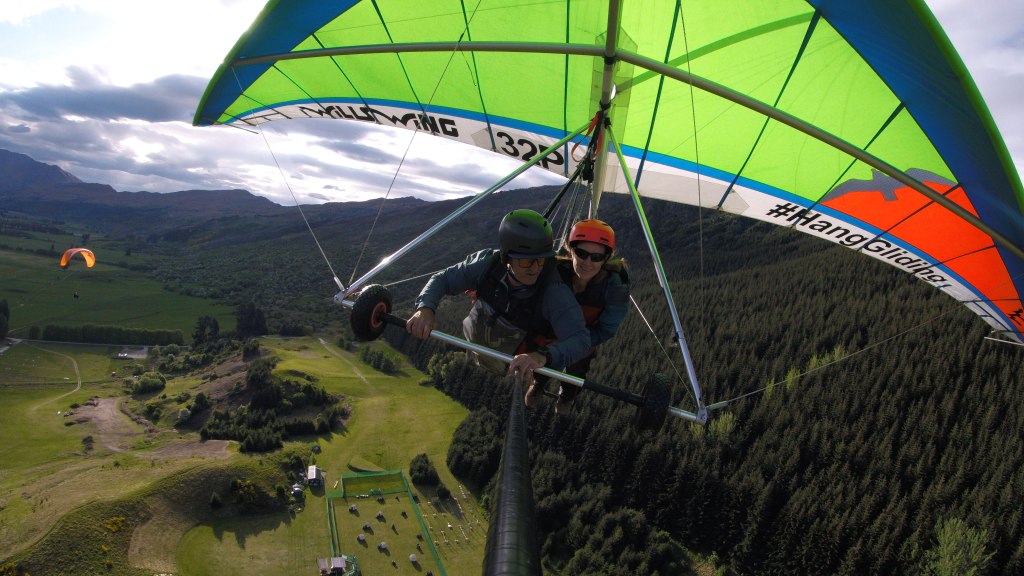
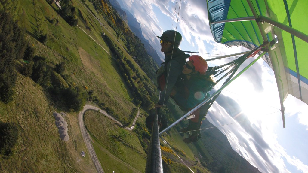
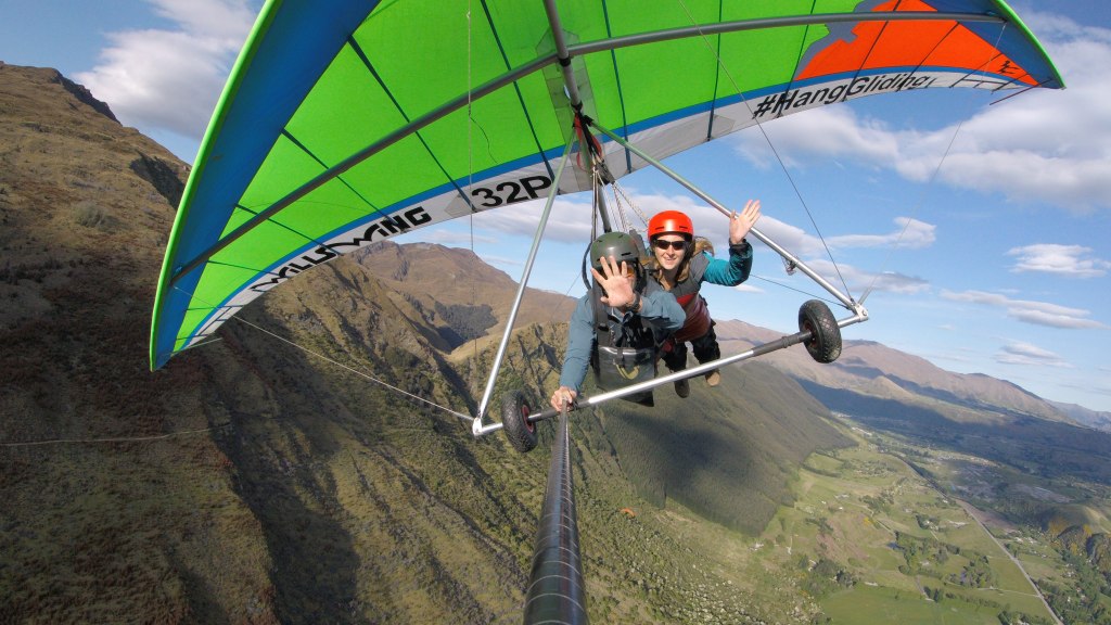
After a quick safety briefing and instructions of how successfully run off the mountain Claire and her instructor fixed their eyes on a tiny flag and willed the wind direction to change so they could take off. For a split second it did and with no time to waste they were running over the cliff edge and into the air! The 10 minute flight was incredible; catching air currents and soaring over magnificent mountains, forests and valleys with a unique view of the landscape. A perfect way to enjoy a beautiful evening!
DCIM\101GOPRO\G0021520.JPG
DCIM\101GOPRO\G0041540.JPG
DCIM\101GOPRO\G0041543.JPG
DCIM\101GOPRO\G0021515.JPG
DCIM\101GOPRO\G0041549.JPG
For 10 marvellous minutes Claire pretended to be an eagle as she soared over the Queenstown mountain ranges
After Claire landed she discovered that the wind had changed directly after her take off and none of the other hang gliders had managed to take off that evening, She felt so lucky to have had such a wonderful experience.
After leaving Abel Tasman we drove south to the former gold mining settlement at Lyell for an overnight stop and a chance to plan our route over the next few days. We had five days before we needed to be in Queenstown and various sights and activities along our route. One adrenaline activity neither of us had tried before was white water rafting and we were keen to fit this into our New Zealand Itinerary. It just so happened that the Buller River (in the gorge below our campsite) was littered with grade 4 rapids.
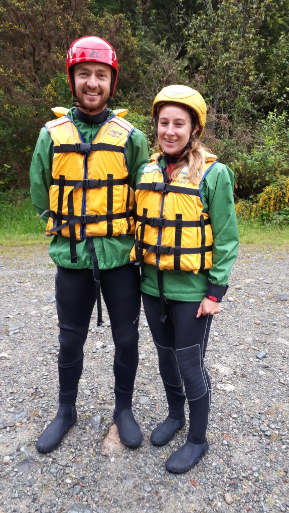
As a result the next morning saw us join Wild River Rafting along with two other couples. It turned out that our last minute booking had been incredibly lucky. All rafting the week before had been cancelled as the river was too high (whilst we’d been basking in the sun in Nelson and Abel Tasman, the west coast had been inundated by storms) and with rain forecasted in the afternoon it was likely to rise again. The high river meant that alongside our rafting captain James we were being joined by Bruce in a safety boat. Between these two guys and Marty watching from the bank they must have had over a century of experience riding the Buller River so we knew we were in safe hands, but that didn’t stop us both feeling slightly nervous as they went through the various ways we could fall out the boat and what to do in each circumstance.
Ready to get soaked!
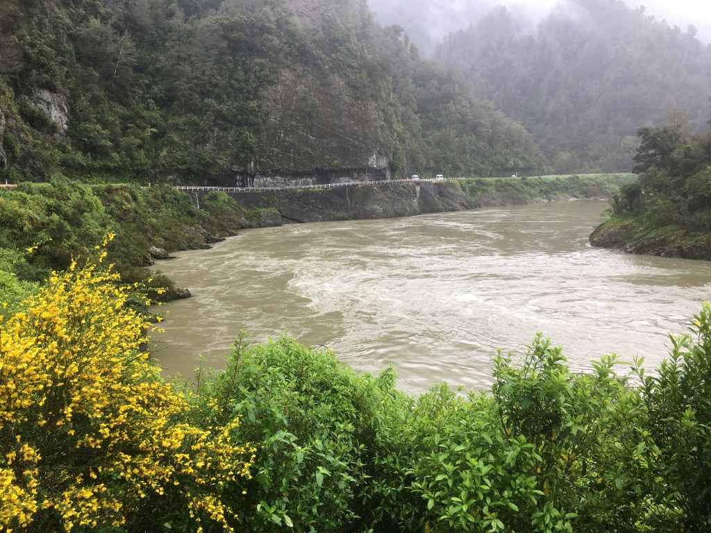
After a few minutes practicing rowing and stowing oars safely on James’ command (who knew a rafting instructor could be so similar to any army drill sergent!) we set off down the swollen river. James was a mine of information, full of the gold mining history of the area along with information about the changeable nature of the river (which could rise by 15m in 24 hours). He also advised us of places we should visit on our journey down the west coast. Soon we approached the first rapids named ‘the earthquake rapids’ due to the tectonics that had led to the huge landslide that formed them. The next few seconds were full of shouted instructions from James, cascading water and frantic rowing. It was thrilling and manic but we made it through without incident and regrouped at the bank by a waterfall whilst James and Marty studied the next stretch of river, picking out the best route. Then we were off again, navigating rocks, whirlpools and 3m high waves.
Unfortunately we weren’t able to take our cameras on the river, but this is a calmer section downstream from where we went in.
We had a couple of close shaves, including almost missing a safe ‘river observation point’ (which may have had something to do with Gareth rowing forwards instead of backwards), and going backwards down the largest rapid (which neither of our guides had ever done before!). Then all of a sudden we were through, the river calmed and we were all still in the boat (at least until we were given the all clear to jump in and float downstream for a stretch!). As we hoisted the rafts out of the water the first drops of rain started to fall – the rafting window was over for the next few days!
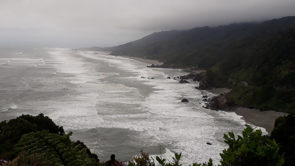
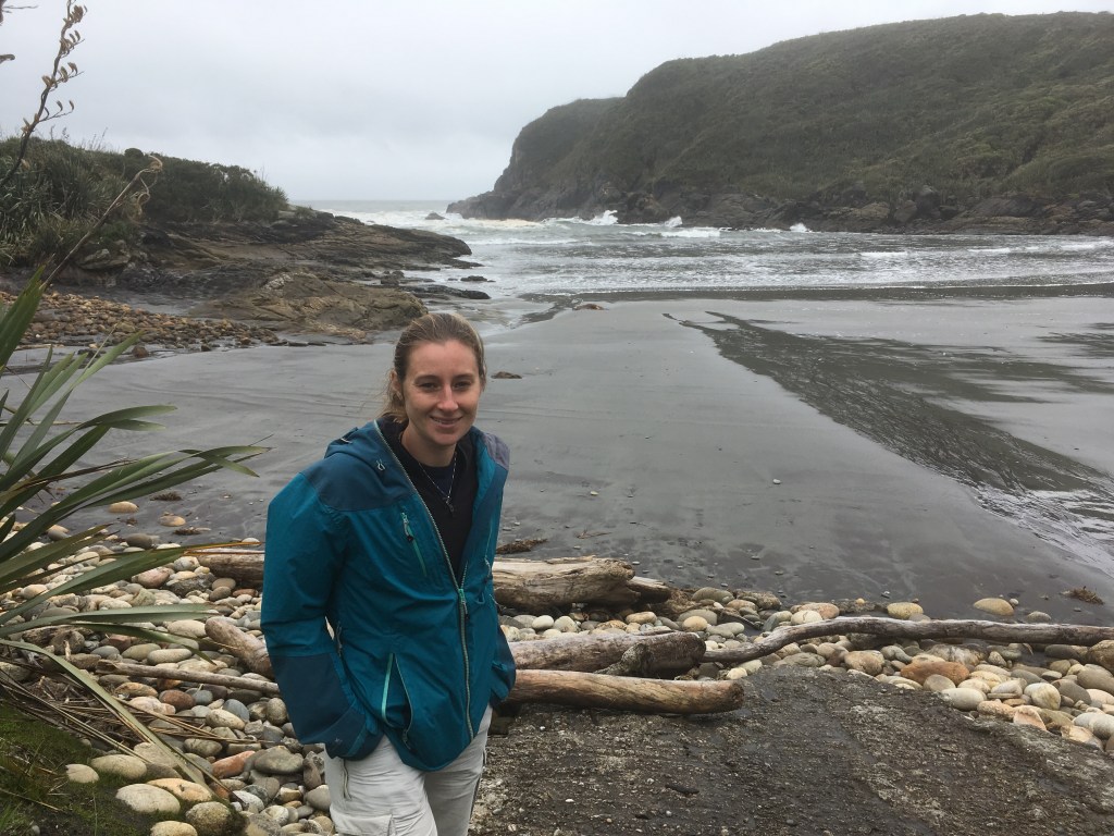
The rugged West Coast – grey and misty!
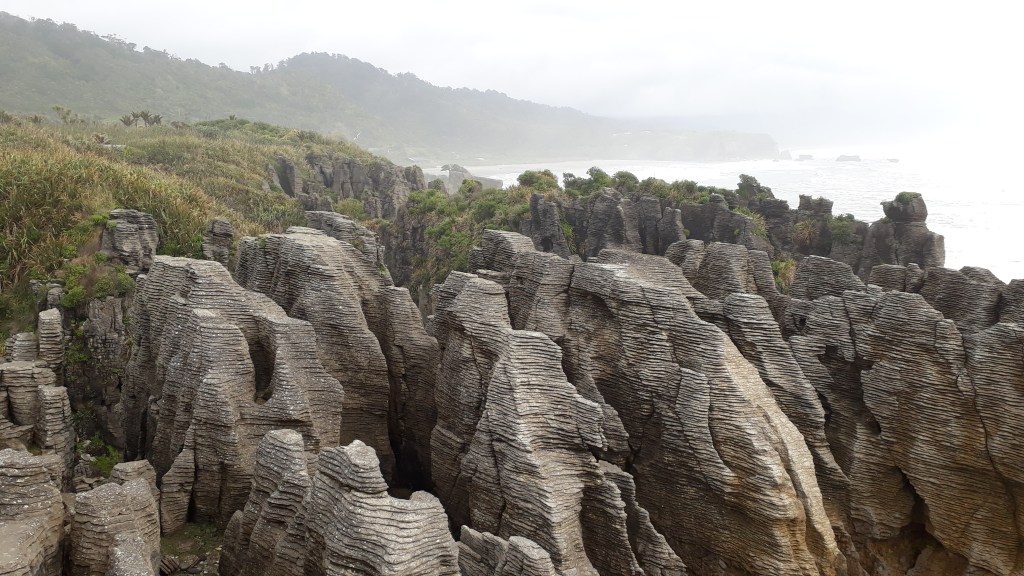
That afternoon we hit the coast and headed south, stopping at Carters Beach (where a natural harbour was vital to the early days of European colonisation of the south island) and Pancake Rocks (amazing limestone formations in horizontal layers). The coastline was wild, wet, beautiful and made us think about the British coastal cliffs on the other side of the world.
Carters Beach where ships used to be hauled between the rocks and onto the beach at high tide.
PAncake Rocks – very interesting formations
At Greymouth we left the coast for the evening and headed part way up a soggy Arthurs Pass (which climbs over the mountains to Christchurch on the East coast) to a campsite at Jacksons surrounded by glow worm walks. One dell was about 10 feet from our campsite.
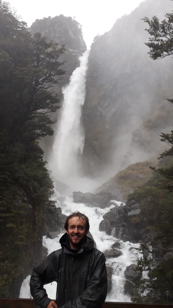
One phrase we would hear frequently over the next week was that rainy days are the perfect weather for waterfalls. So despite the continued rain the next morning we carried on to Arthurs Pass village for an hour long walk to Bridal Veil Falls and Devil’s Punchbowl Falls both of which were certainly thundering impressively.
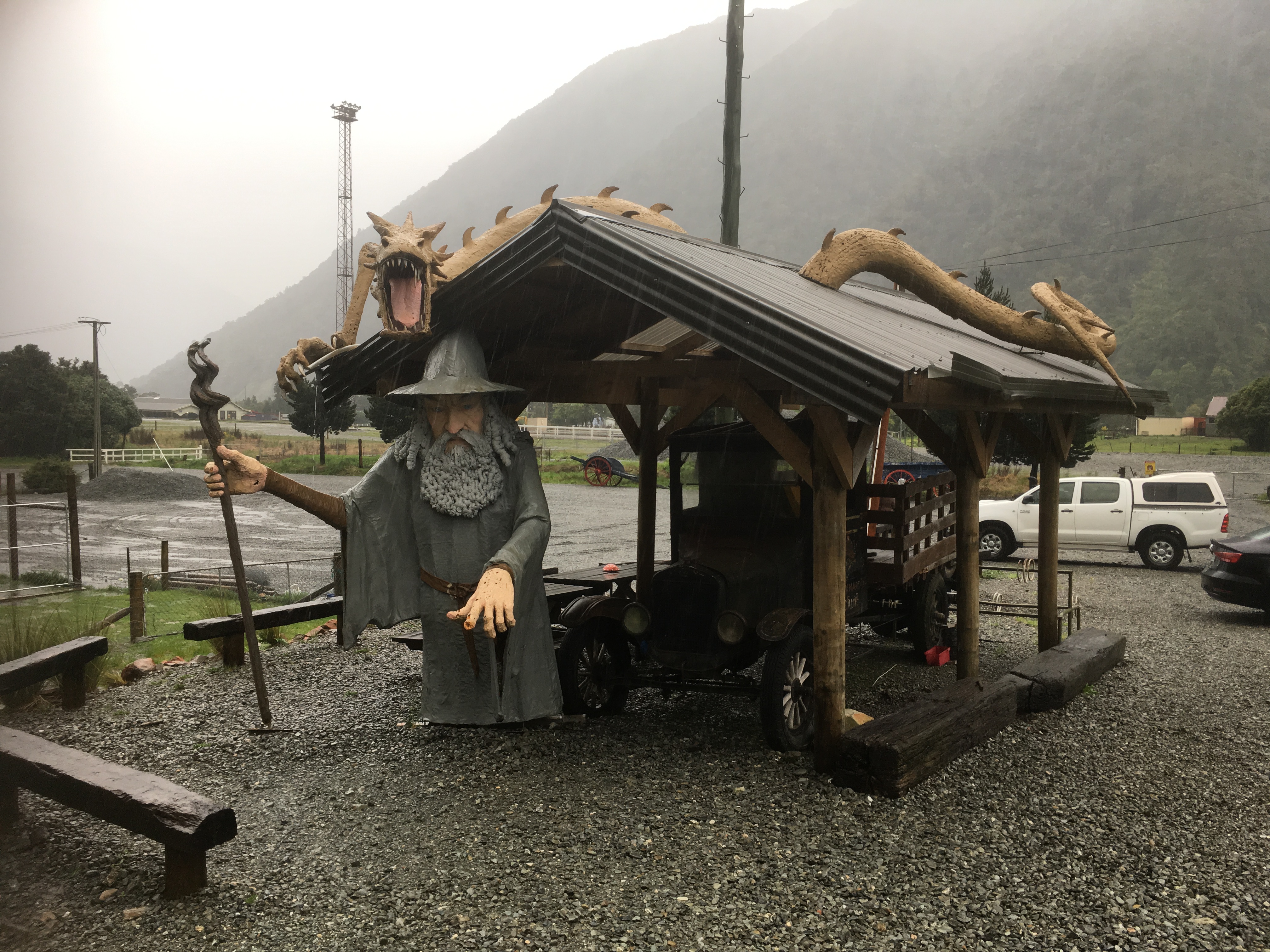
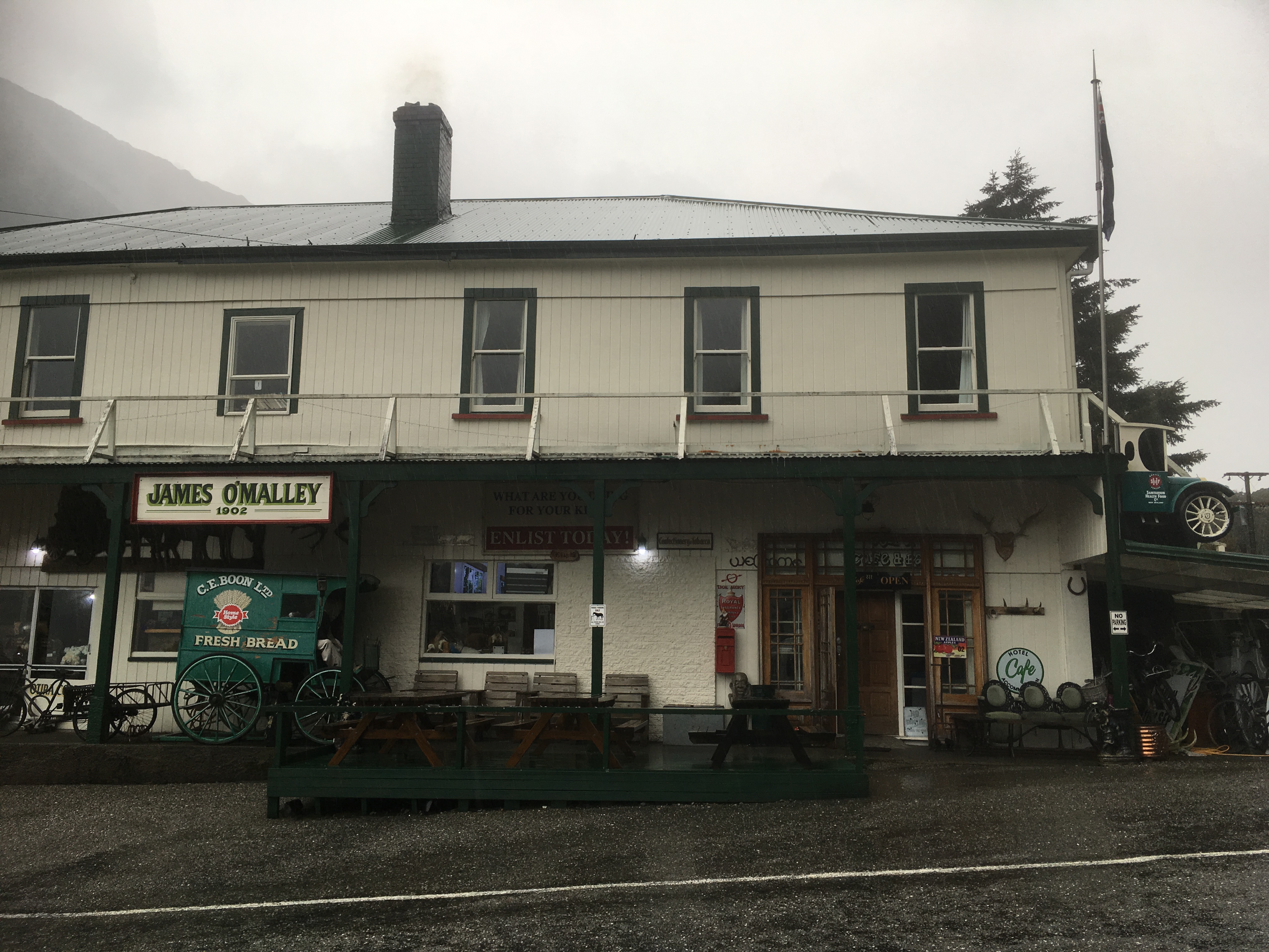
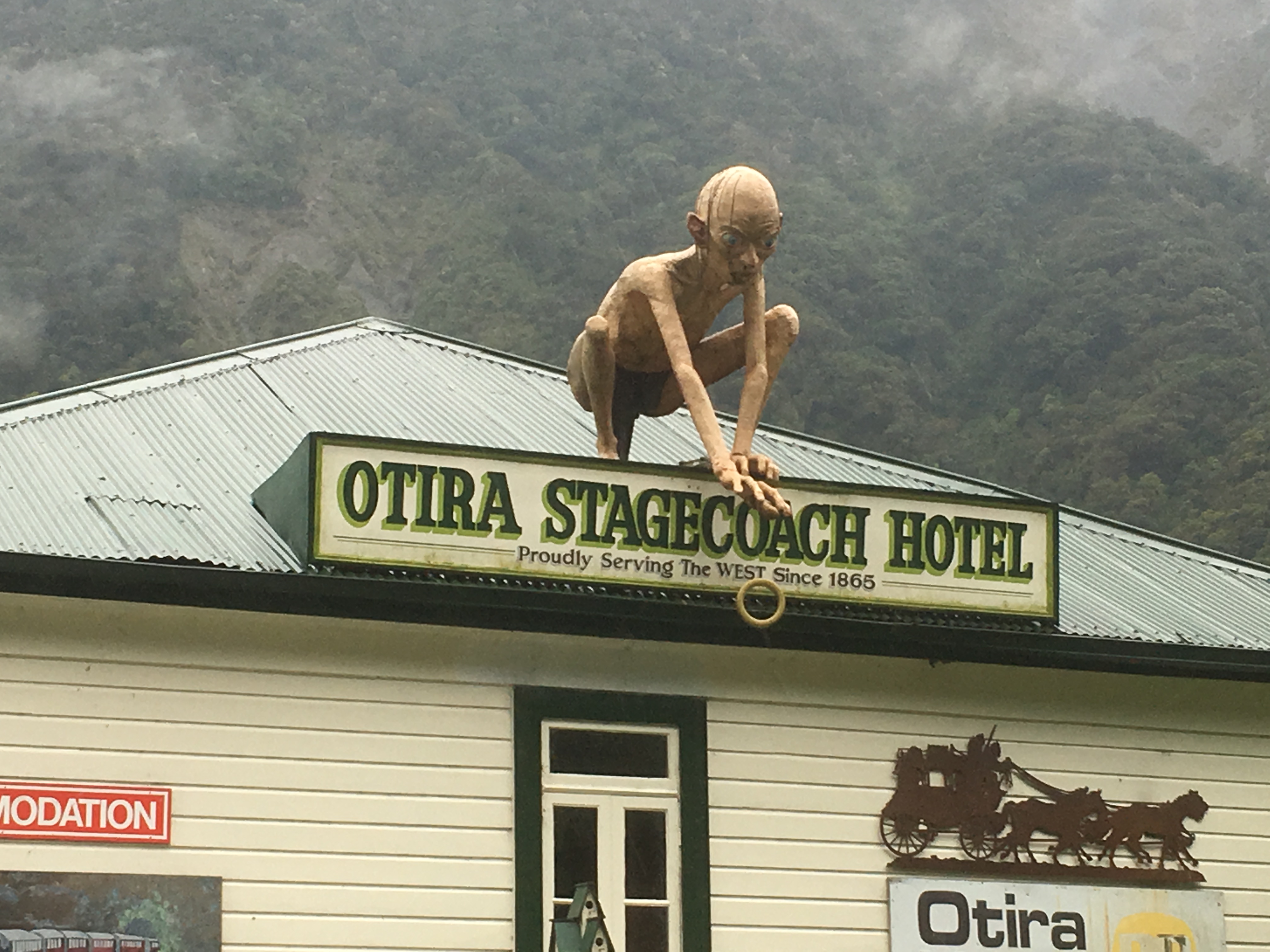
On our return trip back to the west coast we took shelter in an eccentric old hotel for coffee in the small hamlet of Otira, followed by some very disappointing whitebait fritters in Hokitika on the coast before driving most of the afternoon to arrive at Franz Josef Glacier village that evening.
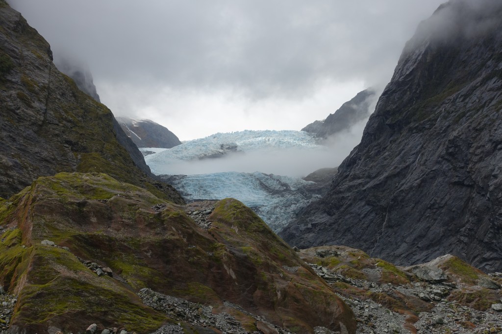
The next morning was Glacier time and we drove and then hiked up the valley to the base of the Franz Joseph Glacier. We were greeted at the car park by a friendly Kea, who was being man-marked by a park ranger possibly looking to ring its leg. Just as it had been in Canada, it was amazing to see how far the ice has retreated since people first started coming here. Our walk in was a couple of kilometres and the glacier had filled the valley in the 19th Century.
Franz Joseph Glacier
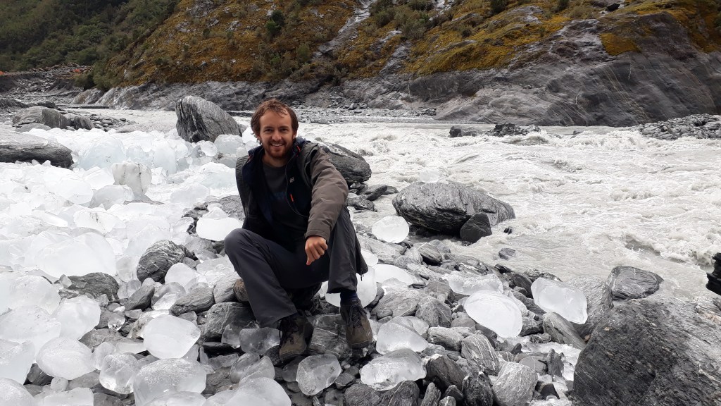
Miniature icebergs washed down from the end of the glacier had been deposited on top of the moraine next to the meltwater stream.
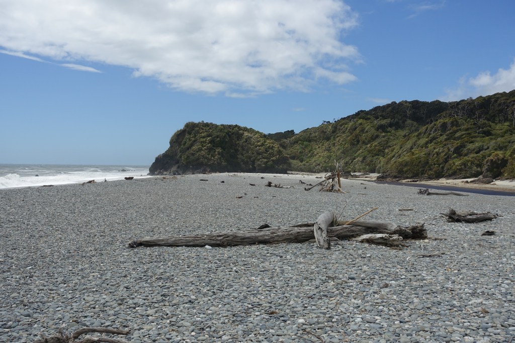
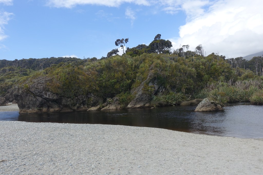
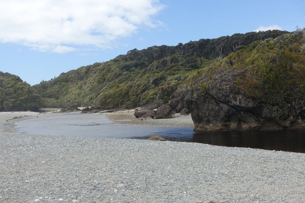
We considered trying to visit neighbouring Fox Glacier, however both the roads into the gorge were closed so we continued our journey down the coast towards the Haast Pass and our journey inland. We made one final stop at Ship Creek (fortunately we didn’t get stuck there without a paddle) and although it was windy, we were able to take advantage of some rare blue sky.
Ship Creek – a nice spot to stretch our legs on the journey south