Geirangerfjorden

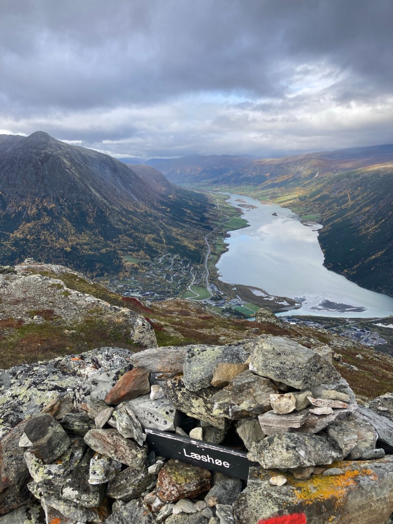
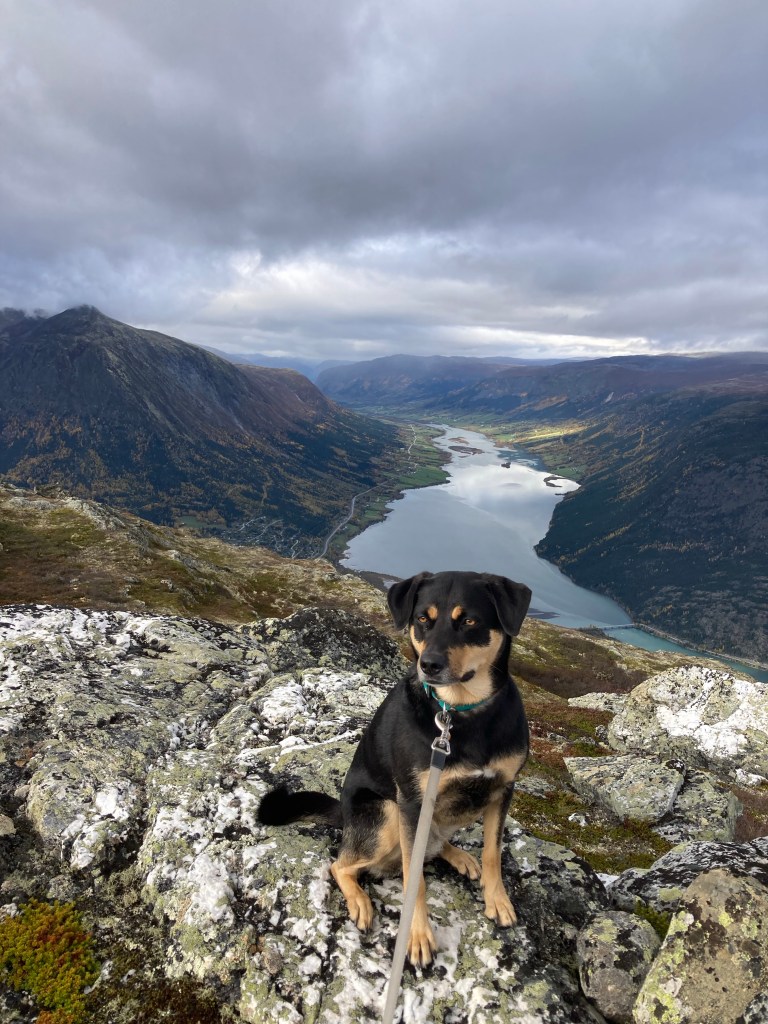
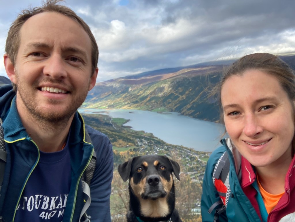
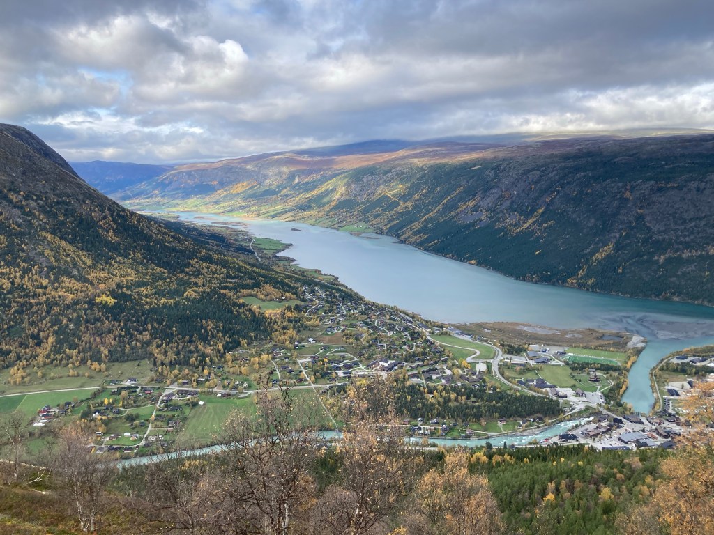
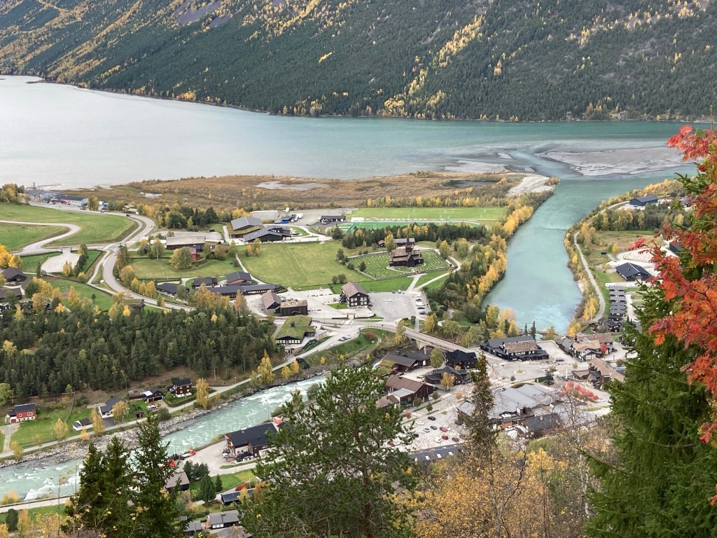
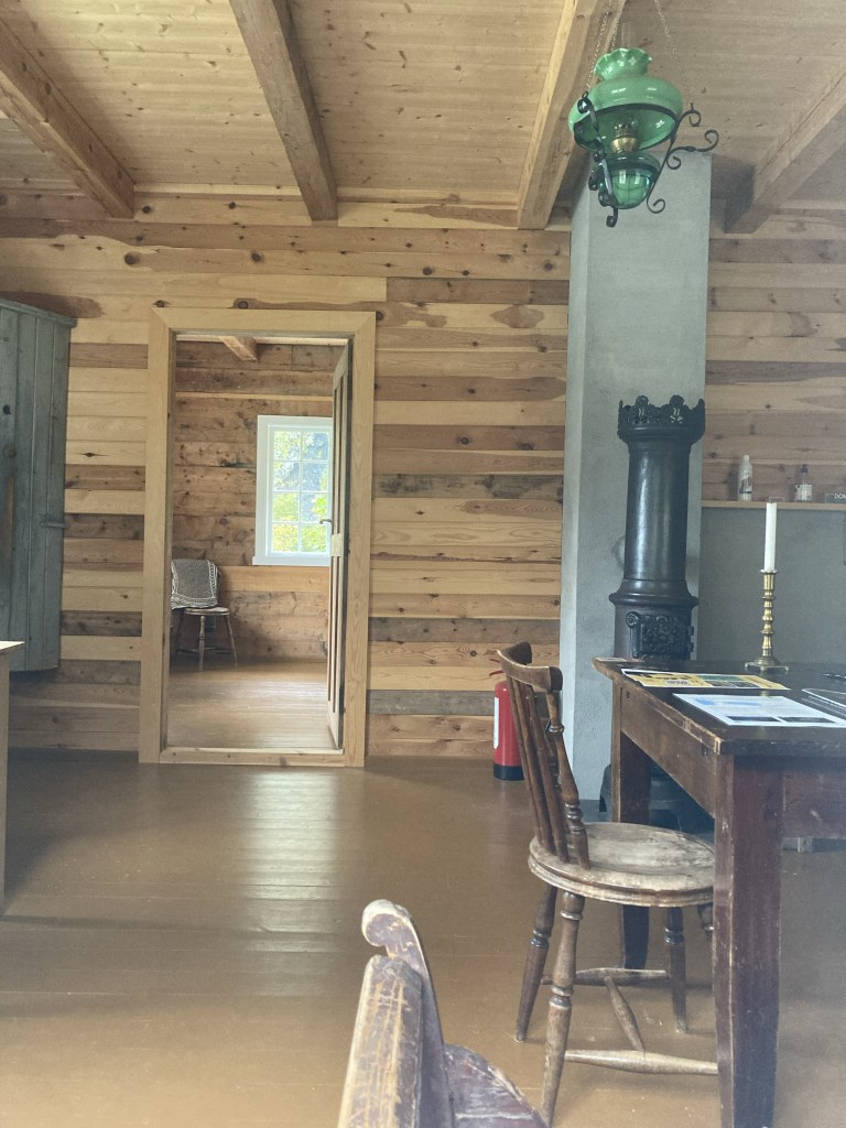
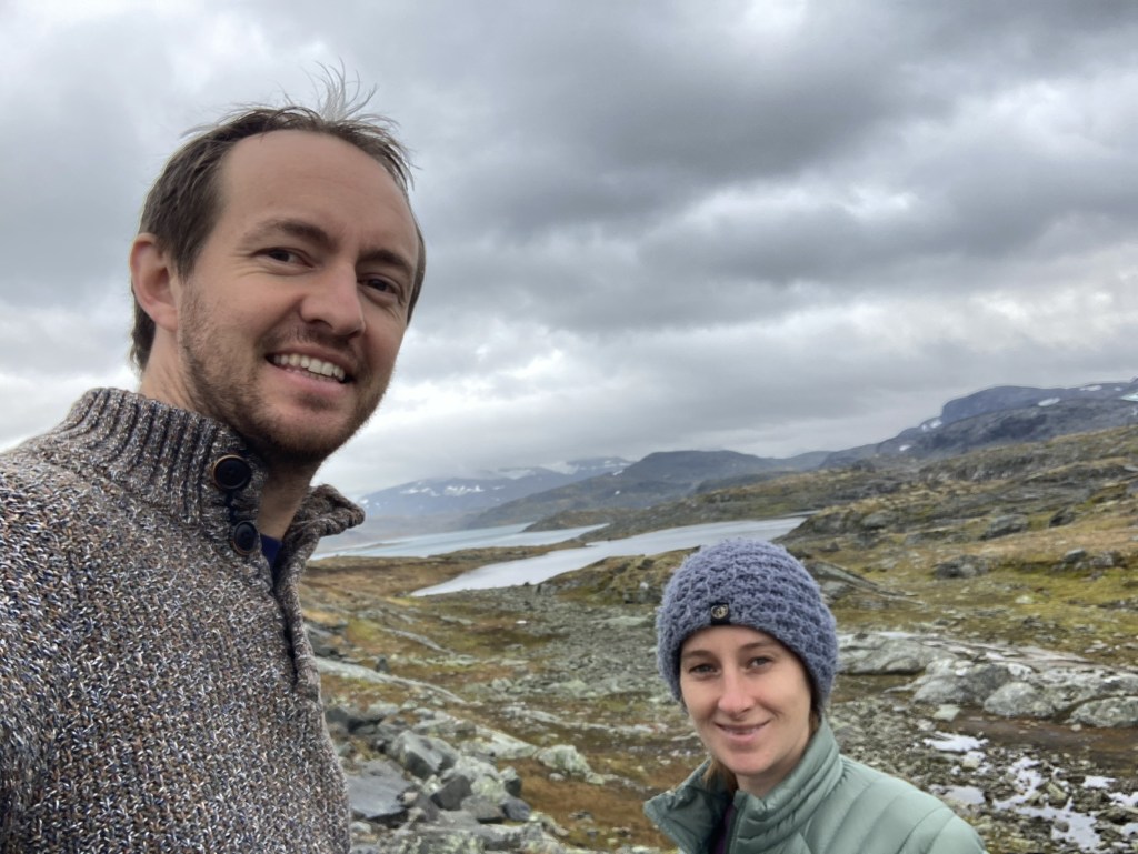
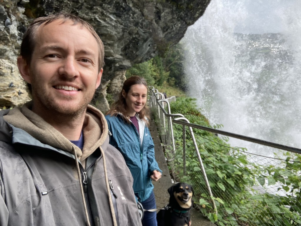
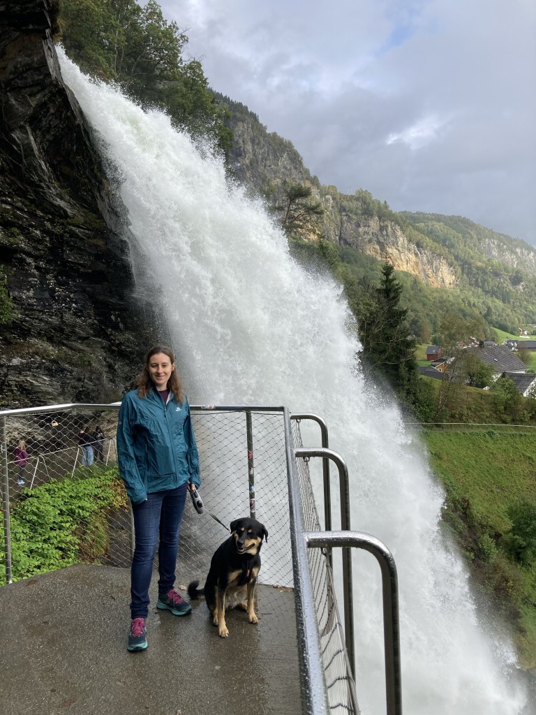
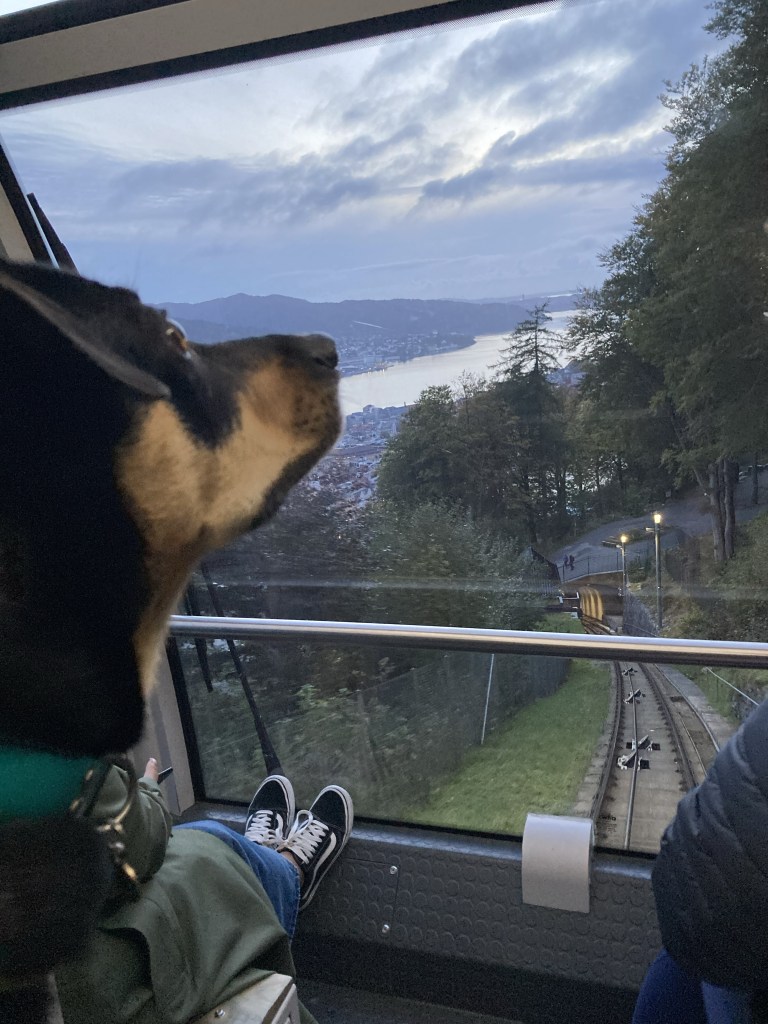
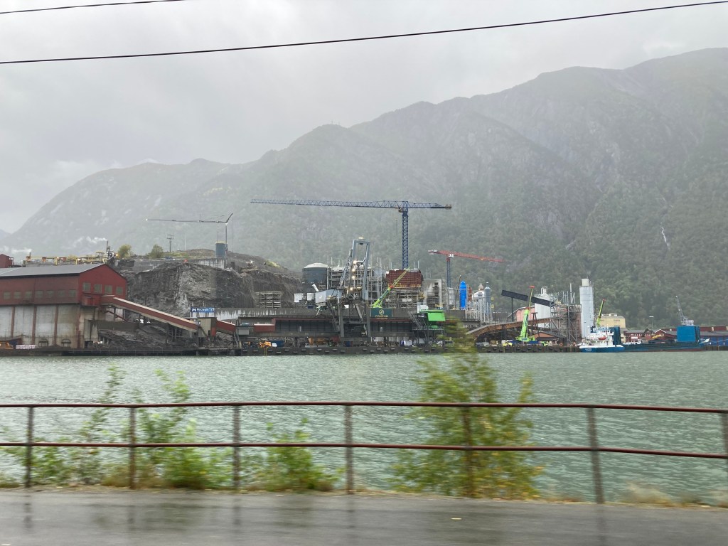
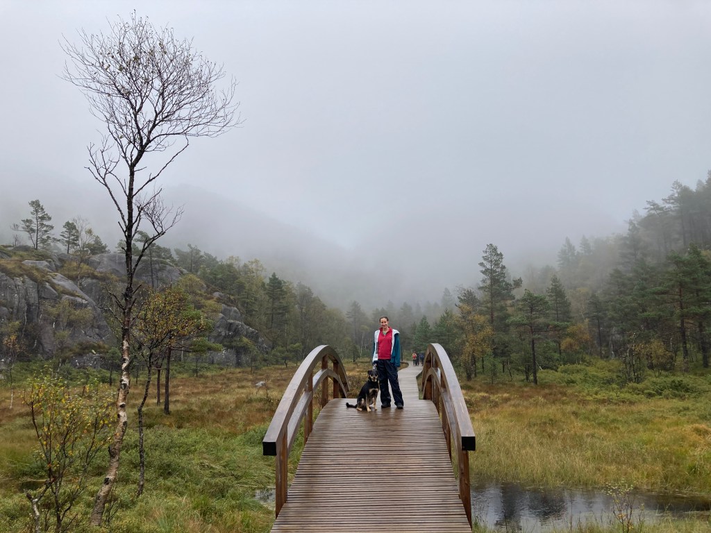
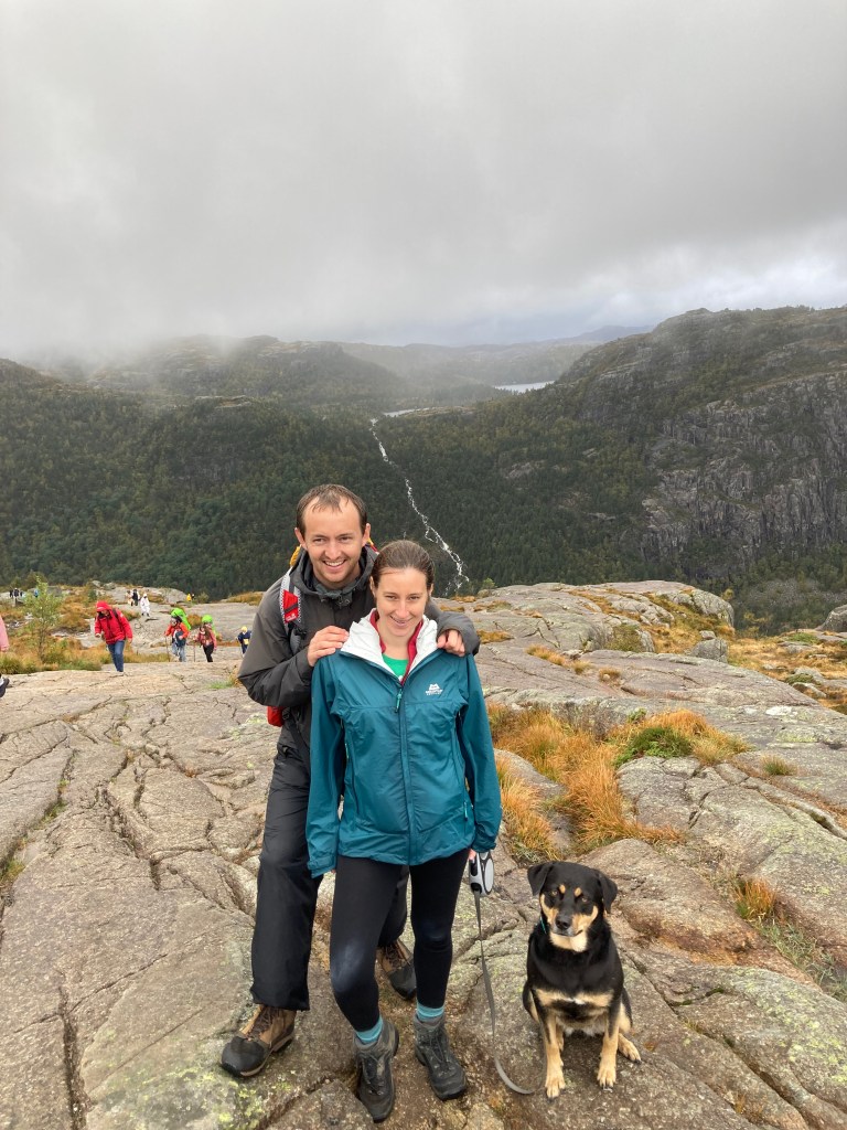
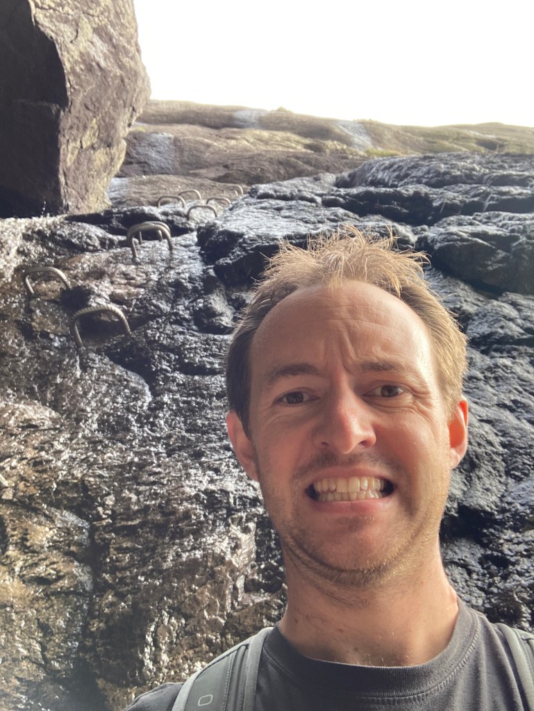
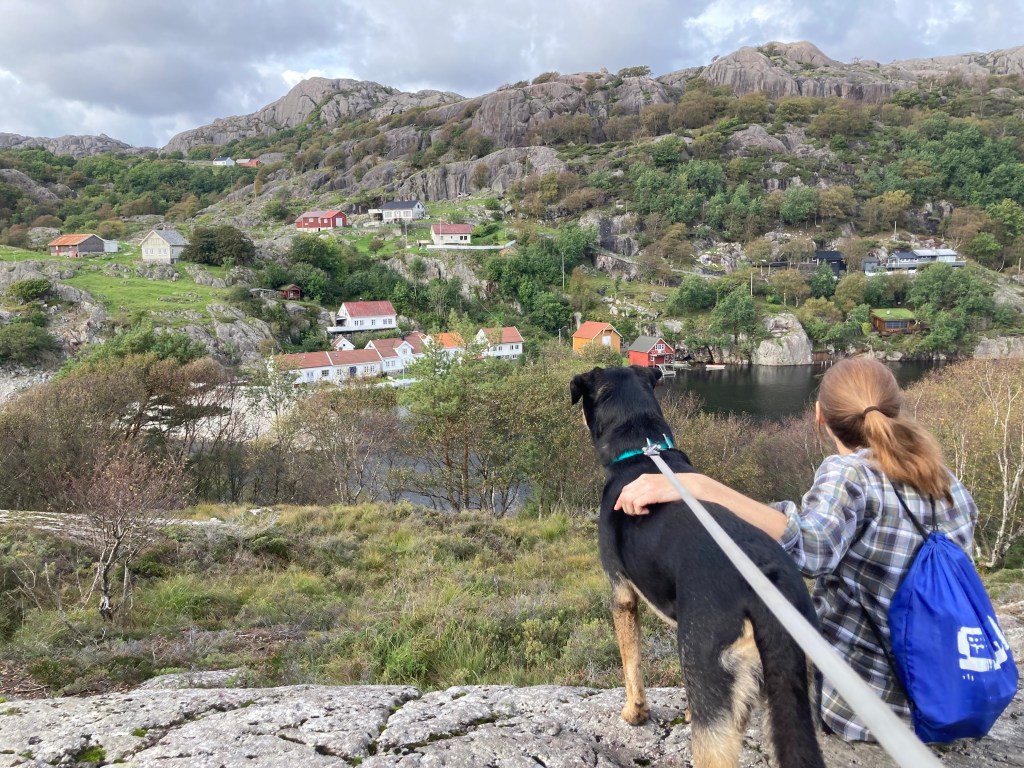
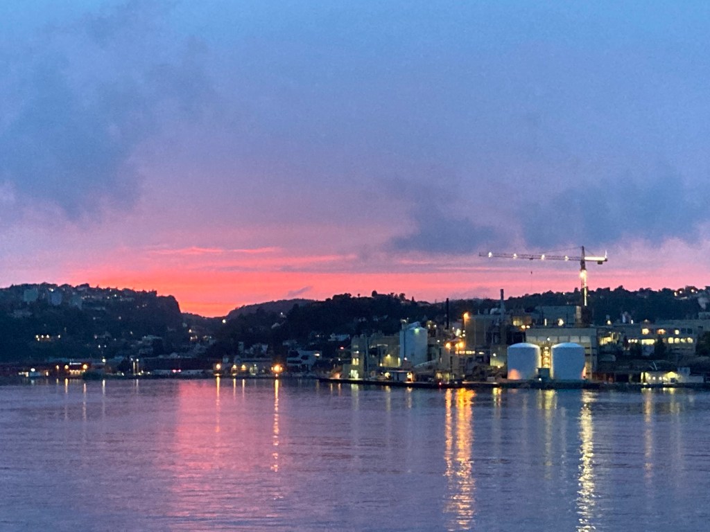
After our second night in Lom, we headed up to our most northerly point of the trip. First we picked up some pastries from the Lom bakery, which were delicious! For a small town it’s got quite a good range of restaurants and other eateries. We also had some food at the restaurant at our campground which was tasty too!

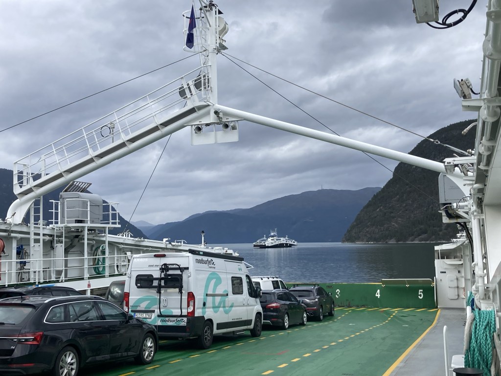
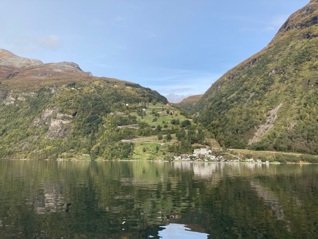
The destination for the day’s main activity was Geiranger, a small village at one end of the fjord where we were going to catch a boat for a tour of the fjord. We got there by coming up and over a hairpintastic pass going past Djupvatnet lake.

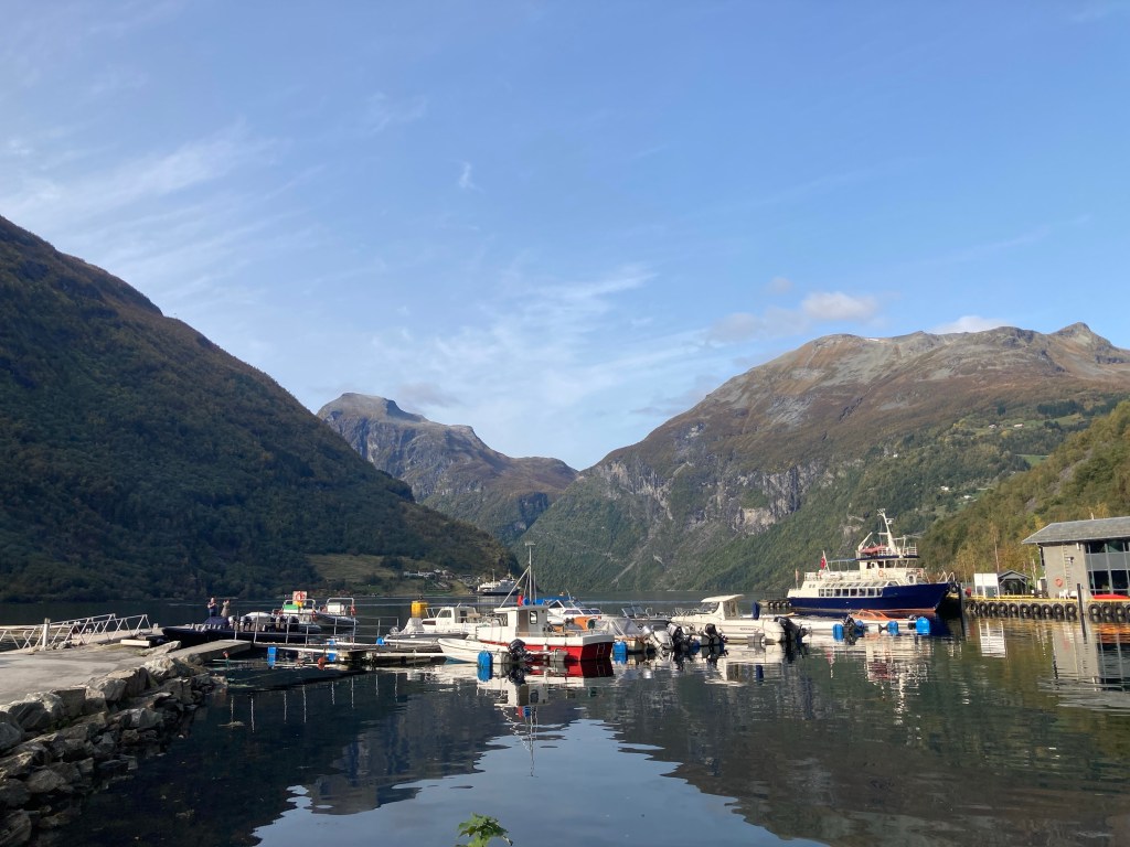
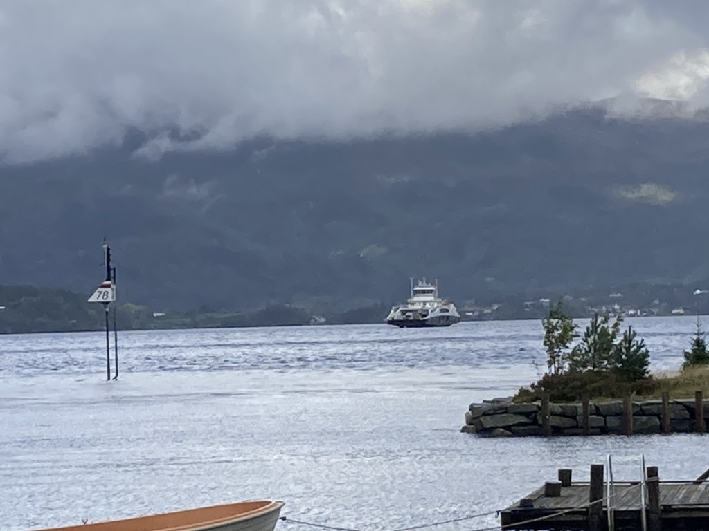
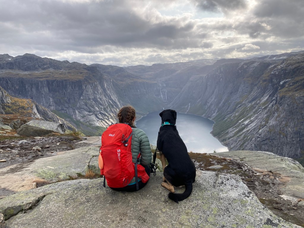
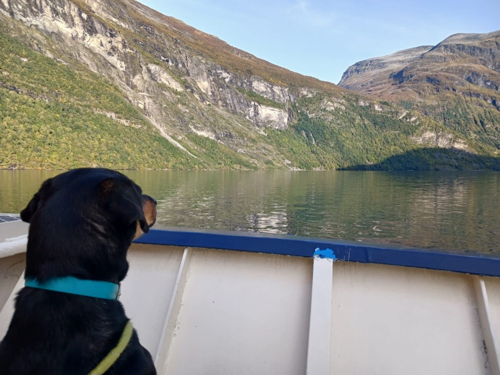
It was a clear but cool day. Our boat, furthest right in the picture had outside seating for us to enjoy the views.

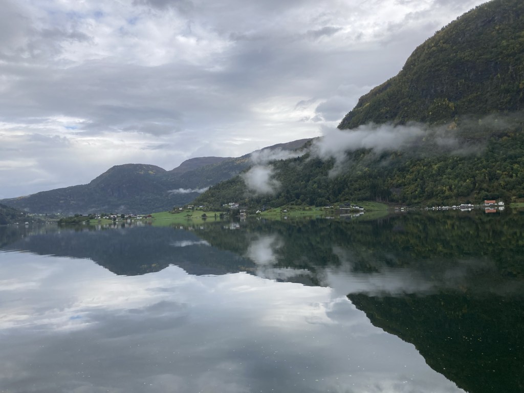
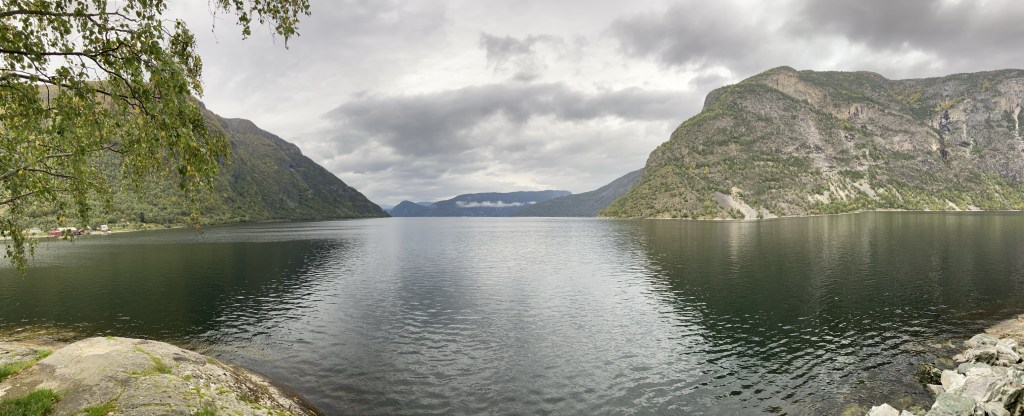
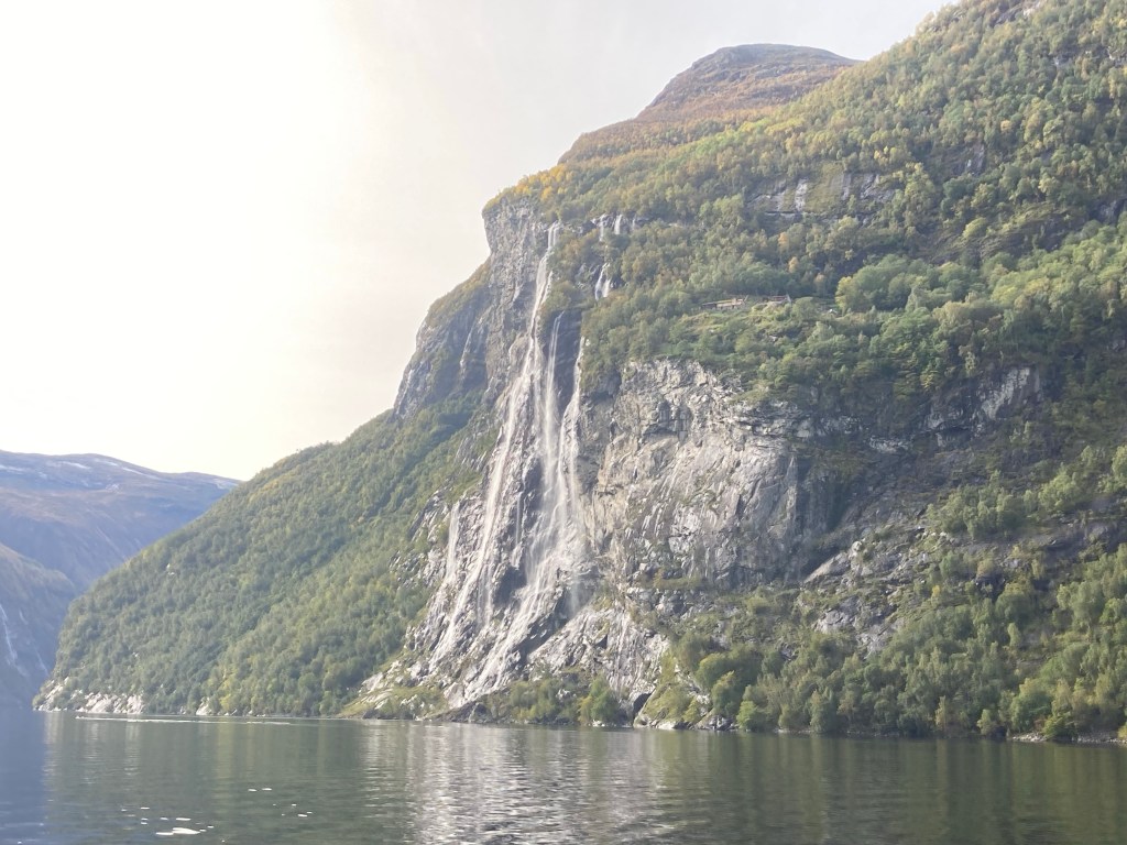
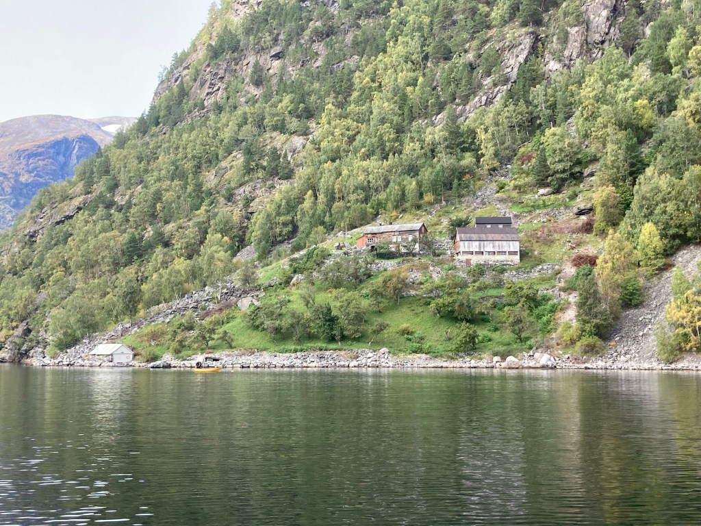
Geirangerfjorden is reputed to be one of the most beautiful and most famous of the fjords. It is a UNESCO world heritage site and is a 15km long branch leading off from several other fjords. It is interesting for a number of reasons. Before Norway discovered the oil that has made it one of the richest countries in the world (per capita), it was relatively poor, and land to farm was difficult to come by. A lot of people lived anywhere they could find some spare land, including on the steep sides of fjords, such as at Geiranger. The farms here have been abandoned, but the buildings have been preserved and can still be seen high up on the cliffs.

If you have good eyes you might be able to see a farmhouse near the top of the waterfall

Another interesting feature of Geiranger is the windy road out of the valley to the north. Called the Eagle’s road, it was seen as a lifeline to the villagers, who are often cut off for long periods in the winter. It’s used by car manufacturers to test their cars’ winter handling.

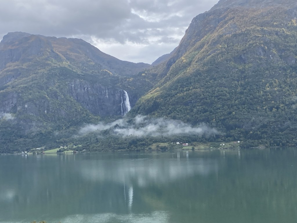
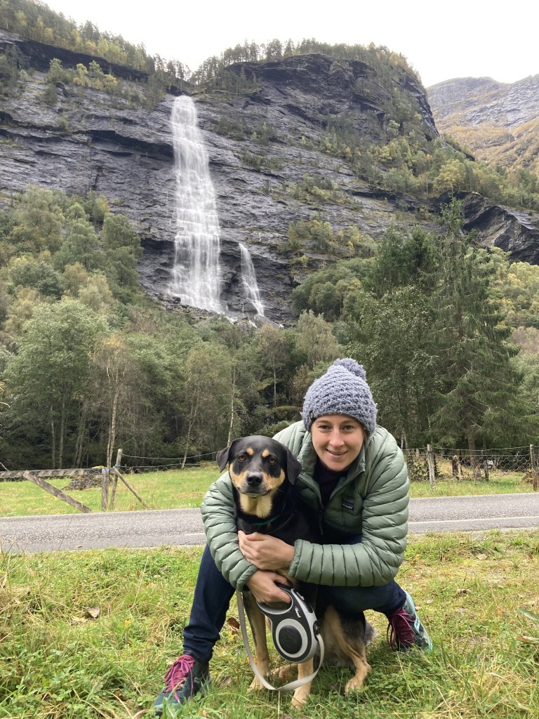
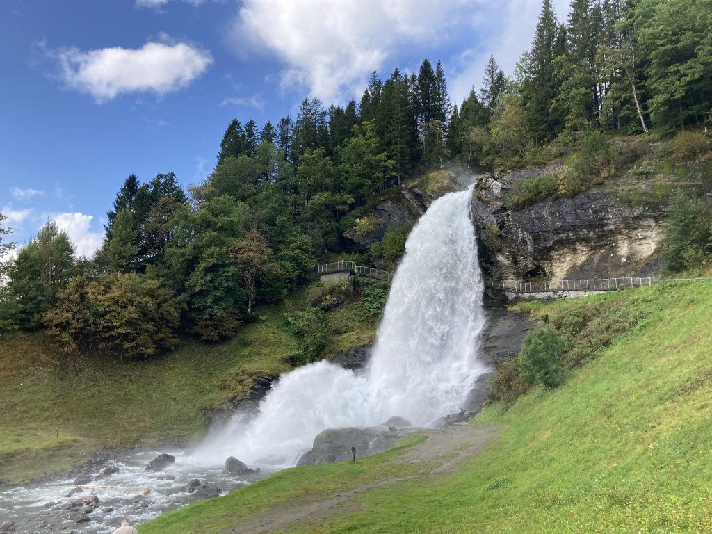
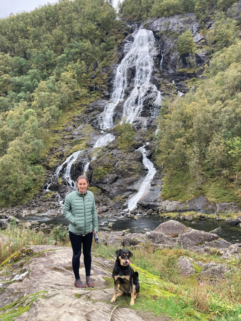
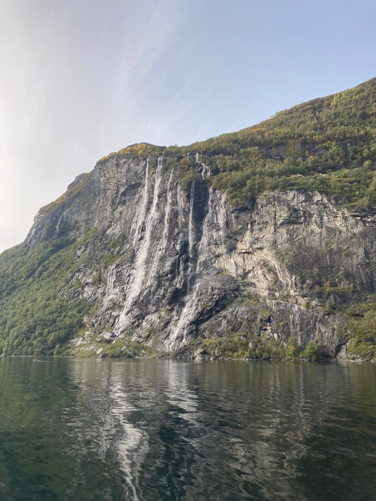
The main attraction (at least for our boat tour) is the waterfalls. On one side of the fjord there are the Seven Sisters, who tumble down the same section of rock face together (rainfall dependent) in distinct an separate paths.

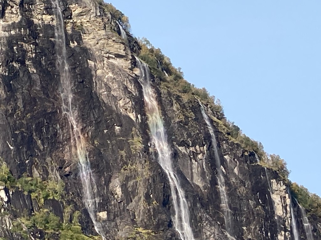
On the way back up the fjord we were treated to the sun catching them at the right angle to create rainbows, which I tried my best to catch.

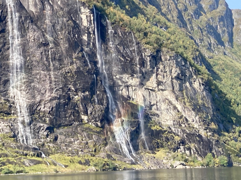
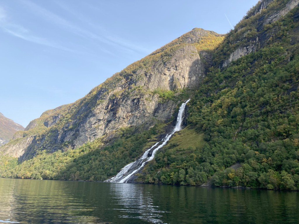
On the opposite side of the fjord sits a larger but solitary waterfall called the suitor. The story is that the suitor tried his luck with each of the seven sisters and was rejected each time. The poor thing is consigned to watching them from a hundred or so meters away until the forces of nature divert them away from each others (could be a while).

Lom ridge walk

Before we came to Norway we had put the country’s highest mountain, Galdhoppigen, on our to do list. But at over 2,400 meters it’s not a straightforward undertaking. After discovering that the official climbing season had officially closed and not being able to verify if we could get access to the route, we were worried that we could waste a lot of time and effort on a fruitless endeavour. our long hike to Trolltunga, we weren’t sure Combining this with an iffy (but not terrible) mountain weather forecast, we decided that an alternative might be more suitable.

Fortunately Lom is a town of opportunity when it comes to walking and we had several options to choose from. We chose a ridge walk that started over the road from our campsite and had the potential for a view of Galdhoppigen.

It was quite a steep climb at the start up through the forest on the hillside, so we had a few stops for breathers on the way. But as we got higher up the trees started to thin out and the slopes got gradually gentler.

Once we made it onto the shoulder of the ridge we could see a small lake, called Ausa, just sitting in a dip below us. It was our first milestone and reassuring that we were on track (as our map wasn’t particularly detailed).

We stopped for a quick snack, but not for long as it was chilly and there was a bit of rain in the air. Fortunately it was quite a light shower and although there was a little breeze the visibility was good.

After a few false summits we eventually got to the summit of Læshøe, the highest point of the ridge (1206m). This gave us some great views in all directions, of the high mountains to the south, the not as high mountains to the north and the lake to the west (which was fascinating as you could pick the deeper faster flowing parts due to the different colour of the water).

The pictures speak for themselves, but it was an incredible view. On our way down we were lucky that the view continued and we did stop again to take a few more snaps.

We ended the walk as we’d started it, winding our way through steep woodland. We did get some more good views of the stave church though, a very impressive piece of craftsmanship.

The road to Lom and Sognefjellet

From Lærdalsfjordet we took a short ferry trip, between two tunnels, which then took us to Kaupanger. We made an impromptu stop here to visit the stave church. These are churches made mainly of wooden boards, but often with ornate carvings on the corners. We were going to miss out on seeing the most famous example at Urnes, so thought that this might be our last chance to see one. We’d soon be proved wrong.

Our next part of the drive to us past more fjords and lakes glistening where the sun shone the the clouds.

We also passed Feigefossen waterfall, albeit on the far side of the fjord. At 218m of unhindered drop it’s Norway’s second highest.

Our lunch stop also was included a waterfall, but also a bit of culture. First, we saw Åsafossen waterfall, which was lovely, but to be honest was overrun by the competition so far in the trip.

Then we headed down a track on the other side of the road, which took us to the edge of a lake on the opposite shore to the town of Skjolden. A short way up the hillside we came to a small house, which was once the Scandinavian retreat of the philosopher and Cambridge University lecturer Ludwig Wittgenstein. He said he did some of his best thinking there because of the landscape’s “quiet seriousness”. You can read more about him and his house in this Financial Times article:

https://www.ft.com/content/4ebc0304-ce5c-11e9-99a4-b5ded7a7fe3f

“Quiet seriousness”
Sneaky picture through the window!

Unfortunately we didn’t realise, but you can go inside the hut if you pick up a key (from a petrol station in the town), but we did peak through the window. Back to the car park where we to a photo of a random giant hand and then we were on our way up another mountain pass – Sognefjellet.

The climb up to Sognefjellet was even higher than the Aurlandsfjellet pass of the previous day at almost 1400 meters. We took our time coming over here, it was another other worldly landscape although had marginally more facilities/ places of interest.

Then we descended into Lom a quite lively little town and a gateway to Jotenheimen National Park and various outdoor pursuits. After deciding against a very quiet campsite on the edge of town we chose one right in the middle, which had been a lodging since 1897. They also did dinners, so we decided to take the evening off cooking for ourselves and treated ourselves to some local produce.

Just before bed we took a short night-time stroll to have a look at Lom’s own stave church. Here it is at nighttime, you can compare it to Kaupavanger’s version in daylight next time!

Flåm railway and Aurlandsfjellet scenic drive

This is Claire’s second time in Norway. She came with her dad and brother when she was younger and had very fond memories, particularly of the Flåm railway. So, knowing how much of a train fan Gareth is, she was keen for him to have the same experience.

Unfortunately as dogs have to be muzzled on the trains, we weren’t willing to put Yala through that or leave her on her own. So Gareth was allowed to go on his own!

This proved a slightly technical logistical challenge as the trip is usually taken as a return trip and the mainline station at the top of the railway is in the middle of nowhere. So Claire and Yala dropped Gareth off at Vossvangen station, the next closest on the main line to Oslo, where he found he was only able to buy a ticket to the terminus, and that the Flåm tickets were no longer for sale. Undeterred, Gareth jumped on the train to Myrdal (the Flåm railway terminus) in the hope that he would be able to buy a ticket at the station.

No such luck! Half an hour later a slightly worried Gareth was waiting at Myrdal, where there was no ticket office, or station staff. There was a café and a bike hire centre, which was a useful fallback option as the next train from Myrdal to anywhere wasn’t for another 3 hours at least!

Fortunately, when the Flåm train arrived (and weather conditions had turned less than ideal for a mountain bike ride) a ticket inspector arrived with it who was able to sell Gareth a ticket.

Myrdal – Norwegian for “the back of beyond”
The train arrives with someone to sell tickets!

Claire’s most striking memory of her time on the Flåm railway was a waterfall with a lady singing at it. On his way down Gareth also stopped at the waterfall but the lady had given up singing live and had been replaced with a recording!

It was quite an impressive cascade, but not the same scale as some we’d seen on the trip. As the train carried on down the valley, you could see back up to the point where the train had looped underneath itself as well as some amazing views of the mountains.

There was also a good view of the steep twisty mountain bike path which would have been the alternative descent.

The valley had countless waterfalls and lots of pretty views of the valley and as the train speed was limited, there was plenty of time to take it all in.

A shock awaited at the end of the journey in Flåm (not that Claire arrived at exactly the same time without getting lost, that was just great planning), a huge cruise ship towering over the tiny village. It was probably what kept the railway making money, but it also seemed to take away from the scenery. It was like a huge block of flats parked in a remote rural valley.

After a quick once round the village and the purchase of some craft beers from the brewery (also no doubt kept afloat by the cruise ship industry) we hit the road together again.

Our options were to go through the world’s longest tunnel (24km long!) or to go over the top of it up a steep mountain pass. We chose the latter because it would give us better views of the fjords and a chance to travel on the Aurlandsfjellet scenic drive.

The drive started with some very windy roads, including a lot of switchbacks, but soon reached a viewpoint overlooking Sognefjord. It was a great vantage point and even the cruise ship looked tiny down below.

Even the viewing platform itself had an elegance to it.

Carrying on further up the pass we came to a more barren landscape of very uneven rocky outcrops that looked like the surface of another planet. The road kept climbing until eventually we reached the plateau and some small lakes. Apparently there were fish in them but it was hard to believe it.

We tried another night of wild camping in a small lay-by most of the way down the other side of the pass. It was very remote and we must have only been passed by about eight cars the whole time we were there. The only company we had was the roaring of the small river that followed the road down the valley.

The next morning we finished the scenic drive by heading down to Lærfalsfjorden where we stopped to admire the view.

We’ll cover the rest of the day in the next post. Enjoy the view for now – we did!

Bergen

After our long hike and final night in Odda, we headed towards Bergen. The road took us through an 11km long tunnel under the Folgefonna glacier and then a 10km tunnel to Jondal. Here we had to wait for a ferry across Hardangerfjord and our luck with ferries was out again as one had just left (at our last ferry we had waited in line behind a lorry whose driver had gone to do some shopping and didn’t come out until the ferry had already started to leave). It did give us some time to brew up a coffee and enjoy the view of the Fjord.

Ferry coming back for us

Off the ferry we took a quick stop to let traffic pass us and found ourselves in a lay-by with some ancient rock carvings attached, so we got out to take a closer look.

Can you tell what it is?

Our next stop was scheduled and guess what, it was another waterfall! The attraction of Steindalsfossen is that you can walk behind the fall – they’ve even put a path in!

From here we went to the outskirts of Bergen and found a great campsite next to a little lake. We caught the bus and then a tram into the city and started on a walking tour of all the sights (or at least the sights that the author thought were worth seeing).

First stop was the harbour market, where we picked up a bite to eat and marvelled at the giant crabs!

Then we crossed over to the other side of the harbour to Bryggen, a series of buildings dating from the time of the Hanseatic League, when Bergen was an important trading port. The old buildings were very impressive and you definitely got a sense of going back in time.

We then walked through some slightly less old streets to the bottom of the Fløibanen. It’s a funicular railway up to the top of Fløien – one of the seven hills of Bergen – where there are fabulous views across the city and the surrounding islands (which are in fact one and the same!).

After a short walk round at the top we took the railway back down again and admired the views from the front carriage.

We finished the rest of the tour as the sun was setting and then headed back to our campsite. We probably didn’t do Bergen justice, but there was more natural beauty of Norway to be explored (and that’s the main reason we came).

Trolltunga (the troll tongue)

Our longest stop of our tour so far has been at Odda (three nights in total). This was to give ourselves a couple of days to get the best weather for the hike to Trolltunga (one of Norway’s most scenic viewpoints but also a bit more difficult access than most).

The town of Odda, which is the base for starting the hike for most, is odd by nature too. It’s partly an outdoors hub from which you can also access the Folgefonna glacier (one of Norway’s largest), but it’s also an industrial town. A former carbide factory towers over the town centre and on the edge of town is an even bigger zinc plant, where huge ships come up the fjord to unload materials and load the refined product.

As we’d come outside of the summer season, the shuttle to the trail head wasn’t running, so we had to take a pricey taxi to the start of the hike early in the morning before the school drop offs. Campers aren’t allowed on the road to the trailhead unfortunately.

At the top of the road there was an area several log cabins in the mountains, it’s a common feature here for people to have a summer cabin. They all looked very cosy.

From the top of the next climb we could start to see the valley that our ultimate goal was in – Ringedal. It looked pretty impressive from here, but we had a few kilometres left to go before the ultimate view point.

A few people overtook us on our way to the main viewpoint as we clambered over a few more ridges and past some small lakes and ponds. A couple of people had obviously camped overnight on the ridge. When we got to the end though, we thought we must have been about the 20th people there that day (it was worth the 6am wake up). And the view was worth it too!

We did have a short wait for a photo, but not long. A kind French guy took a few photos of us on the precariously perched troll’s tongue. Yala was very relaxed about it all (Gareth less so).

The view was amazing, but it’s a bit of an optical illusion as Trolltunga itself sits in an inlet in the cliff face and doesn’t jut out as far as it looks in the photo. It is still a very long way down though!

So after a quick bite and passing on the free photo taking to some North American ladies (who had run up!). We set off on the return leg.

It was definitely more difficult to get to that the Preikstolen viewpoint and, ignoring the weather difference, it felt more special to have hiked over 20 kilometres (there and back) to get there.

And we did have a few more stops on the way back to enjoy the views.

Chasing Waterfalls (Fosser)

After our misty trip up to pulpit rock, we drove into the night looking for a spot to camp off grid. Unfortunately the Norwegian law allowing this also stipulates that you must be off the road and more than 150 meters from any home. Despite being quite a sparsely populated country, this was quite hard to find. We eventually pulled off the road at a picnic spot between two road tunnels, hoping we’d picked a quiet spot.

It turned out very well, as our view in the morning was a very fine one over Sandsfjord.

We followed the Ryfylke scenic route along Riksveg 13 to the town of Sand to see an award winning footbridge. If the award was rustiest bridge (or even most urban bridge in a rural setting), it probably won hands down. Judge for yourselves.

Nevertheless it was in a nice spot, although as it was Sunday, our trip to Sand was short lived as nothing was open (except the salmon museum, which didn’t reel us in).

Next on the trail was the very pretty (but very quickly outdone) waterfall of Flesefossen. After a bite to eat we got back on the road past the small town of Røldal (we pronounced it like the children’s author) and found our next waterfall the other side of a steep pass.

Latefossen is an interesting waterfall, right beside the main road (main for Norway at least). It’s the confluence of two separate short outflows from Lotevatnet (a lake on the Austdelo river).

The reunited Austdelo then flows under route 13 and straight into the Storelva (which I think literally translates as big river). It was definitely a popular tourist stop.

We spent the night in the sizeable (for Norway) town of Odda. We might come back to talk more about Odda later, but for now we’ll move straight on to the next day, when we headed north again, in search of another waterfall.

The valley north of Odda, on the banks of Sørfjorden, is famous for fruit, so we stopped to pick up some apple juice and cider to sample later.

Past the town of Eidfjord, we climbed up towards the Hardangervidda plateau, including some tunnels that looped round over each other.

At the top of the climb we headed down a side road to a grand car park next to an impressive if a little dated looking hotel.

Just below the hotel was a viewing platform overlooking a vertical drop back down the valley we’d just come from and into it cascaded the magnificent Vøringfoss waterfall. It was an amazing sight as the water shot out of a gap in the rock face and into the valley below.

As well as the first platform, there are many other viewing platforms, some of which were very precariously hung above the rocks.

We were very impressed by such an awe inspiring place, and were very lucky with the weather, which was supposed to have been much worse back down the Fjord at Odda.

If you haven’t had your fill of waterfalls, don’t fret, there are more to come, but for now we’ll head back to our campsite for tomorrow’s big adventure!

Preaching into the mist

Our campsite in Stavanger was in a really great location. So great in fact we almost wish we had stayed a bit longer. It was right next to a huge open air swimming pool, which was very modern and completely spotless and apparently only a short drive from some of Norway’s best beaches. But unfortunately we didn’t have time for swimming, because as always we already had a full itinerary.

First on the agenda was the Stavanger parkrun, which as it would happen we could see the start from our camping spot. The course was a lap of the lake that was in the same park.

It wasn’t a particularly fast run, but it was a very pleasant route mostly under tree cover and with a bit of a hill towards the end. We all ran together for a change, which we all enjoyed.

After taking full advantage of the campsite showers, we headed off to our next destination. One of the best views in Norway is from Preikestolen (or pulpit rock), which is on the north side of Lysefjord. Unfortunately when we arrived at the car park to the trail it was raining quite hard, so we made ourselves some tea and sandwiches to consume before setting off.

But as you can see the rain had only eased slightly when we set off. It was a quite challenging route with a fair bit of climbing but enough flat bits to get our breath back quickly.

The cloud got thicker as we got towards the top and the rain did stop every now and then but not for very long. As the edge started to narrow we knew we must be getting close.

So when we finally got to the top, there wasn’t much of a view to see. Although the drop off into misty nothingness did give an amazingly eerie feeling. We waited around for a gap in the cloud, but there was no sign of any appearing, so we reluctantly headed back down.

As our misfortune would have it, the weather did get better the closer we got back to the car park. So potentially we missed out on the view, but we did console ourselves with Strawberry ice cream from the gift shop and a postcard of the view we couldn’t see!

No way! We made it to Norway 🇳🇴

After a night in the slightly dodgy surroundings of the bus stop car park on the edge of a small town near Kristiansand, we were ready for the Norway part of our trip to begin.

In the morning we drove past the southern tip of the country to Flekkefjord and the town of the same name. We had a wander around the pretty streets and picked up some more supplies.

Then we headed onwards along the Jæren scenic route to a tiny fishing village called Roligheten. Here we took on a very challenging walk to Brufjellhållene (which I think translates as The Bridge Fell Holes or potholes). We first went up to the top of Brufjell which was a pretty challenging scramble.

It was a great spot to get a good view of that section of coastline.

From the top, we headed down the most difficult section of the route. Marked as “black” difficulty on the map, we were a bit anxious that it might be too much for Yala. As it turned out, we were right!

Some sections of the path were ladders fixed into almost vertical cliff face. So we decided to go down one at a time and keep hold of Yala at the top.
At the bottom of the ravine the route opened up onto a wave cut platform (or for the non-geographers a narrow ledge) about 20 feet above the sea.

At the far end of the ledge was a cave, which to be honest was slightly underwhelming, but it would have been a good place for a silhouette photo (if we had someone to take it!).

After clambering back up the way we came, and being reunited with a worried doggo, we made our way back over a different path and stopped to admire the scenery.

As a brief footnote to this story, the start of the walk did not go so well for Gareth as he managed to open the bike rack (attached to the back door of the van) into the bridge of his own nose. Although he was convinced that it was broken, by the end of the adventure he had almost stopped complaining about it, so a trip to the Sykehus was averted.

We carried on along the Jæren scenic route for a while, past the lovely Jøssingfjord, before joining the main E39 to our home for the night in Stavanger. But that is a story for another day.

Dunes of the Danes

Following a wet day the day before it seemed strange to be heading to sand dunes the following day, but that is exactly what we did.

But first we headed into Skagen to do a bit of shopping and get a better feel for the town. It’s a charming town full of wooden board houses, many painted yellow, and an obvious tourist trap.

We pottered around the port and picked up some pastries from a very good but out of the way bakery. We then meandered down the main street and back past the church to the brewery (Gareth’s church), where a variety of samples were purchased.

After a quick shopping trip we took the road back south and a few km down a side road we found Råbjerg Mile, Denmark’s largest sand dune!

It was more impressive than the pictures do justice to – a little bit of desert in the middle of the Skagen peninsula. The sand was fine and always on the move and you could, for a brief moment, convince yourself that you were in the Sahara.
Yala was in her element, a beach but without the scary wet sea grabbing at her – bliss. She ran around, dug in the sand and couldn’t stop wagging her tail.

And then it was time to go. Not to leave Denmark for good, we’ll be back in a few weeks to visit the eastern islands, but it was goodbye to the flat fields of the Jutland peninsula and its long sandy beaches.

However there was just time before we got the ferry to have a fish supper overlooking the port of Hirtshals. It was delicious and filling and seemed to be a very popular restaurant. So a happy ending to that part of the trip.

The final surprise of the day was a gorgeous sunset as we arrived into Kristiansand. And after a night in a park and ride car park, the Norwegian leg of our adventure was about to begin!

Design a site like this with WordPress.com
Get started