One aspect of New Zealand’s culture that has impressed us is the importance placed on sport and exercise. This of course includes the countywide support for the All Blacks and Black Caps but extends to a nationwide enjoyment of the outdoors. This has led to a vast network of walking and cycling trails across the country, with the most popular 10 walking routes given ‘Great Walk’ status and 22 ‘Great ride’ cycle routes. Of all the Great Walks one section of the Northern Circuit stands out as one of the greatest day walks in the world: The Tongariro crossing.
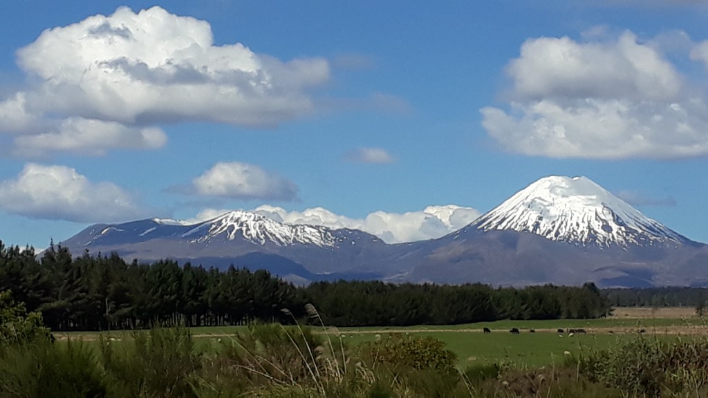
The Tongariro Alpine Crossing is a 6 to 9 hour one way hike between Mount Torgariro and Mount Ngāuruhoe (Mount Doom for all those Lord of the Rings fans), which is conveniently accessed using a shuttle service to return you to your vehicle after the walk. Whilst we were still in the shoulder season for Alpine walking we had been advised to book the earliest shuttles to beat the crowds. Whilst we absolutely appreciated this advice once we were on the crossing, we were less convinced as we were woken up by the 5:45am alarm!
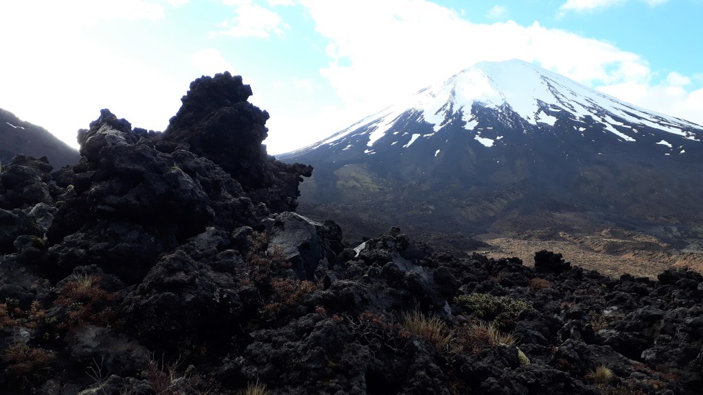
We started our walk from the west side of the crossing at 6:30am which meant we were some of the first hikers on the trail that morning. Over the first hour the morning cloud gradually began to lift as we slowly ascended through a slightly marshy valley scattered with basalt rock formations from past lava flows. As the mountain peaks crept in and out of the clouds we caught glimpses of the path ahead climbing into the ridgeline.
We took a slight detour off the route to admire the Soda Springs waterfall where we got a great view across to Mount Taranaki to the West. When we rejoined the path 20 minutes later we realised the benefit of our early start, as we were caught up by the next bus load of hikers who did not seem interested in completing the detour. All of a sudden the path seemed much busier.
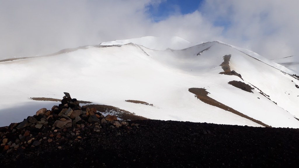
Gradually patches of snow began to appear in sheltered spots between rocks. As our climb steepened, the crowd thinned again and snow began to invade the path until we reached the south crater, which formed a completely white flat plain of ankle deep snow which ended in the first ridgeline of our hike.
The top of the ridgeline took our breath away (both literally and figuratively). We could suddenly see across both east and west sides of the valley and the peaks looked majestic with their snow covering. Clouds were above and below us, but were moving quickly so that different parts of the landscape kept appearing and disappearing adding extra magic to the scenery. In Claire’s opinion the views for this half hour period were the most dramatic of our trip (even beating Moraine Lake in Canada!).
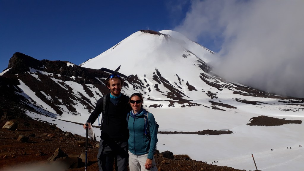
The ridge climbed up for a short way to reach the summit of our journey at the Red Crater, where the snow had been melted by the volcanic warmth below and the ground was even warm to the touch. The view now opened up to the Northwest, where we could see the summit of Mount Tongariro itself. Claire was keen, considering how well we were keeping to time, to make it to the summit, but Gareth decided that it would probably not be sensible considering that there were no marker poles in the snow to show the way and as the view to the Northeast was obscured by cloud, which could roll in at any moment and create “white-out” conditions. Having heard that a Japanese tourist had got lost and died on the route the previous week, it was not worth taking any chances.
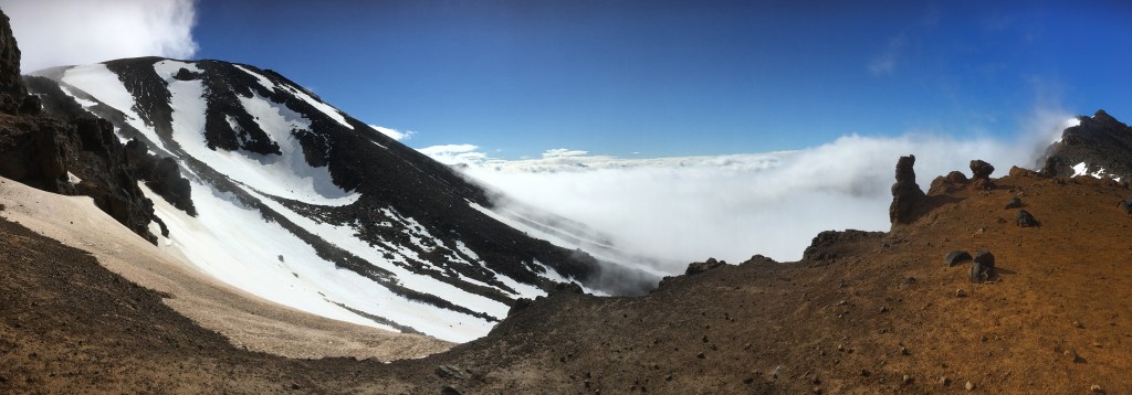
Instead we hung around at the top for about 20 minutes waiting for the cloud to disperse and show the views to the north and east. Unfortunately the opposite happened and the clouds closed in and we were only able to chat to some other travellers hoping optimistically for the same.
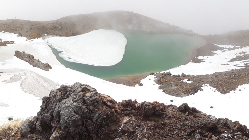
We then dropped down a short way to the Emerald Lakes, where the view of the valley remained partially hidden, but the lakes looked very beautiful in their semi melted state, so we stopped again to admire them before crossing the central crater, which was another snowy plain. Our final climb of the day was up to the Blue Lake, where the view of the lake and the central crater made a good place to stop for lunch.
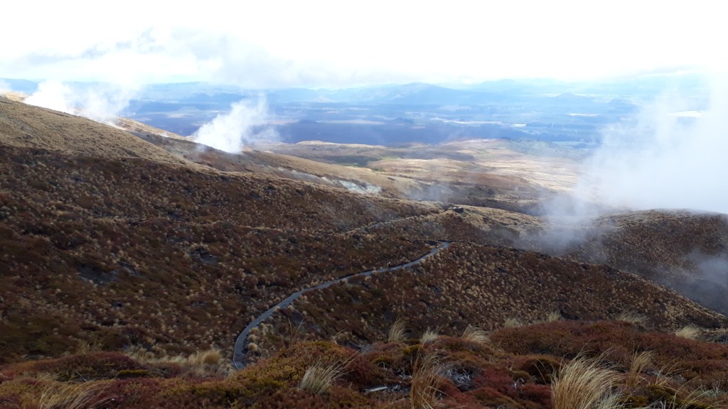
Past here we dropped out of the cloud and managed to get some views of Lake Taupo and the forests to the North, before Gareth decided that we should try to make the first of the hourly buses back to the car as we were on track to just miss it. Having “encouraged” Claire to run the last 2km, Gareth was pleased when we got to the car park just before the bus arrived. He was a little disappointed to discover though that the bus driver always likes to wait 10 minutes, “so that nobody just misses the bus”!
Regardless, we made the bus and were back to our car with plenty of time to visit National Park Village for a coffee and to stock up on supplies before heading south to find a campsite.
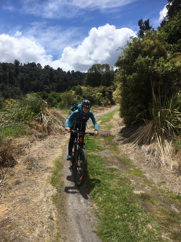
We stayed the evening in Raetihi in the hope that we could do some kayaking on the Whanganui River as part of the Whanganui (pronounced Fanganui according to its Maori roots) Journey (a river based version of a great walk). Unfortunately due to it being low season, there was limited availability for hiring Kayaks, so we instead headed to the nearby town of Ohakune to do some mountain biking on a stretch of the Mountains to Sea ‘Great ride’ track known as The Old Coach Road. This trail is between two railways, which had proved difficult to build and so historically coaches carried people between the two termini.
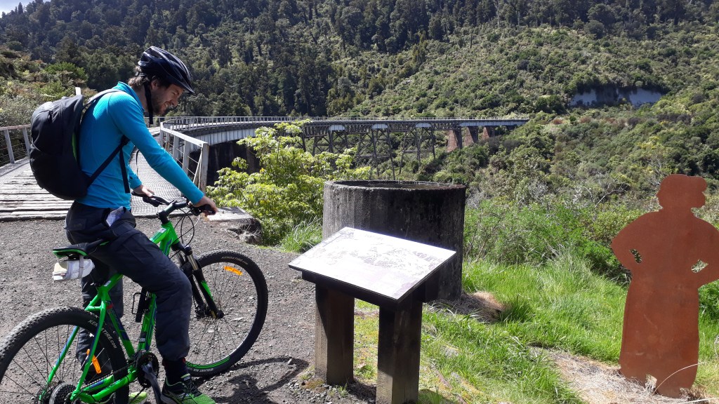
Picking up the bikes in the centre of town, we cycled uphill past the train station on a tarmac road, before turning onto a gravel road and then onto a small track, which was a mixture of dirt, grass and the original cobbles. The climb was quite steep, and uncomfortable on the cobbled sections, but fortunately there were lots of information boards to read, which gave us a valid excuse for each rest! We were rewarded with occasional exhilarating downhill section where we thankfully didn’t meet too many people going in the opposite direction on the narrow track.
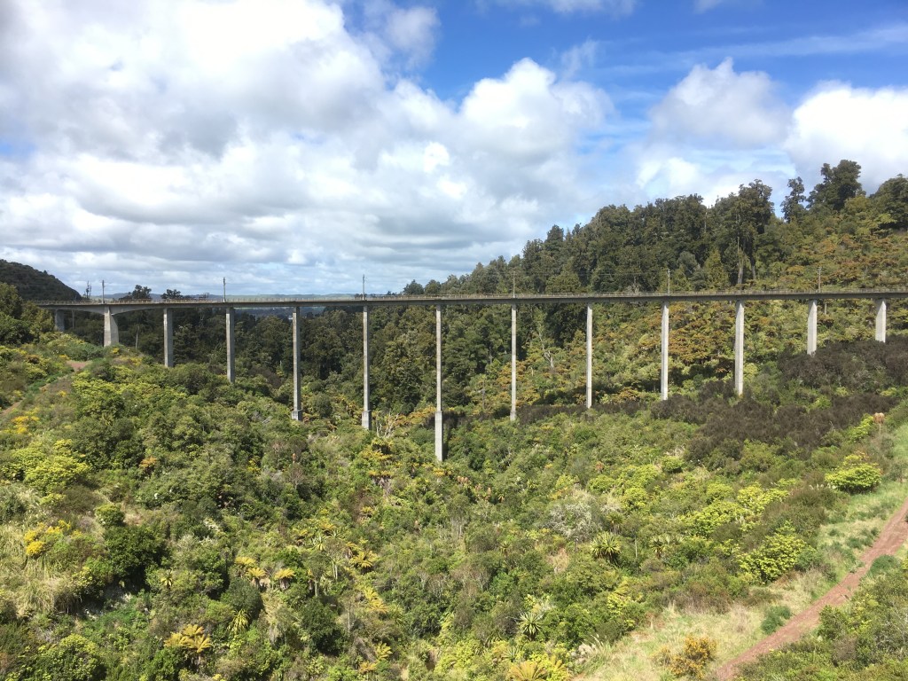
After about an hour we came to the first of two viaducts that had been abandoned by the railway and could be cycled across, giving fantastic views of the valley below. After another battle uphill which reached the summit of a ride and enjoyed a steep hairpin turn filled downhill section to the second viaduct, which was also our turnaround point so we went straight back up the hill and collapsed at the top for a well deserved picnic. With approximately 11km of our 12km post lunch cycle downhill our afternoon was sheer joy. Our stops were now opportunities to gather our nerves before hurtling down the track again. It was over far too quickly and neither of us really wanted to return our bikes (although our legs probably couldn’t handle another ride!).
We treated ourselves to a post ride coffee and cake (or in Gareth’s case beer), before we set off on the road again (swapping 2 wheels for 4) towards our overnight stop in Palmerston North. On the way we were treated to some stunning rolling hills, amazing river gorges where the flat land just dropped away and viewpoints that were so expansive that it seemed as though we could see half of the North Island. New Zealand appears to have a new pocket of beauty with every turn of the steering wheel.
If our blogs are giving you itchy feet and Peru is on your bucket list then please check out our friend Erick’s website who has set up his own tour company IncasPath in Cusco, Peru. He’s a really friendly guy and probaly the best tour guide we’ve ever had. We completed the Salkantay pass with him to Machu Picchu four years ago and have had the travel bug ever since!!!! http://www.incaspath.com
