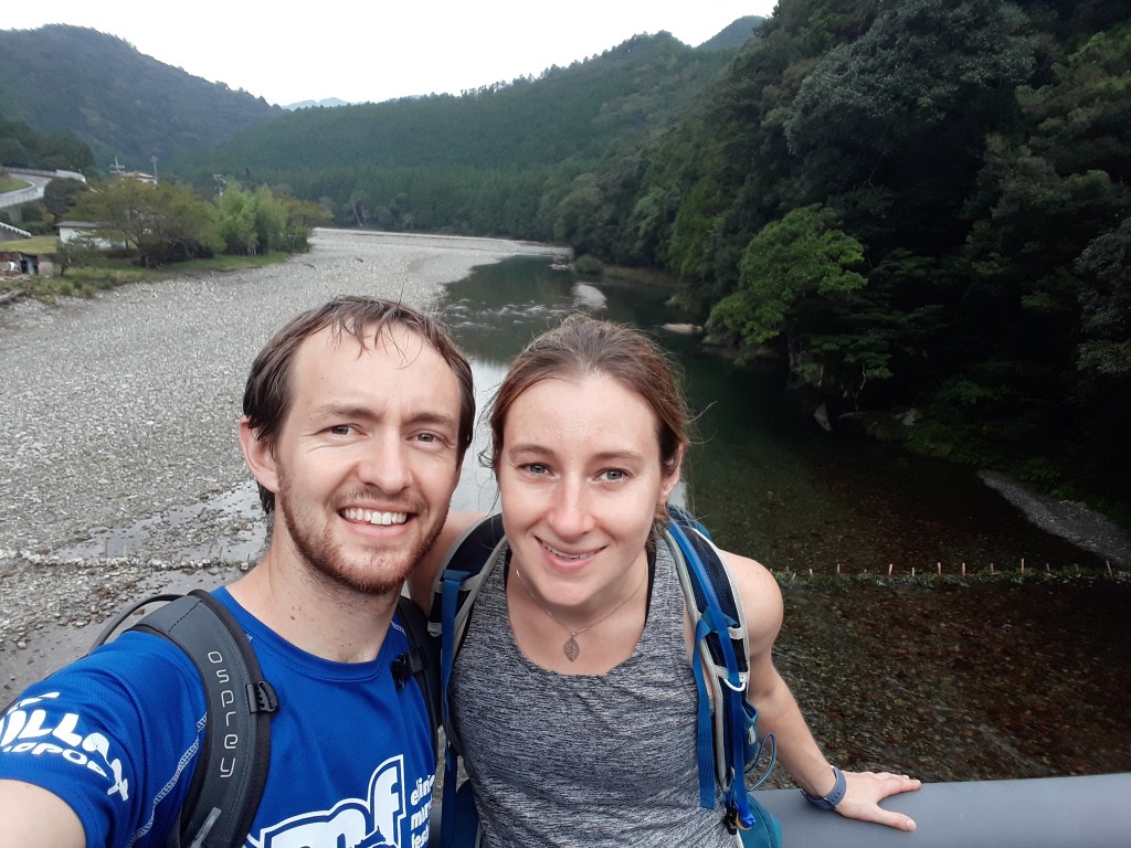
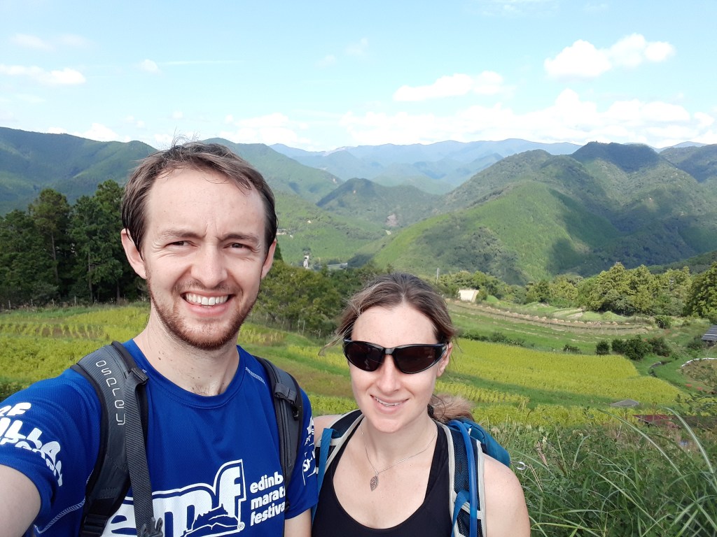
One of the first things we had planned for our world tour was a four day hike across the Kii peninsula, which is to the south of Kyoto and Osaka. Both of us had come across the Kumano Kodo pilgrimage trail independently in our research and we thought that it sounded like a great trip. The large network of routes on the peninsula have been used by pilgrims heading to the main temples at Hongu, Hatayama and Nachi for thousands of years. We picked to do the whole of the most popular Nakahechi Route (or the Imperial Route).
Booking the trip was a little more difficult. The only tourism company that books trips is called Kumano Travel. Rather than booking one trip in one go, you have to book all the different elements, accommodation, breakfast, lunch, baggage transfer, side trips all separately, but through the same website (sort of like a build your own trip). The website that you book through is also a little confusing at first too (probably because it has too much information – in a typically Japanese attempt to be helpful), but we eventually figured it out.
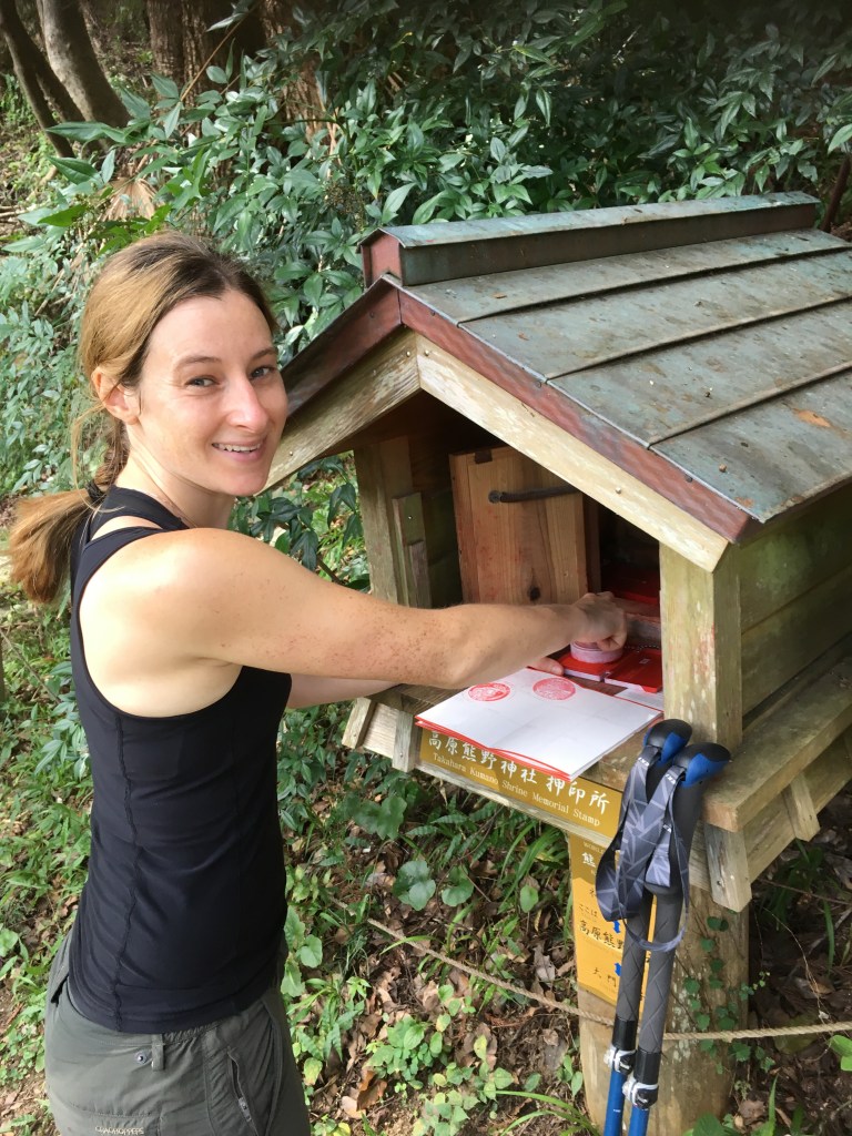
Fuelled with five Chiffon cakes from our Café owner host in Tanabe and after successfully working out how to use the public bus (there is a tutorial on the website!) we were ready to hit the start of the trail at Takijiri-oji. The start point, had a visitor centre and was the first shrine on our trip (“oji” means shrine). It was also the first place to pick up a stamp for the stamp books that we had picked up in Tanabe (essential for certification as a true pilgrim). Each stamp was kept in small boxes on pedestals, that looked like fancy bird tables and they formed good targets along parts of the walk.
The day was hot and very humid and the start of the trail was steep uphill. With Drill Sergeant Piper setting the pace, we were soon sweating as if we’d just stepped out of the shower (well Gareth was at least). Along with shrines, we did have some other distractions from the heat along the way. The first was Tainai Kuguri (or “The Test of Faith”), which was a cave that gradually got smaller until a human sized hole at the end that you had to squeeze yourself through. We both managed it, despite a lot of other pilgrims seeming satisfied that their faith didn’t need testing and walking around!
After just over a kilometre, we got caught behind a big school group, whose trail etiquette left a lot to be desired. Fortunately the track widened slightly and we managed to overtake them before the first view point of the day, which we enjoyed briefly, before heading on to keep ahead of the rabble.
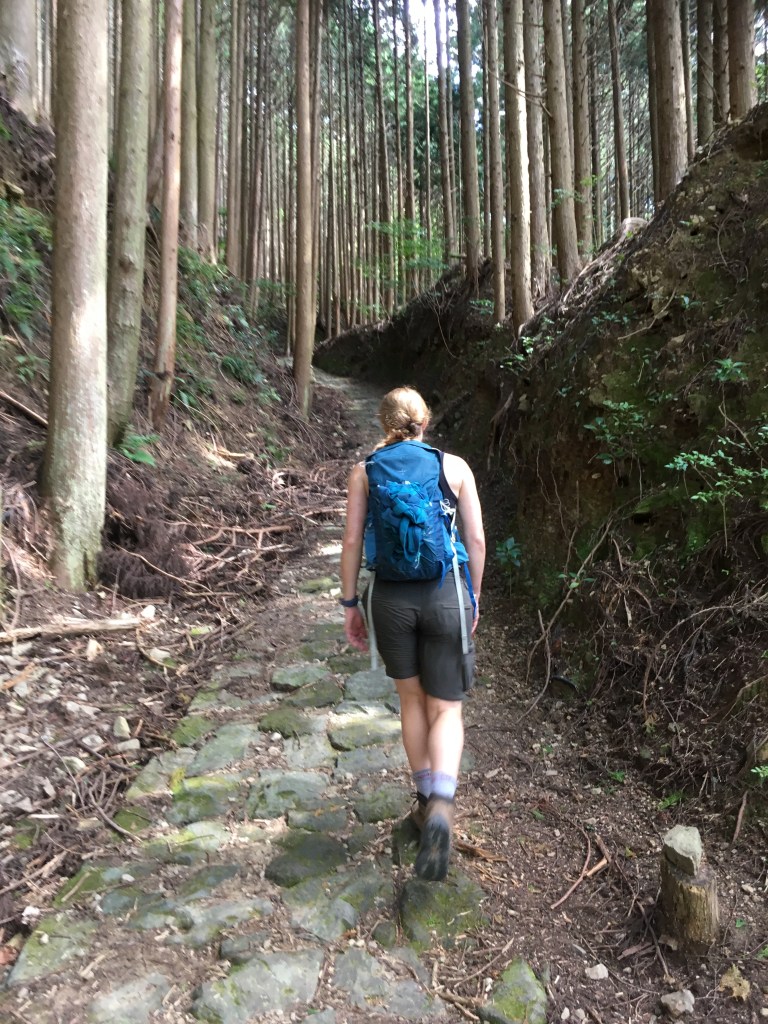
We were now out of the crowds on top of a ridge, which took us up and down as we travelled through the trees, with the sunlight creating shafts of light that made the forest look stunning. We dropped briefly into the village of Takahara, for another amazing view (and a stamp).
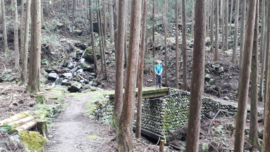
We then began a longer but shallower climb up through slightly denser forest. After passing a couple more shrines and a lunch stop at Uwadawa-jaya teahouse remains (not much left) we started to descend again into a valley and passed over the river.
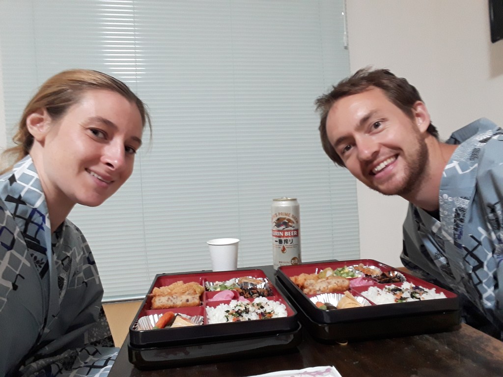
The rest of the afternoon was very pleasant with the main highlight being a view of the village of Chikatsuyu, where we would be staying the night, from the adjacent hillside. In cherry blossom season it much be even more spectacular. Our final stamp of the day (number 7) was on our way into the village and just next to where we needed to pick up the keys to our Minshuku (Japanese style B and B). We were very glad we arrived when we did as an hour later the heavens opened as a Typhoon passed by to the north. We had a relaxing evening which included a hand delivered supper from our host, which was a selection of Japanese style foods served in something called a Bento Box. It was delicious and we ate dressed in the traditional Japanese Kimonos that we had been supplied with.
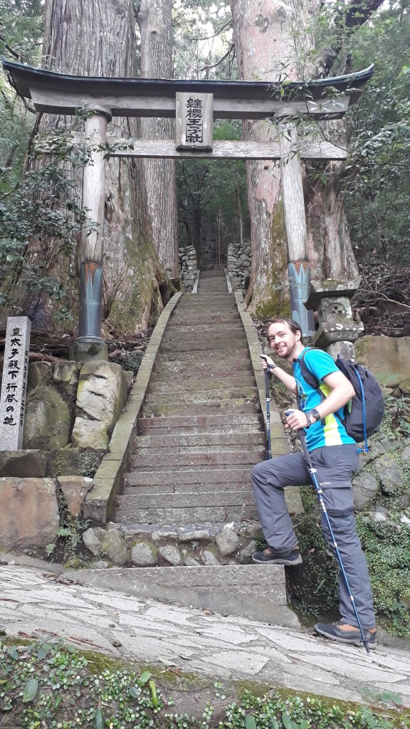
Day 2 was set to be a much longer day and we had found out from the previous day that although we were faster than most of the guides suggested the heat, slippery cobbles, steep hills and stopping for stamps, photos and views made some sections pretty slow going. With slightly cooler, cloudy conditions and sections of road making the uphill easier we made good progress. We stopped briefly to explore the first shrine, Tsugizakura-oji, which was built into the hillside and lined with tall pine trees and looked very impressive.
6.5km in, we got to a place where the path took a detour from the original route. In 2011 a Typhoon had caused landslides that had destroyed the path, so an alternative route over “Detour Pass” was found. It was not as well marked as the main path, which has markers every 500 meters and there was a peculiar section that was fenced off and the only way to get in was to go through a net, which opened like a secret door once you knew where to look. We assume that the fence was to keep the dinosaurs in, so we tried to get over the pass as quickly as we could!
Back on the main trail Gareth posed on a bridge for a photo and as he did so spotted a sign that had been hidden by a rock from the other direction that denoted a short detour to a shrine (and more importantly another stamp)!
A bit further along, after descending the slightly slippery Mikoshi-toge Pass, we came to another detour, which this time was unexpected. Typhoon damage meant we would have to add extra distance on our walk and that we would have to do an out and back section of the trail if we wanted to get all of the stamps (which, of course, we did!). Having stopped at the very pleasant Hosshinmon-oji for lunch, we were back on more road until we got to the next shrine at Mixunomi-oji, which was supposed to heal aching backs. We both made donations at this one!
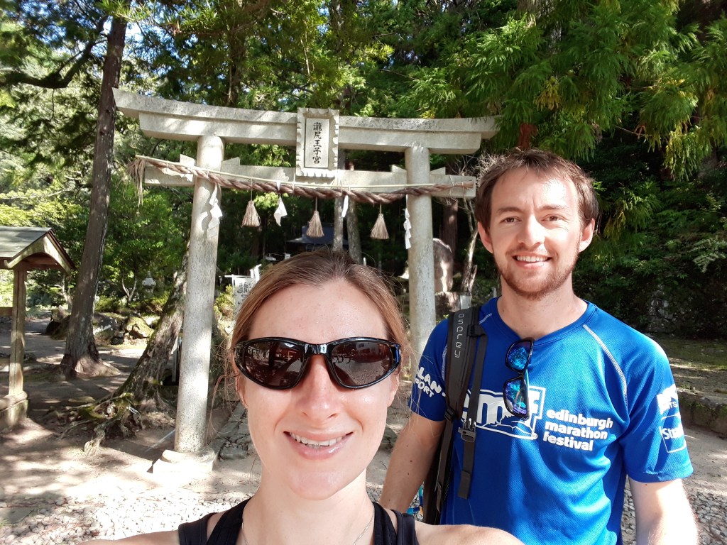
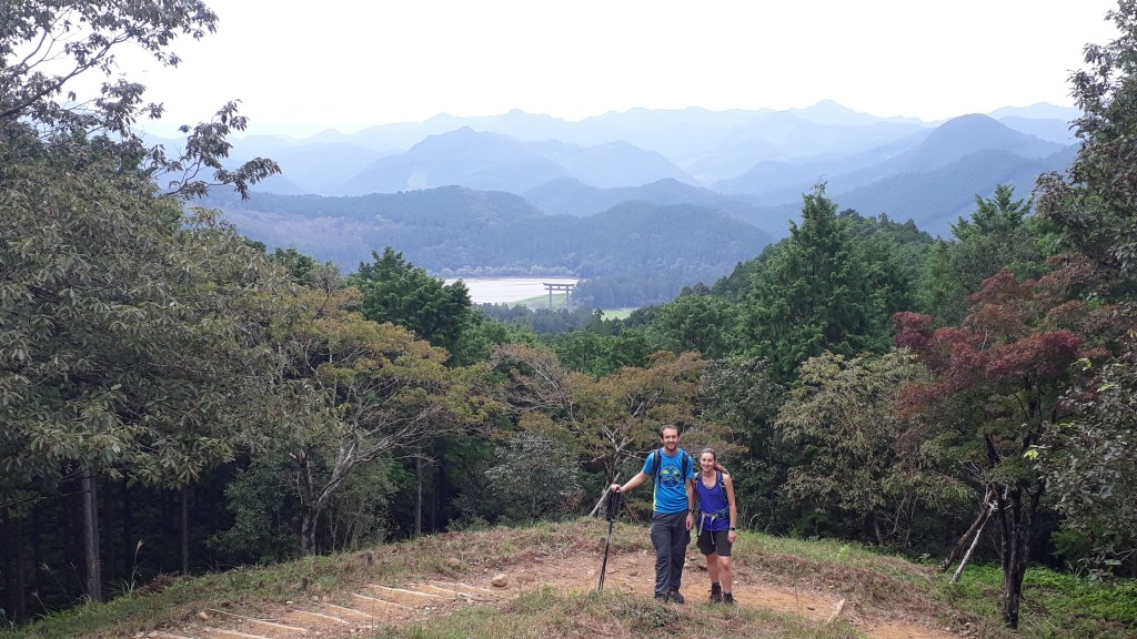
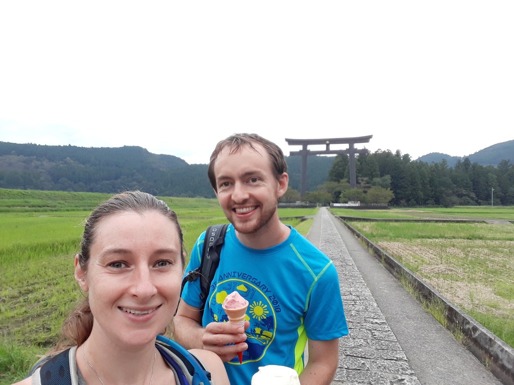
The afternoon was full of more great landscapes. At Fushiogami-oji we saw right down into the valley (and the hills beyond) we were aiming to arrive in at the end of the day (this was also the only tea house we saw on the route that wasn’t just the remains). Further along we got a stunning view of the Oyunohara Torii Gate, which is the largest in Japan. This was our first view of it, we would see it up close later and it looked even more impressive.
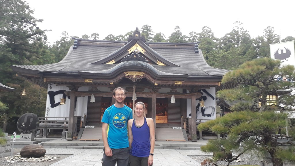
The Torii gate was part of the Kumano Hongu Taisha temple complex. As we entered the complex after our long walk, you could really get a sense of the awe all those pilgrims over the 1000’s of years have felt. For the first time we did the full Shinto ritual at the temple – it felt appropriate.
The Kumano Hongu Taisha complex and giant Torii gate were so impressive that we spent a little too much time there (which may have also had something to do with Claire’s insistence that we needed an ice cream break). This meant that we had to race the daylight for the last 3km of our hike and finally arrived just as it got dark (turned out the sun sets very quickly in the hills!) to a fantastic minshuku in the Onsen (Japanese hot springs for bathing) village of Yunomine. After a soak in our own private onsen and a fantastic meal with about 1000 different plates we felt almost recovered after our long hike.
Day 3 was originally planned to be a day where we could enjoy the onsen in the morning and then complete the short section of walk later in the day. But as a second typhoon was forecast for early afternoon, we decided to get going as quickly as possible to try and avoid it. The onsen would have to wait! Unfortunately Gareth’s walking poles forgot to join us for the bus ride to the beginning of the walk, which led to some interesting (eventually successful) jaglish phone calls to reunite them with the rest of our luggage transfer before we could get started on the trails again.
We eventually got going, and were heading uphill for the first half of the day. Claire was walking in front not paying particular attention, when Gareth suddenly shouted her to stop. Can you spot the difference in the photos below to see what Gareth had noticed (note that the photo on the right is more zoomed in – it’s OK it wasn’t poisonous and both it and we escaped unharmed).
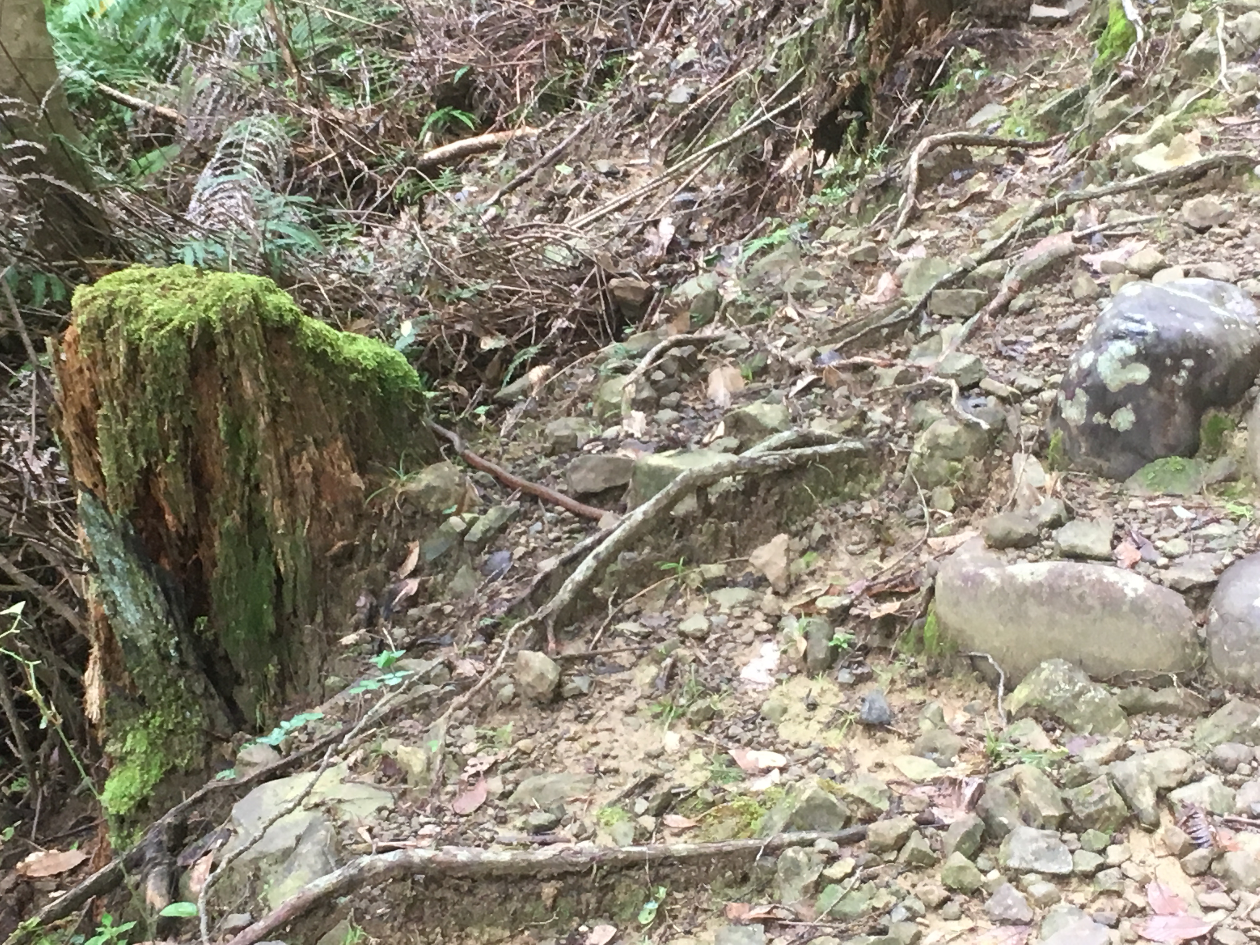
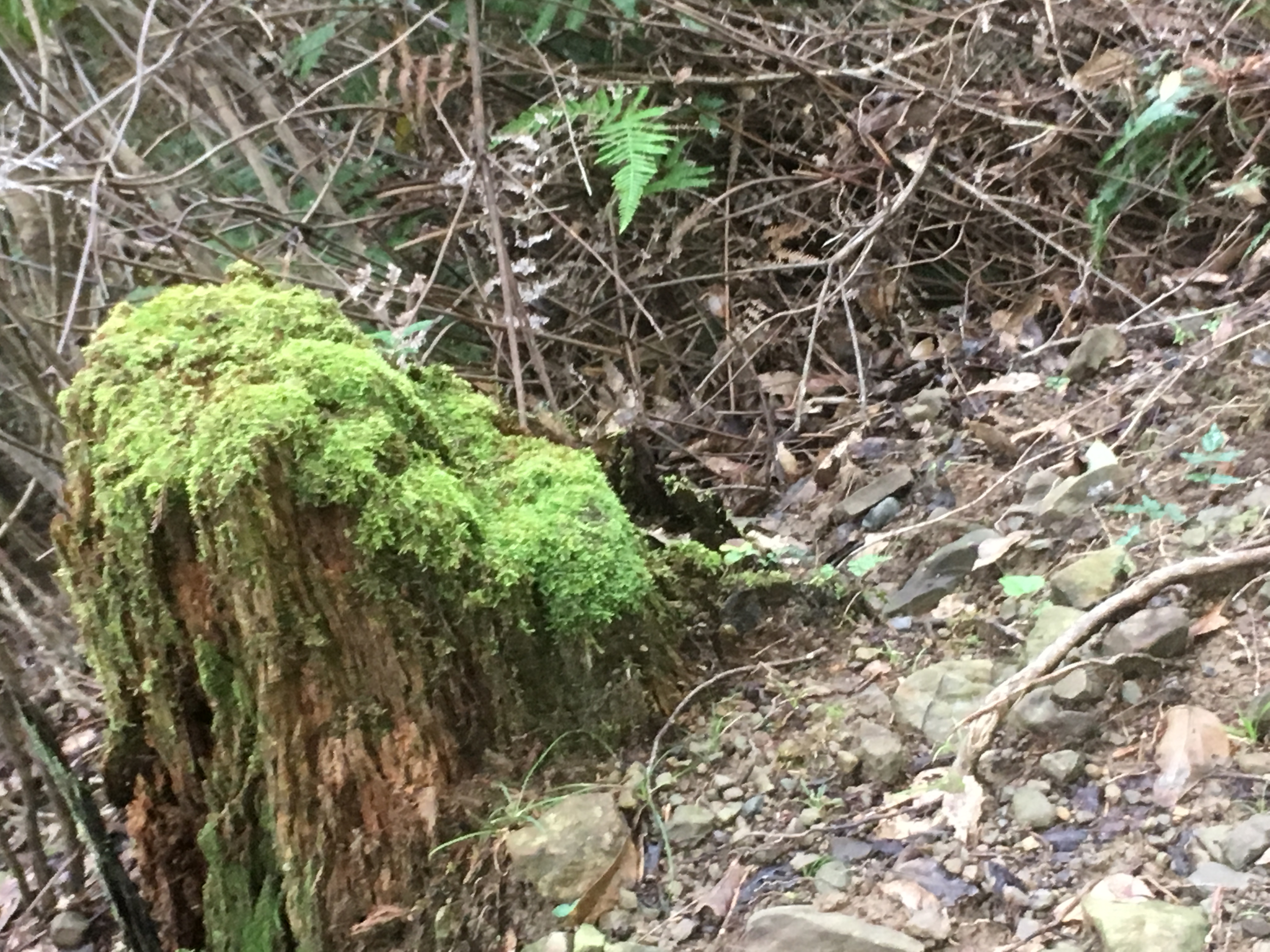
For those that can’t tell the brown stick to the right of the mossy stump in the first picture is actually a snake that we disturbed from its morning sunbathe.
We walked in the trees all morning, aware that we were nearing the summit but never quite getting a view of our surroundings. That was until we reached the summit and the trees parted to reveal the spectacular ‘view of 36000 peaks’ across the Kumano mountains (in true Japanese fashion the sign was quick to confess that there isn’t actually 36000 of them!). Just as we took our final photo the clouds rolled in and the heavens opened – seems like we got here just in time!
Fortunately the rain was just a precursor to the typhoon rains and didn’t last and we spent the next few hours gradually losing altitude. While there was nice walking scenery, there were fewer highlightsthan on previous days, with only a couple of stamps and teahouse ruins. We did stop for a late-ish lunch at the last teahouse remains and there was a very fine view.
After that we had a steeper descent until we appeared out of the forest and over a river into Koguchi, a small village where the old school had been converted into accommodation for Kumano Kodo pilgrims. We enjoyed another onsen, and spent a relaxing evening listening to the driving rain outside.